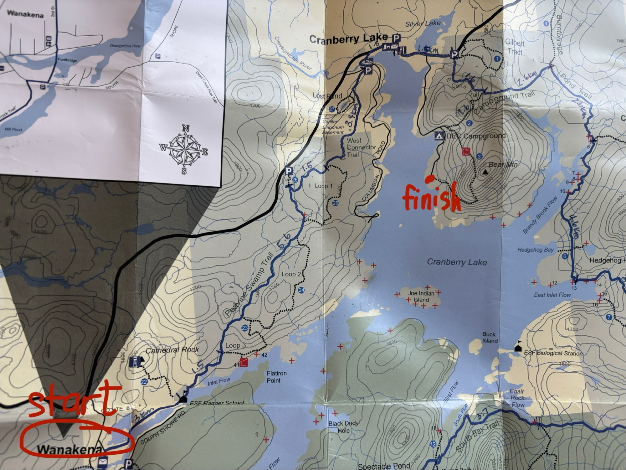
Since it’s my 50th year, I decided that I would take on a new challenge – the Cranberry Lake 50! (See what I did there?) The Cranberry Lake 50 is a 50-mile hike around Cranberry Lake in the Adirondacks. According to the website, “The Cranberry Lake 50 will guide you… through old-growth forests, past back country ponds, across a fascinatingly glaciated landscape, to peaceful campsites, a rejuvenated spirit, a laudable achievement and a memorable adventure.” It is a network of previously existing trails that circumnavigates the third largest lake in the Adirondack park and about 75% of its shoreline is owned by the state of New York. One thing I did not realize was just how remote most of this trail is.
Compared to the high peaks, where I usually hike, this hike is fairly easy in terms of terrain. There is moderate elevation gains at times but overall, it’s never too strenuous. What I didn’t have any experience with was hiking with a full, multi-day backpack. I soon learned that this would be the factor that determined my distance more than anything else.
My original plan was to complete this loop in three days and two nights, as I had seen so many others do. I applied my regular hiking pace to the map, thinking that gradual elevation gain would work in my favour. But day after day, as I added the necessary things to my pack, I realized I really needed to go on a practice hike to see how I would fair. It was a new pack and didn’t even know how it would fit on my body when fully packed.
On the Friday before heading to Cranberry Lake (I planned to start hiking on Monday), I did a practice hike at home with my full pack (weighing in at a whopping 37lbs) and I quickly realized that I woefully underestimated the challenge of hiking with a heavy pack. While I do go to the gym regularly, I’m not young and I’m not fast so after getting home, my husband and I got the map and guidebook out and started modifying my plan. It would take five days instead of three with my capabilities and I hadn’t budgeted that much time so I wasn’t going to be able to do the full 50 miles. Instead, I mapped out a possible 30 mile portion (which equals 50 km so I still hit my target of “50”) to fit into the three days I had. I read on a post that the local general store offers water taxi pick up so I made a Plan A, where I would end up at campsite 18 and get picked up after 50 km and a plan B, where I would simply hike back to base camp and come back to finish the rest when I had more time.
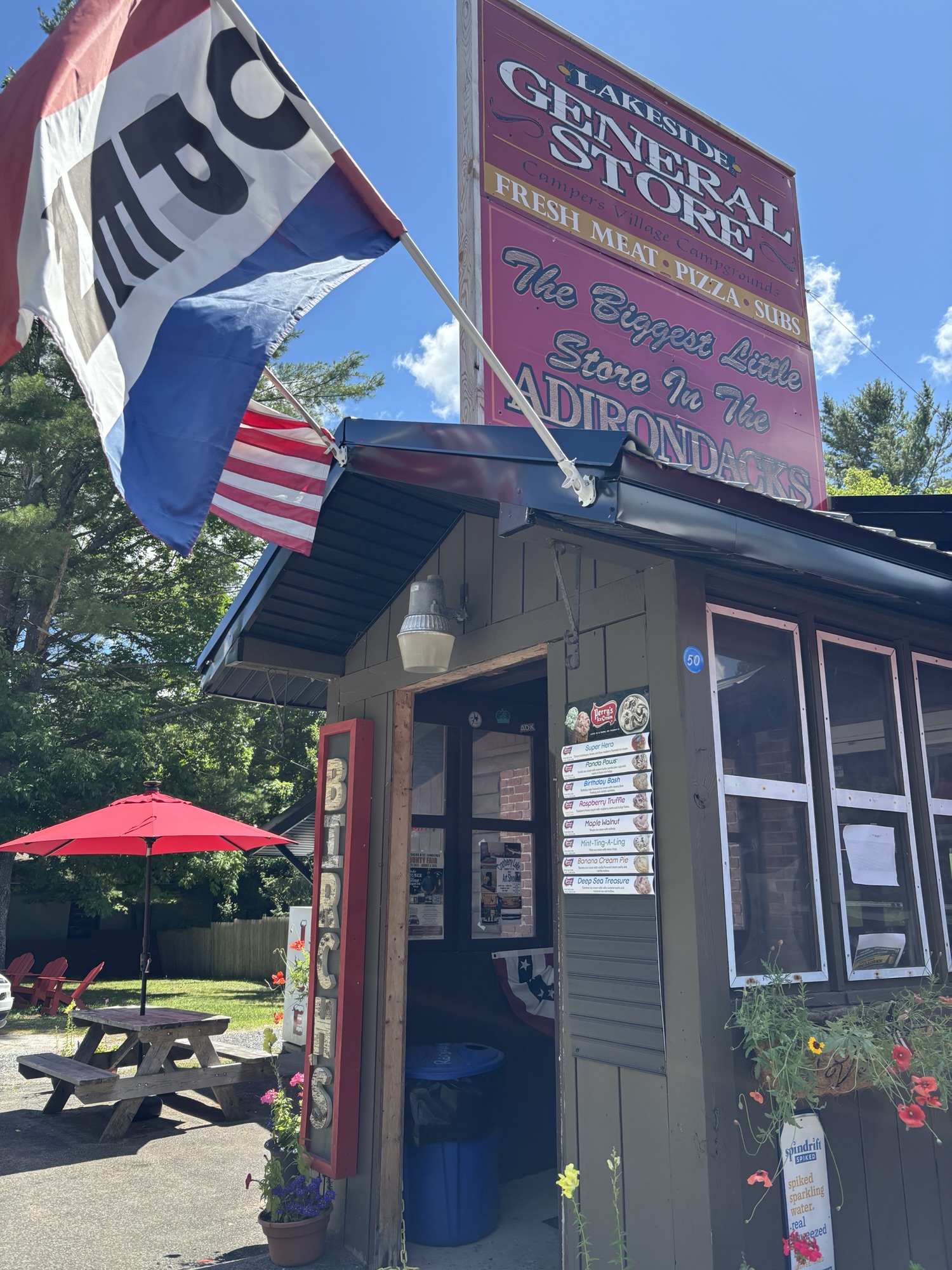
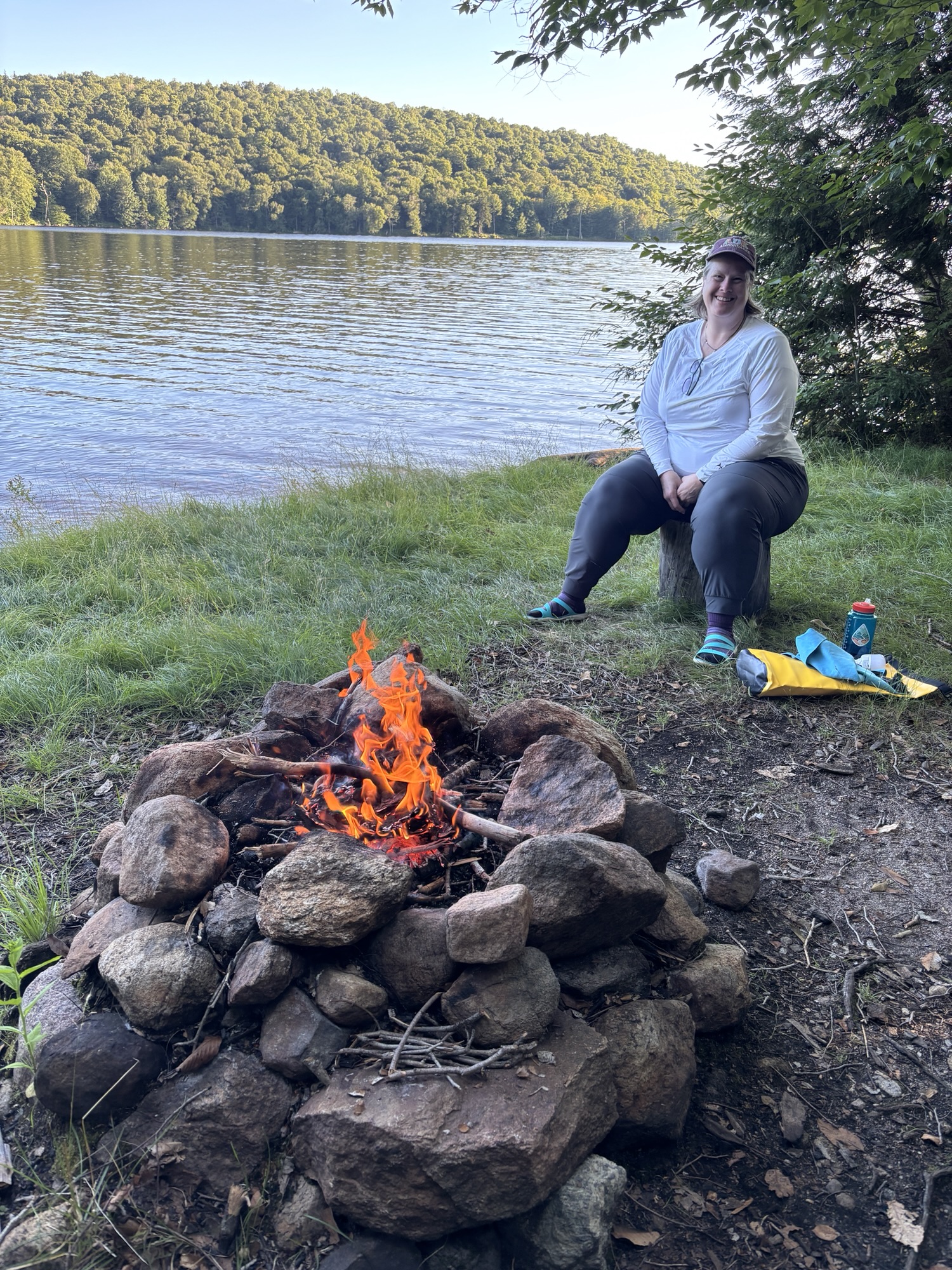
After arriving in Cranberry Lake on Sunday and stopping into Birch’s Lakeside General Store, I was able to book the water taxi from campsite 18 on Thursday morning so my Plan A was good to go! We set up base camp at Cranberry Lake campground at a beautiful site with water access, had a filling carb-loaded dinner of cauliflower mac and cheese, relaxed by the campfire and headed to bed.
Day 1, Monday, July 21st:
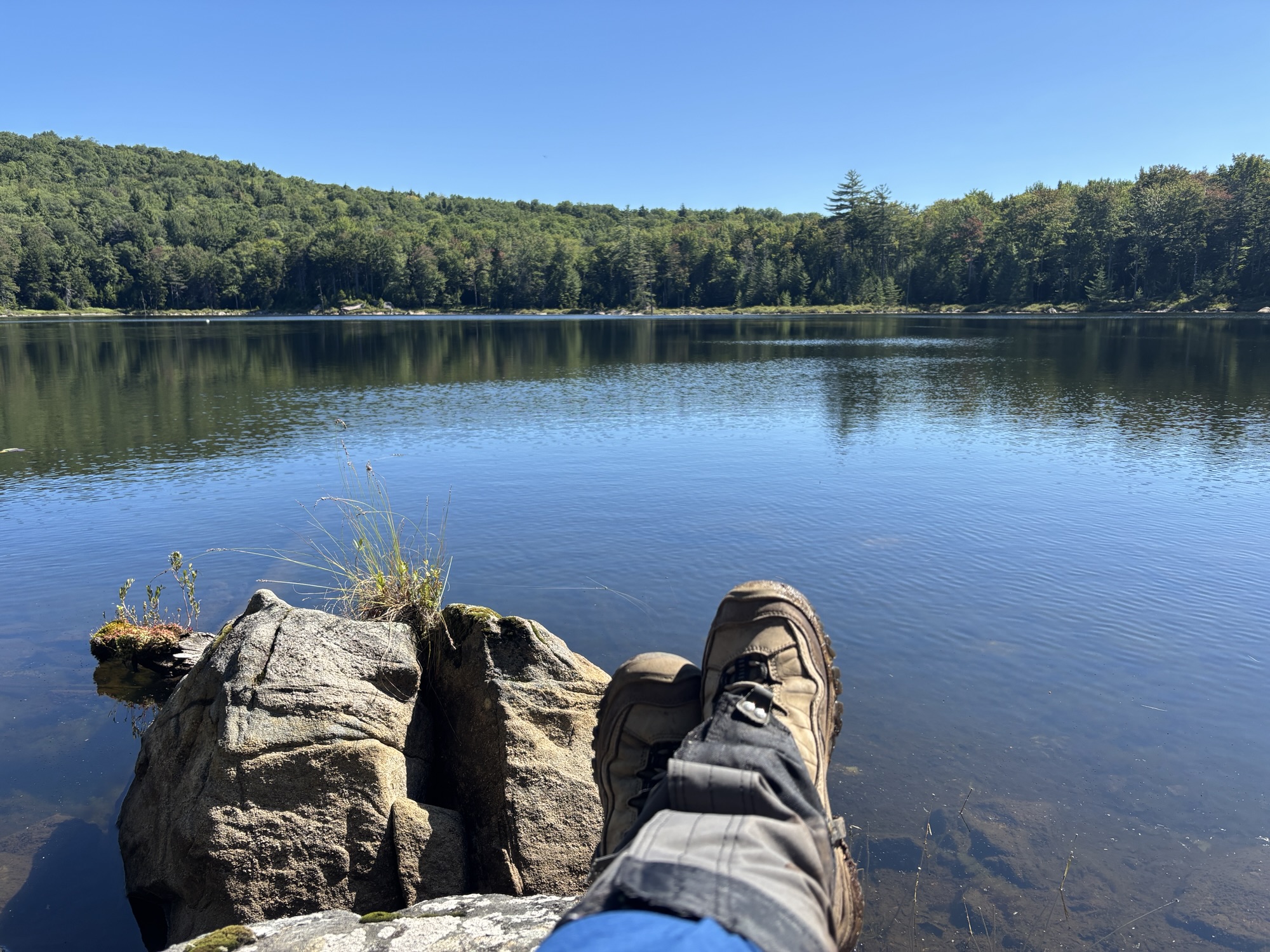
The morning was very cool; the coolest morning so far this summer, I think. There was a mist rolling over the water in our little inlet as the sun tried to break through over Bear Mountain, which sits across the inlet. I sat pondering my upcoming day with my coffee and watching the little family of ducks hunt for food near our waterline.
I started my CL50 in Wanakena and would be walking clockwise 23km back to base camp at the campground. Because I was returning to base camp, I would be “slack-packing” with only a day-pack instead of my full pack. This meant I could cover more distance faster and I could save my body some of the grunt work. Shannon was going to be waiting for me at base camp and we would have real food as opposed to trail snacks and boil-in-the-bag food which is what I’d be having my next two nights.
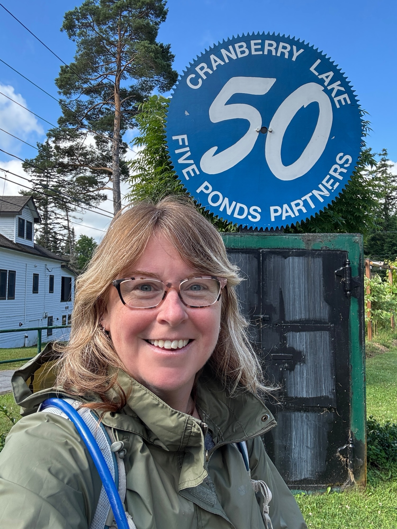
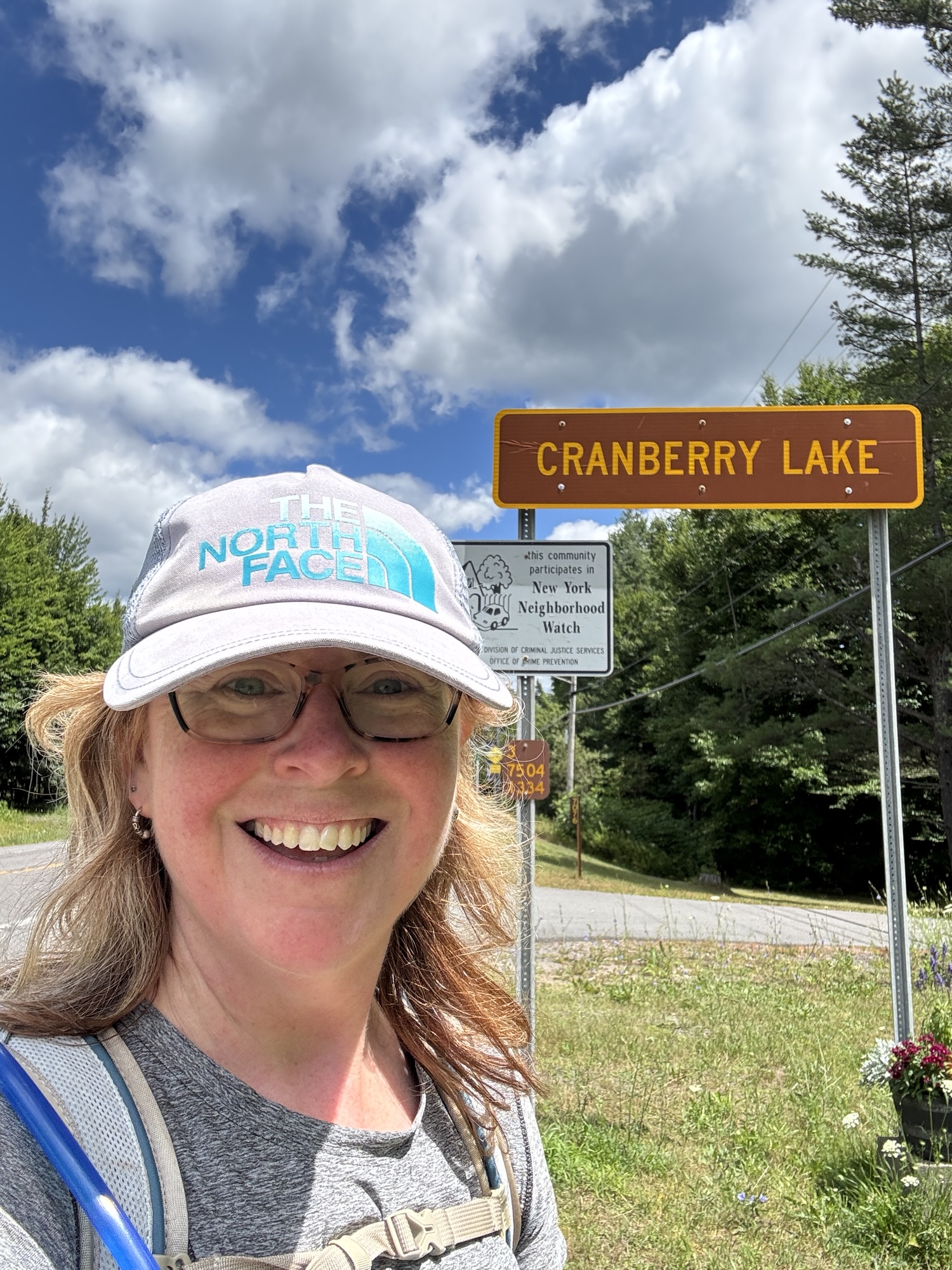
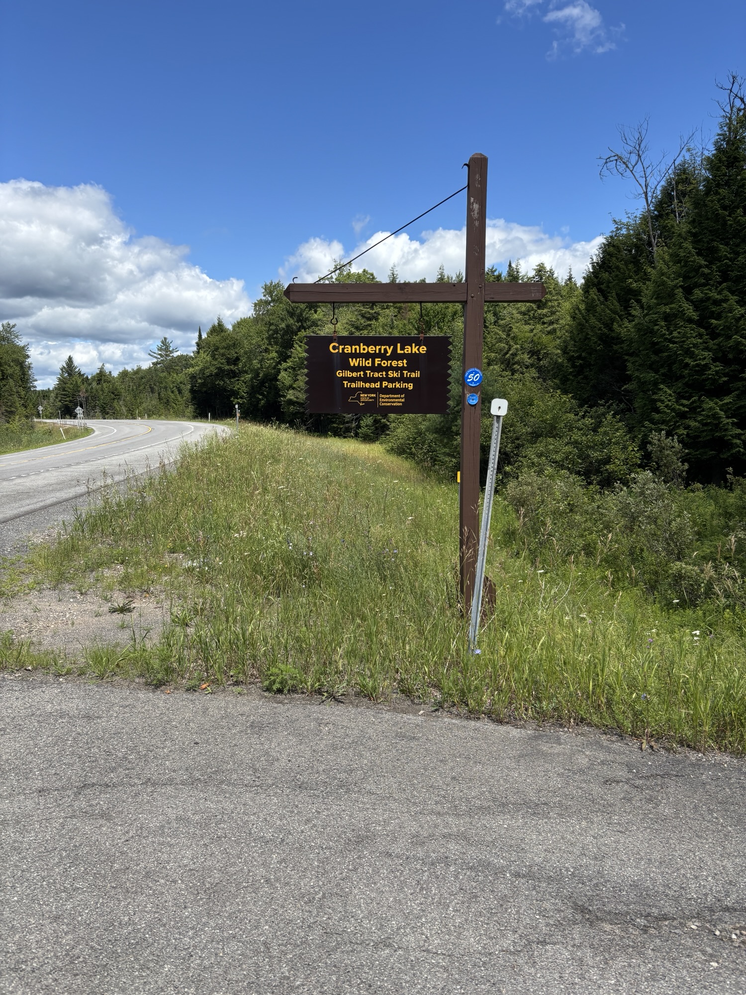
I hit the trail at 9am after being dropped off at the Wanakena trailhead, took a selfie at the Cranberry Lake 50 sign, and started the first few miles of road walking. The day was cool enough I was wearing my rain shell over my tank top. The scenery was beautiful along the road and I imagined what it would be like to live in one of the little cottages that lined the banks of this gorgeous lake.
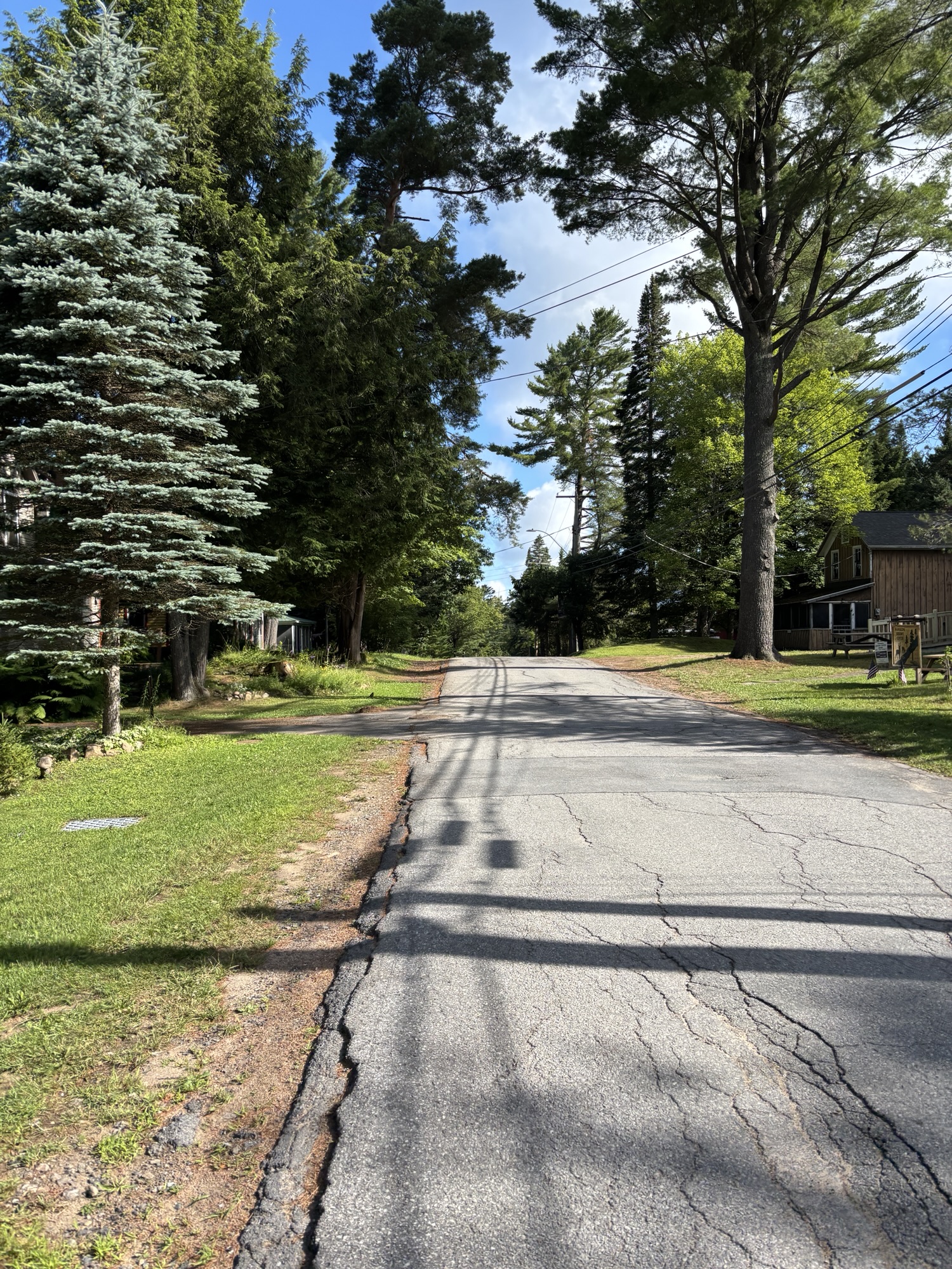

After 3km, I turned off the road and onto the biggest portion of trail for the day. This leg of the route is known for it’s road walking – through Wanakena and past the Ranger School, and then again through the little village of Cranberry Lake. Having done the Camino, which involves far more road walking than you would imagine, I was not daunted or dismayed about it.
It was very level terrain and hardly any bugs or mud. Considering it had rained much of the day before and throughout the night, I was really surprised at how dry the trail was. The trail was generally very well-maintained and I made good time. I’m not sure if the bugs simply weren’t bad or if it was the cloud of DEET and citronella that surrounded me that kept the bugs at bay. I could hear them buzzing around me but I only got one or two bites. Considering some of the posts in the Facebook group mentioned how awful the bugs were, I considered myself extremely lucky!
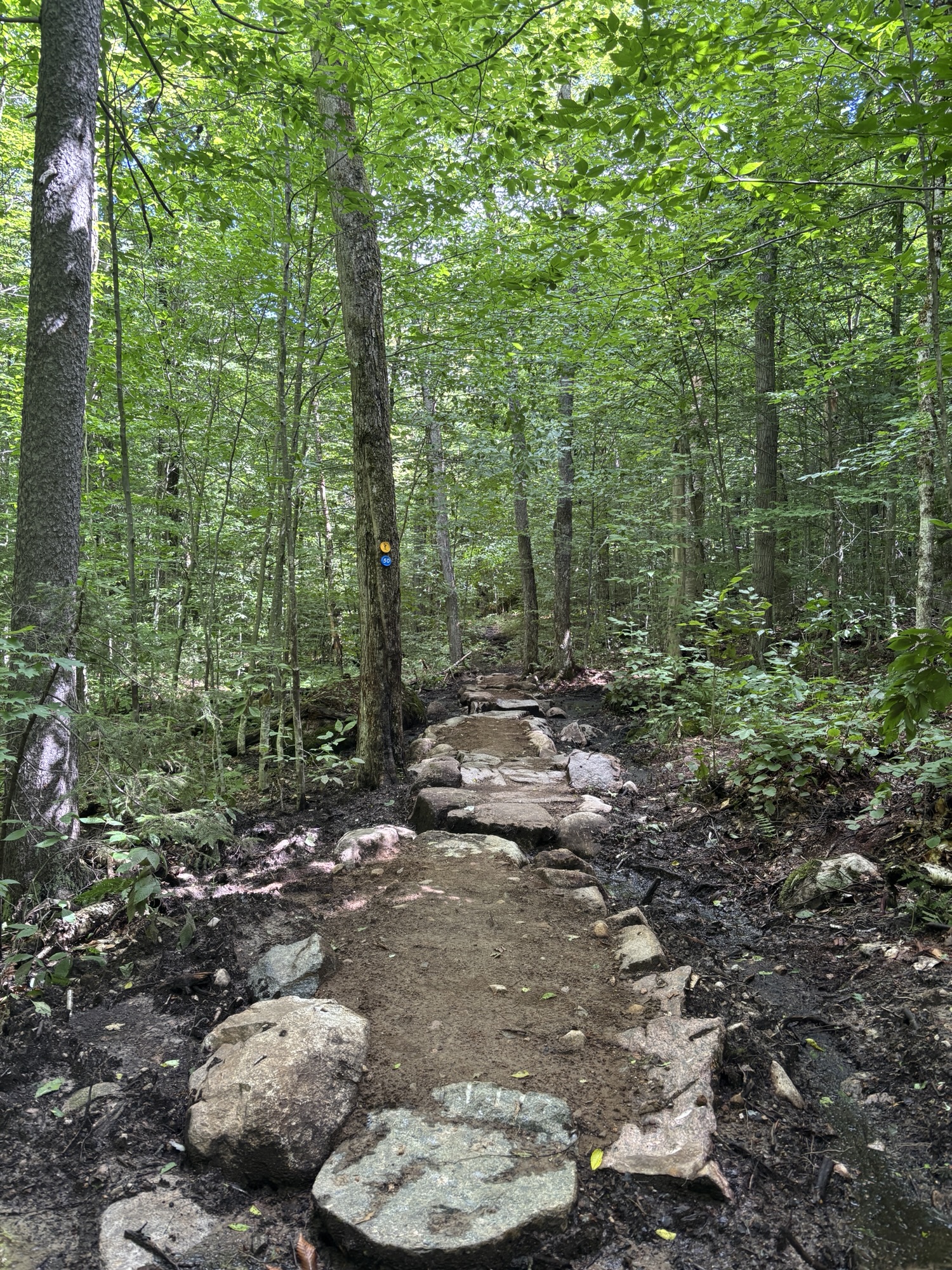
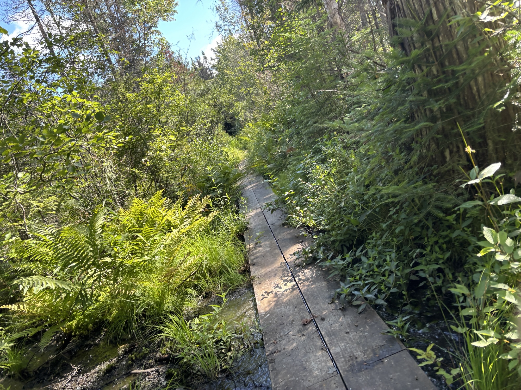
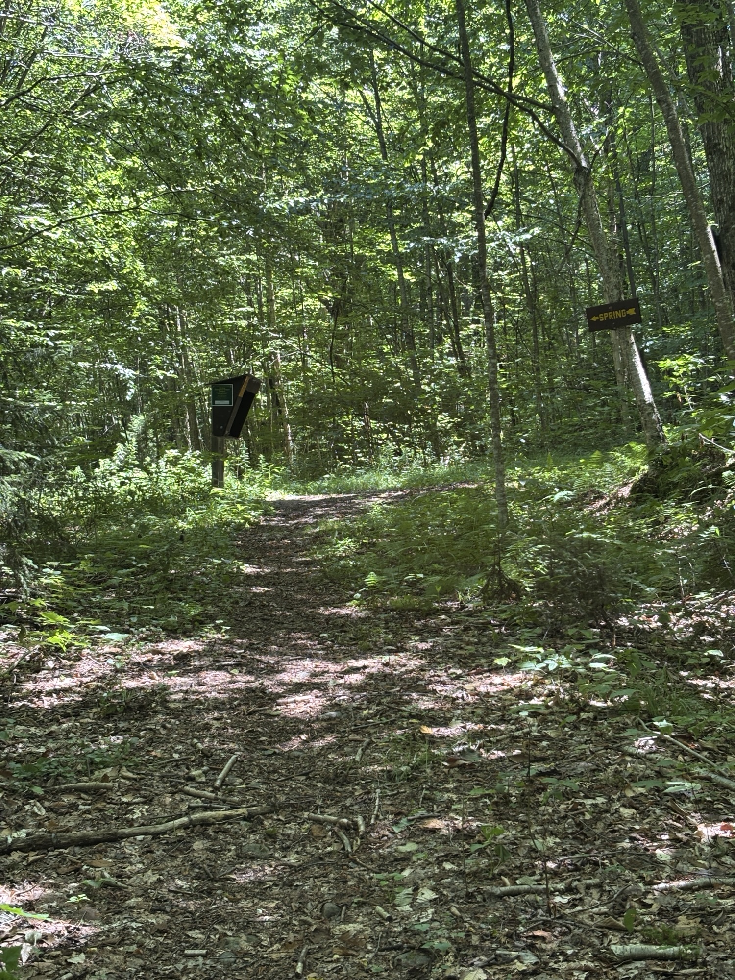
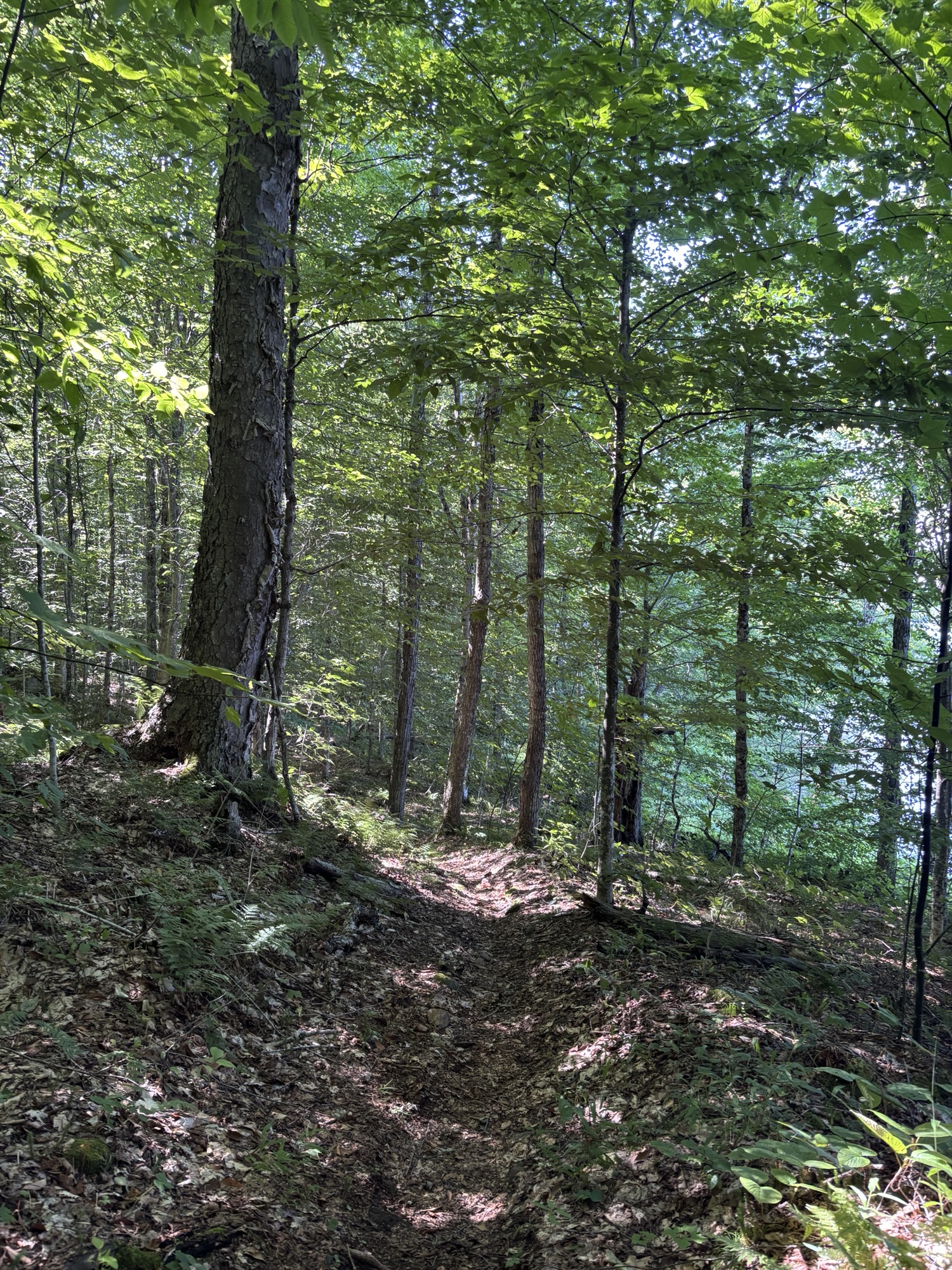
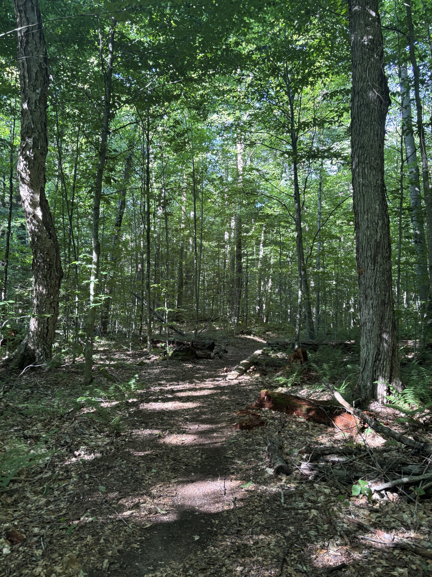
The trail is through a hardwood and beech-dominated forest so it was dark. It’s called The Peavine Swamp Trail and then the West Connector Trail and it’s also used a ski trail so it’s nice and wide and clearly-marked with blue and yellow trail markers. At this point, it didn’t seem very Adirondack-y because it was so even with very few rocks or elevation gain.


I had heard that some people only bring a water bottle and a filter but I brought my 3L Camelbak bladder as well as a filter and I’m glad I did because the first water I heard was 13 km into my hike. At that point, I didn’t feel the need to refill, knowing I had lots left in my Camelbak but also that I was almost in town and could easily buy more if needed at the general store.
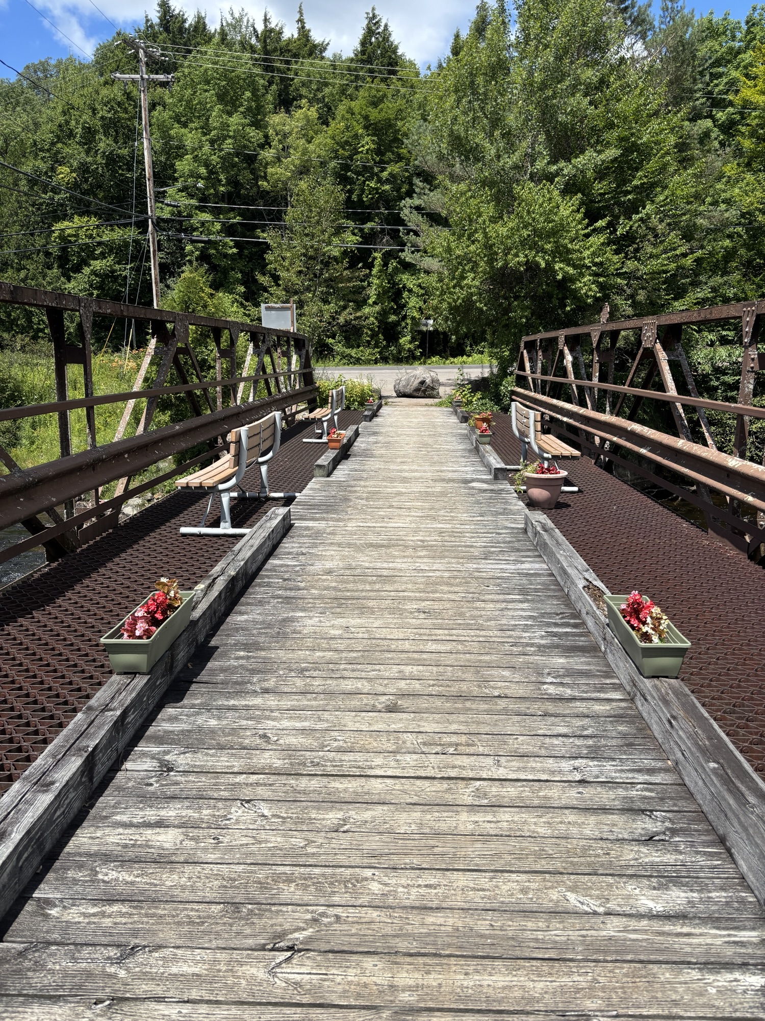
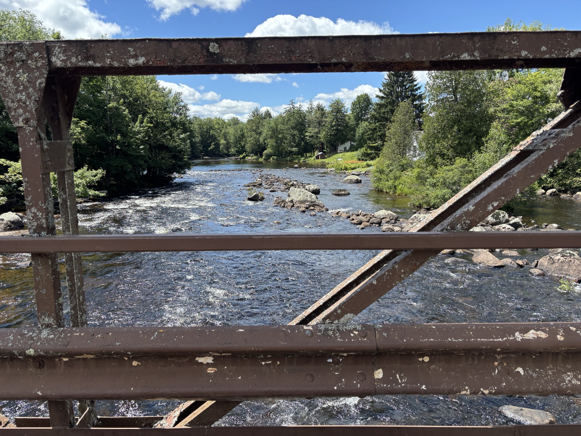
I came out of the woods onto another section of road walking and it wasn’t all at the side of the highway. There is a cute bridge with benches to cross and you walk past the Fire and Rescue station. Then briefly into the woods again along the banks of the lake and then out onto the highway that runs through the village of Cranberry Lake. It didn’t take long to get to Birch’s Lakeside General Store where I refueled with ice cream and had a bathroom break. As I continued walking, I spoke with some of the locals who inquired if I was doing the 50.


Then I was in the home stretch. I turned back into the woods on the other side of the village. It was 1.6km (1 mile) to the intersection with the Campground trail. It was a further 1.6km to the actual campground and then I had to walk to my site which, unbeknownst to me at the time of booking, was the farthest site from the trailhead. So that was another 2km. This was by far the hardest part of the day’s hike – not because of the terrain, but because I was tired and my bad ankle was complaining and also because I knew I was going to have to do it all over again the next morning with my big pack. But we had water access so I soaked my sore and tired feet, which felt amazing, relaxed for the evening chatting about the day and got a great night’s sleep. Tomorrow was the first day with the full pack and I was nervous about how hard it might be.


Day 2, Tuesday, July 22:
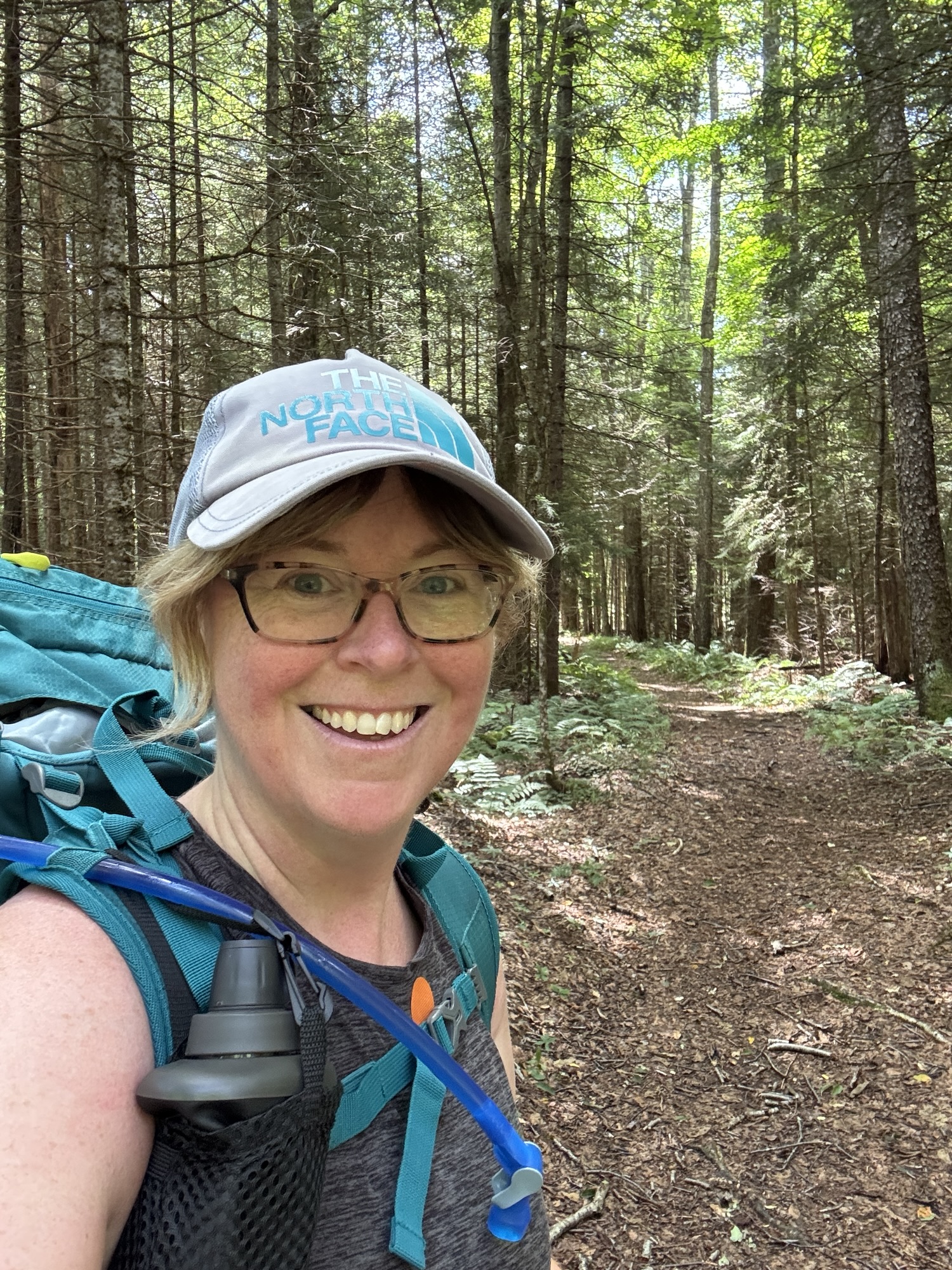
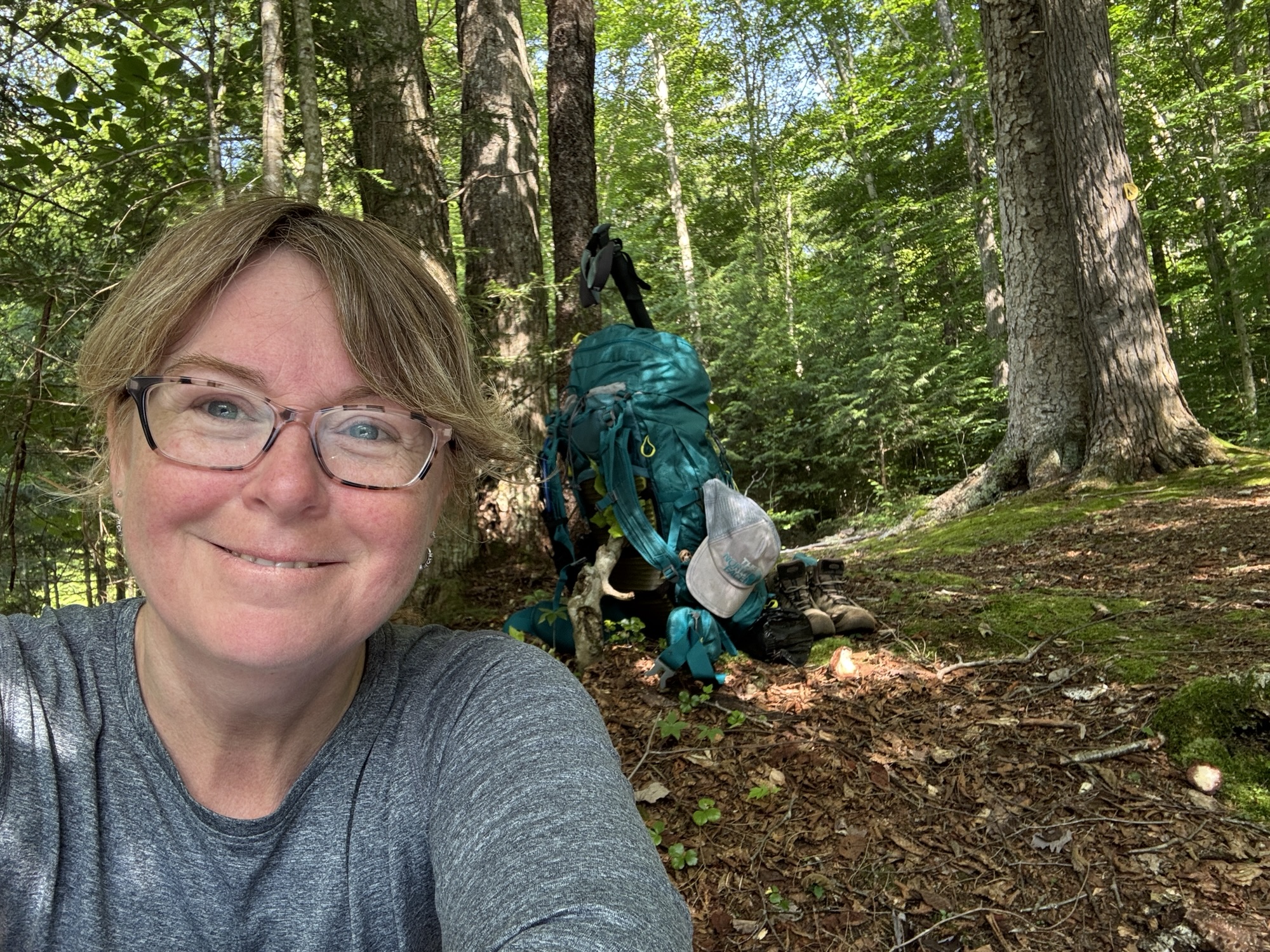
I woke up knowing that today was going to be harder than yesterday. I was going to be hiking with my full pack for the first time. I had managed to get it down to 33lbs with water and I knew I couldn’t do any better than that.

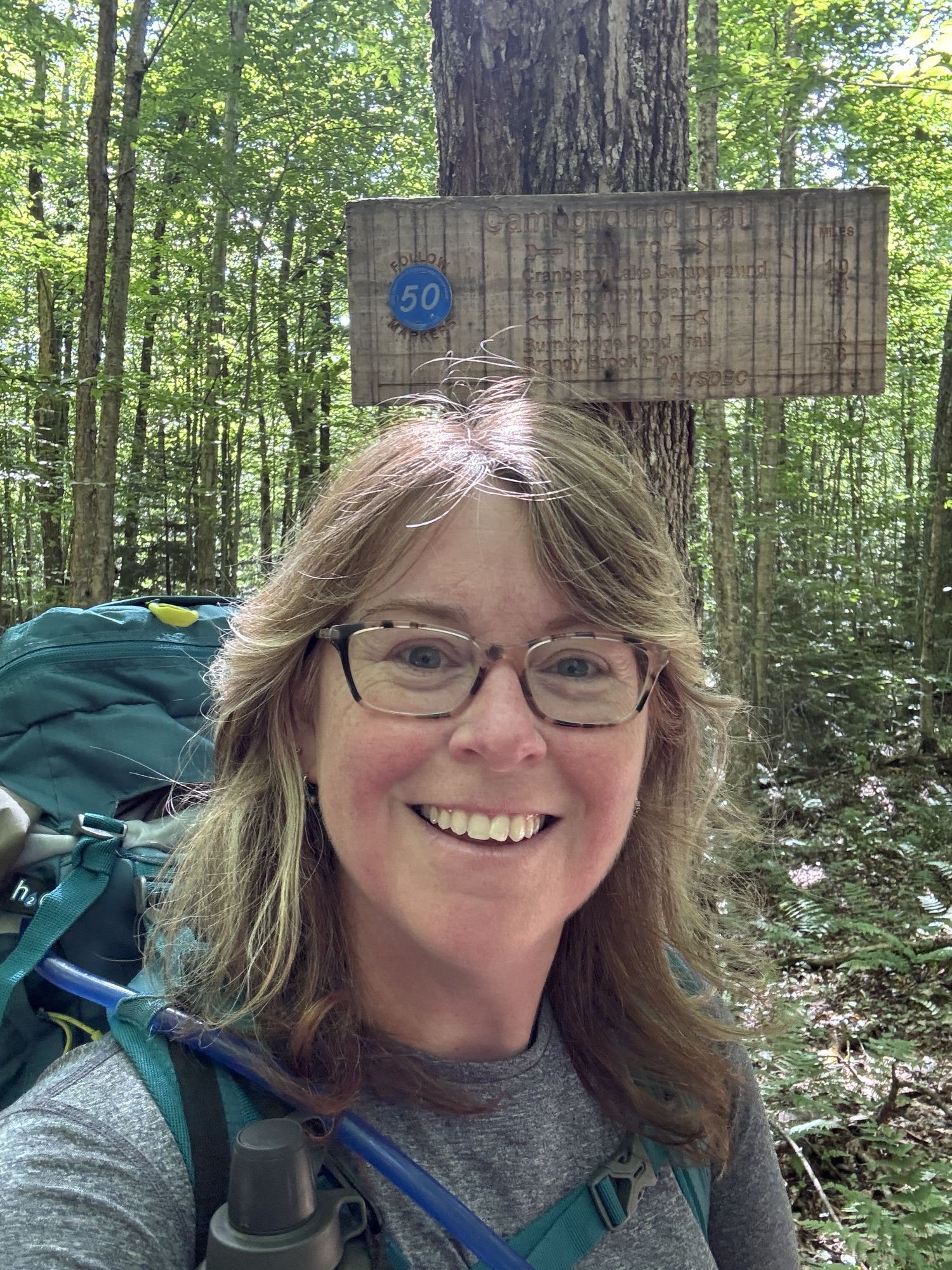
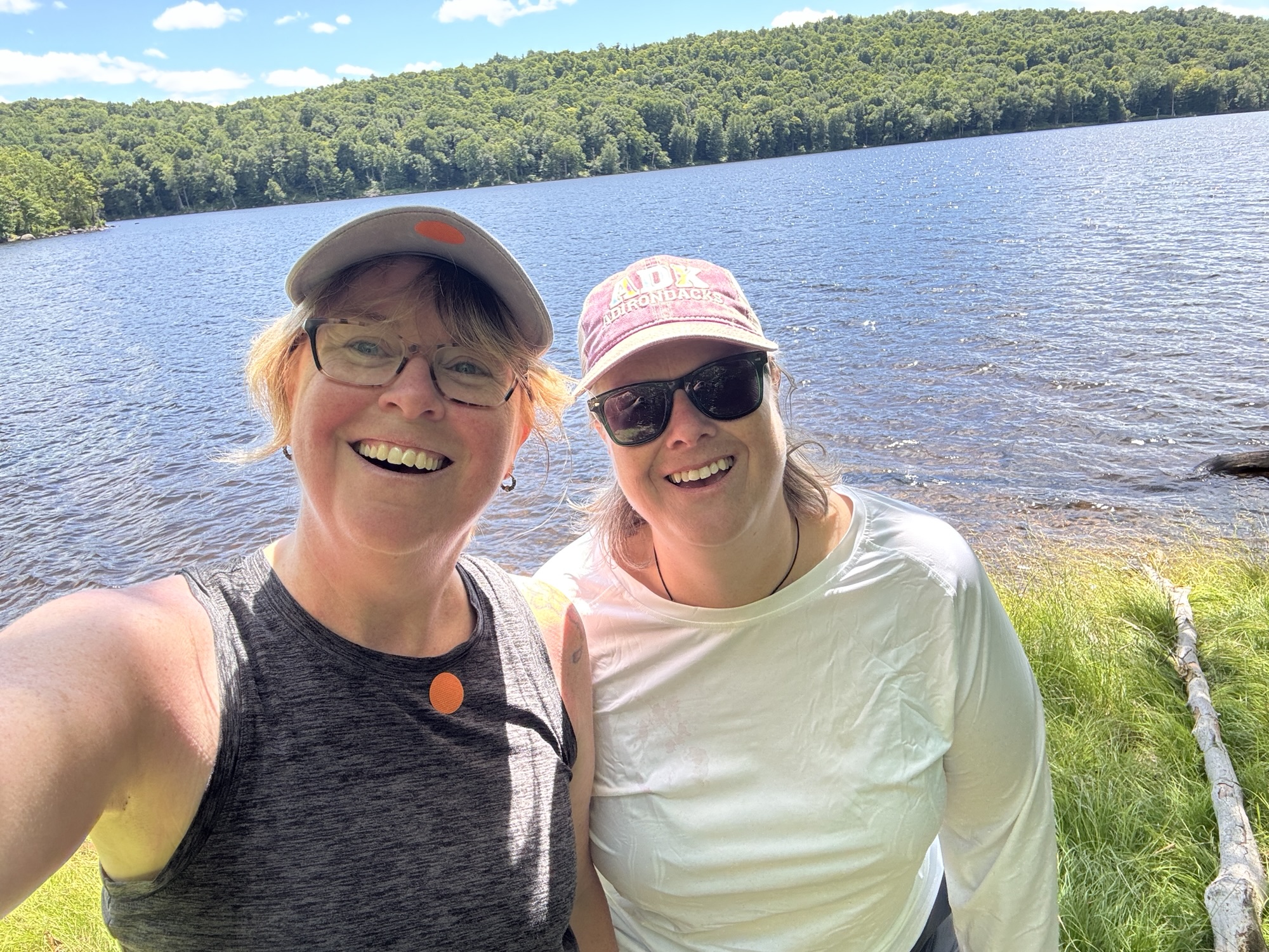
This day’s plan was shorter than the day before but I was assuming it would be over a more varied terrain and with a significant load. Yesterday I had hiked 23km and today I would be hiking 14km. When originally planning this, Shannon had the cool idea of paddling to meet me at a campsite. Even after I had to modify it last minute, we still had that option. We decided I would hike and she would paddle and we would meet at campsite 14, which was on the lake. Judging from her navigation map, we both assumed that she would be there first. I anticipated that it would take me about 4-5 hours to get there.

Thankfully, Shannon agreed to drive me back to the trailhead in the campground so I didn’t have to walk that extra 2km with my pack. I started my day by comically hauling my 33lb pack onto my back. I felt like Reese Witherspoon in Wild at the beginning of her PCT hike, carrying her pack she named Monster. Ha!
My ankle was still a little tender and I realized, this will be a test to see how much my ankle can take after consecutive days. This is a very old injury and for years, I’ve had issues with it. I’ve had to baby it, and buy shoes constructed for stability (making me look like a senior), get orthotics and regularly do strengthening and balance exercises at the gym. Normally, I only do day hikes and so my ankle gets to recover the next day. But not this time.


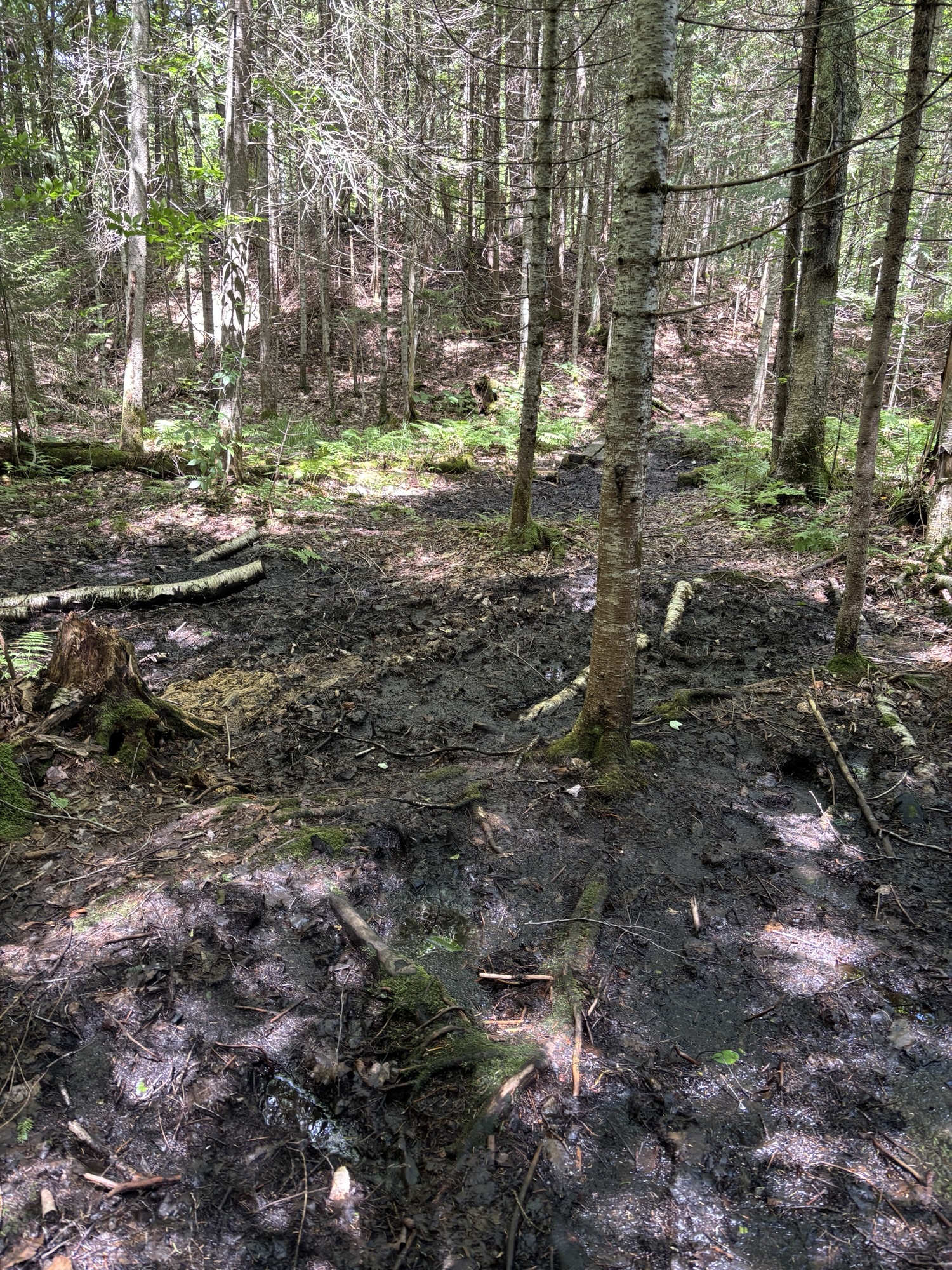
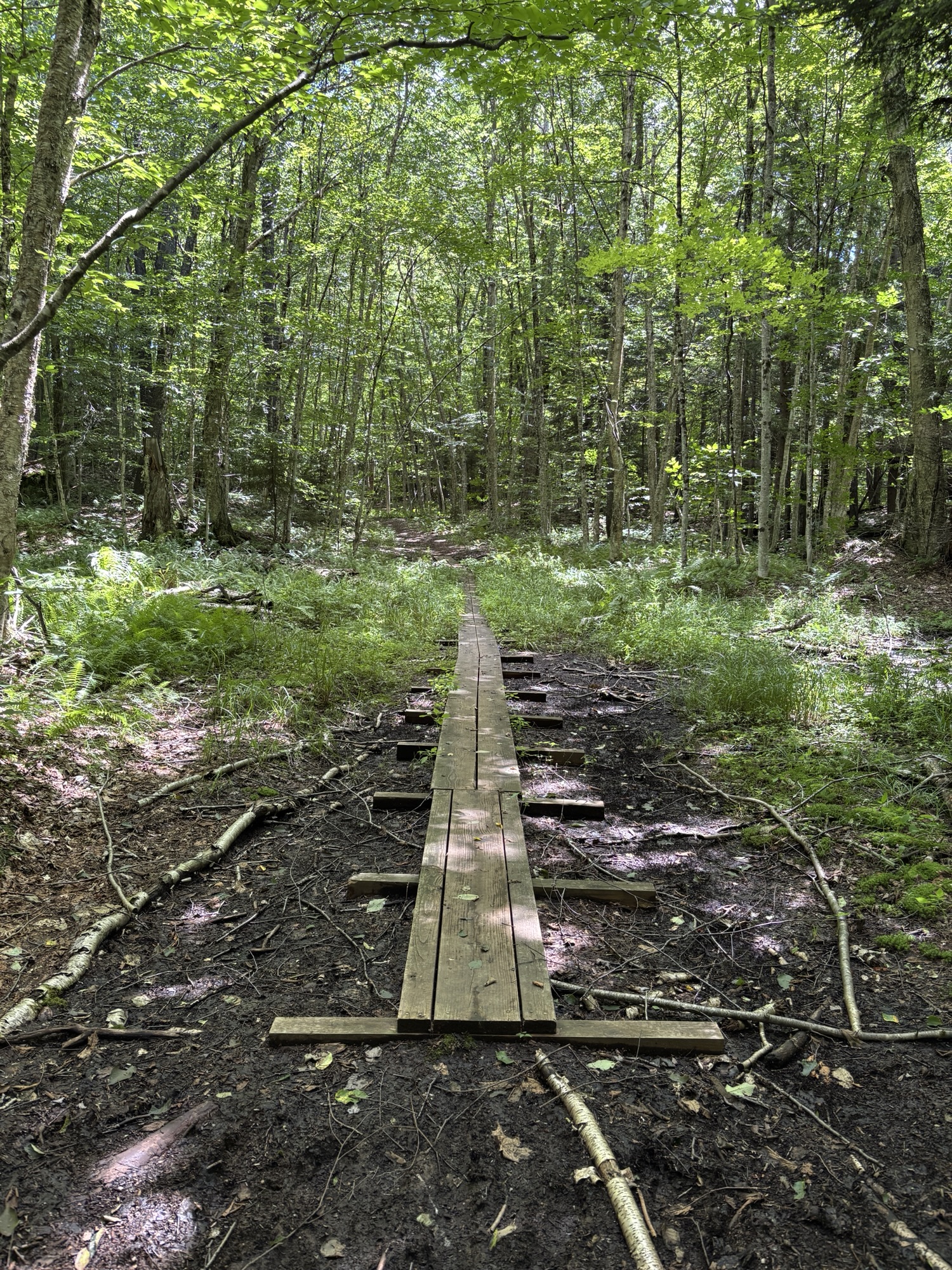
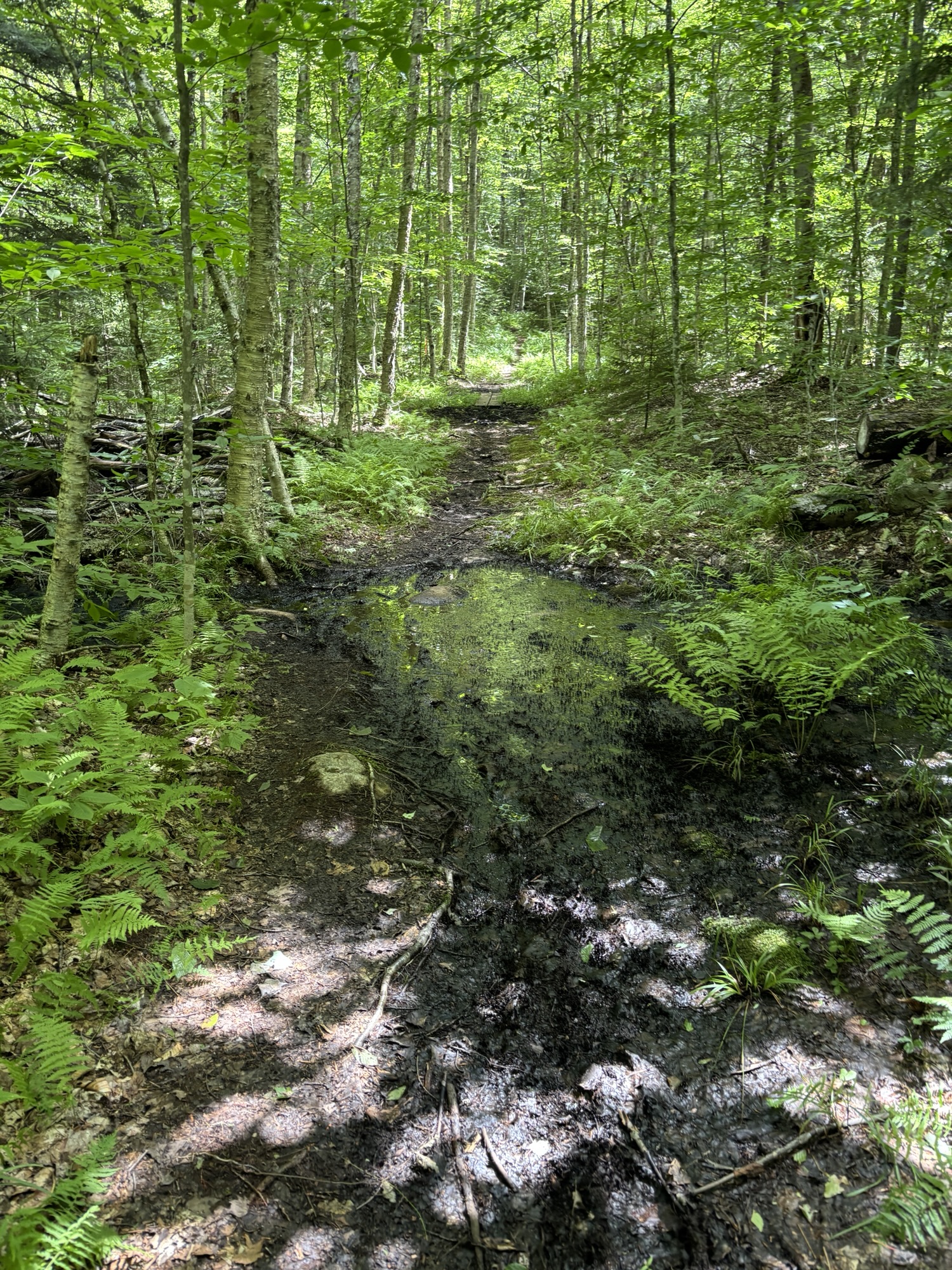
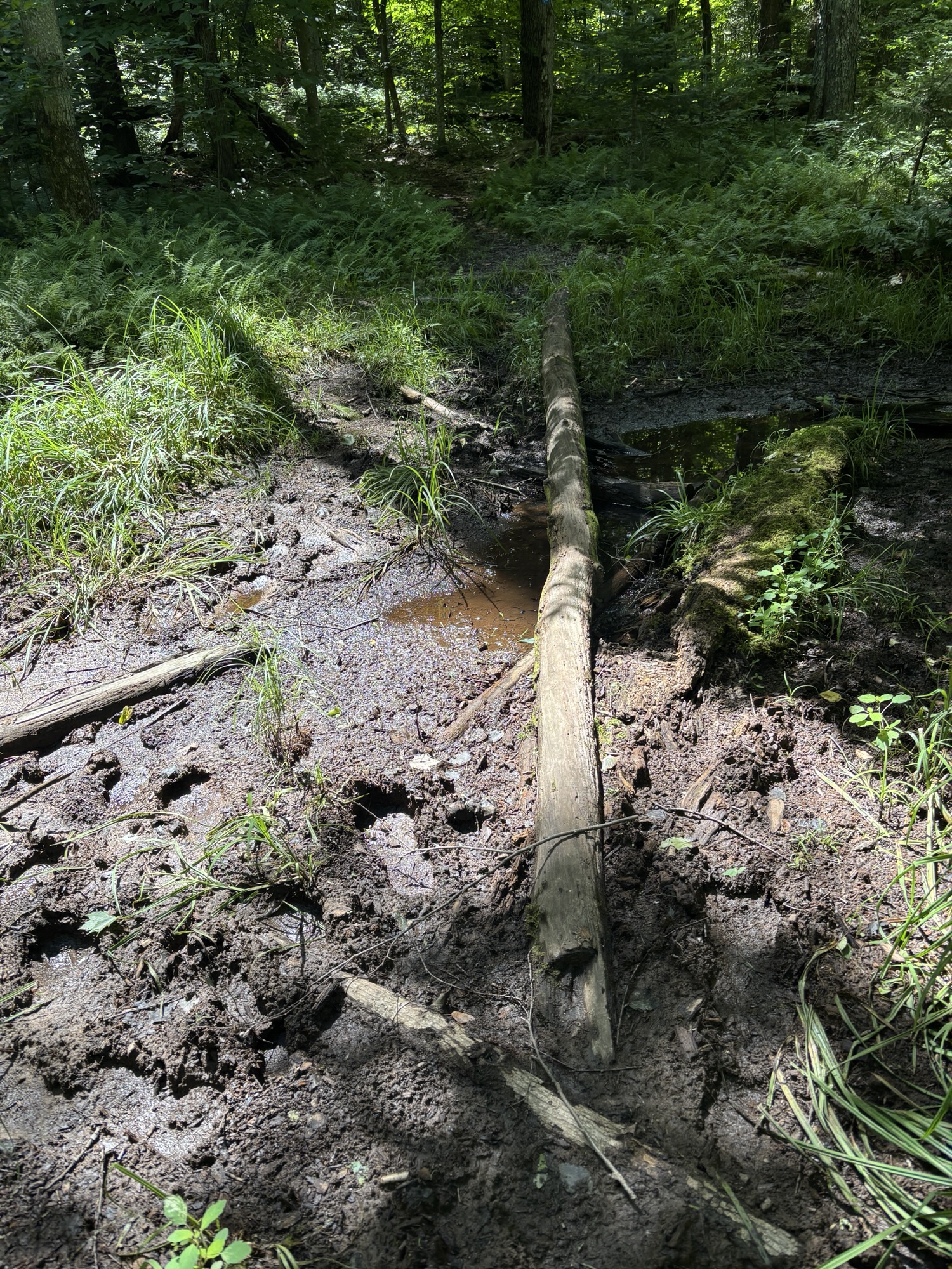
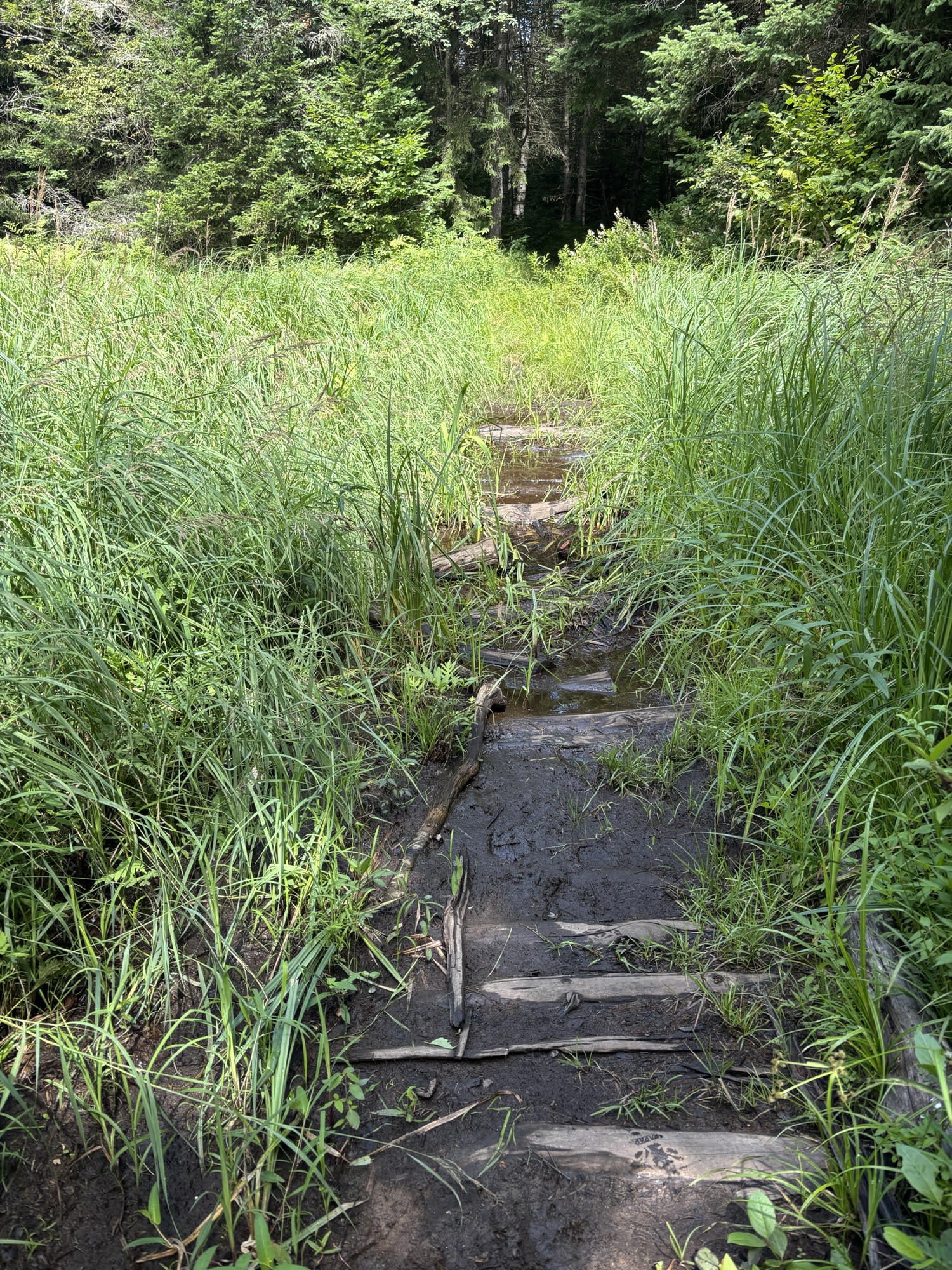
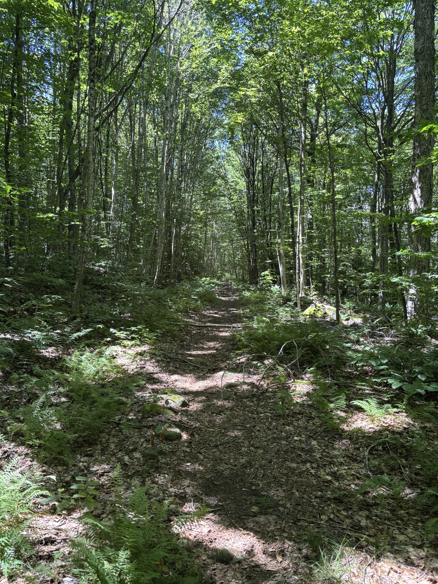
As I started hiking I wondered how I was ever going to make it to campsite 14 with this beast of a pack but after a few minutes, with some readjusting of the pack, I got it comfortable and I started to hit my stride. I was clearly the first person through the woods this morning because by the end of the day, I felt like I was a mummy wrapped in cobwebs (I later found out that’s called “silk blazing”). It felt like I was constantly wiping fine silk off my face and bare arms. The woodsy trail was beautiful and gentle, with very little elevation gain in the first part. It was a bit wetter than Day 1 with a bit more negotiating around some marshier or flooded areas but nothing too challenging and again the bugs were easily kept at bay.


What I really enjoyed this day was the variety of trail – from shaded leaf-covered trails in the woods, to walking through dappled ferns and raspberry bushes (ouch!) and into the occasional sunny patch. Again, I lucked out with the temperature. It was supposed to be quite cool at night and that was one thing I was slightly worried about as I hadn’t brought a puffy. But I did bring my three-season sleeping bag which added weight but at least I knew I’d be warm. It’s my first backpacking trip but I’ve been camping in the Adirondacks for many years and know that nighttime temps can get unexpectedly low.
After two hours, I stopped for an early lunch at campsite 6, a tiny waterside campsite with a picnic table, a privy and a fire pit. As I sat along the bank and ate my sandwich, a massive heron took offence to my presence and took off out of the water just a few feet away.
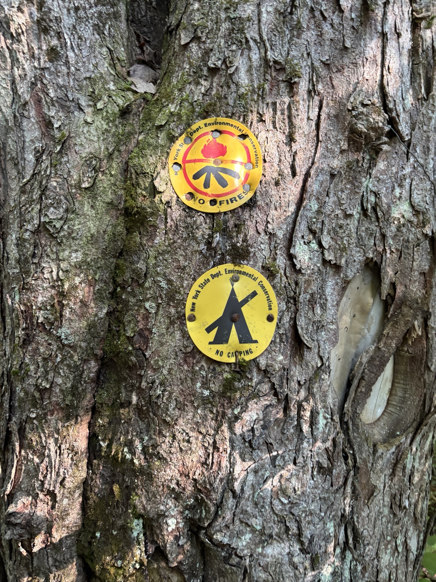
Almost every campsite has a privy associated with it, which means you don’t need to go in the woods. While I have many times since in the High Peaks area, there are very few outhouses or porta-potties, it feels rather civilized to actually have a seat. Even if most of the privies are actually thunderboxes (just the toilet part, no walls). I didn’t see anyone else hiking for the three days I was out in the woods so I wouldn’t be too worried about someone interrupting you.
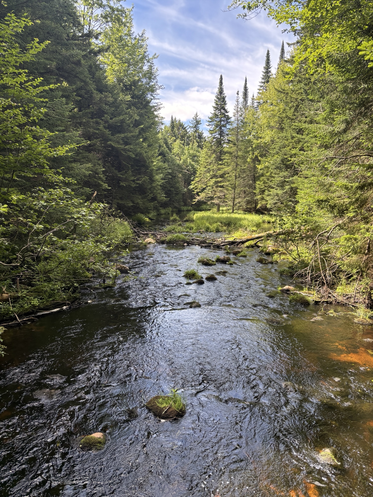


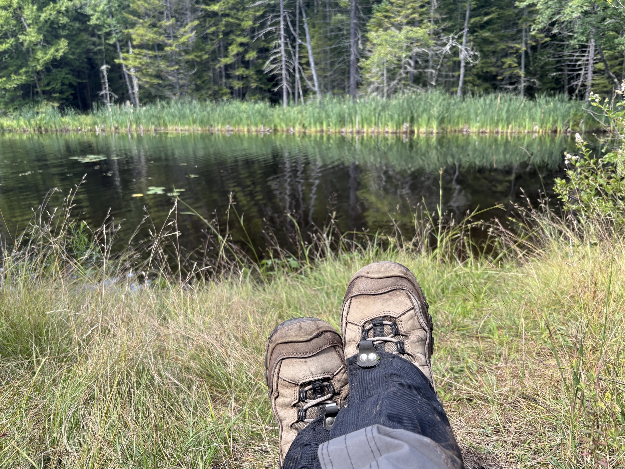
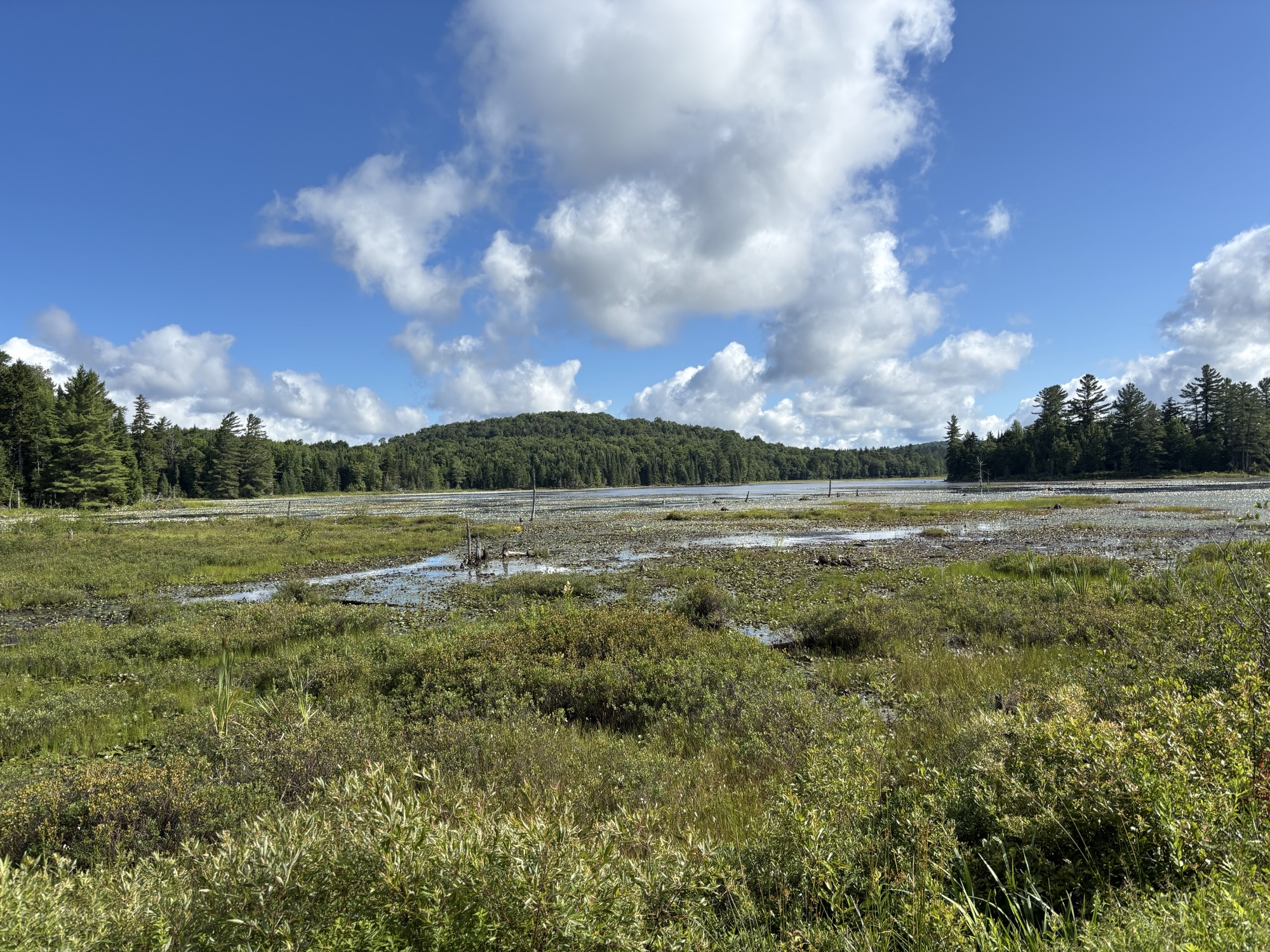
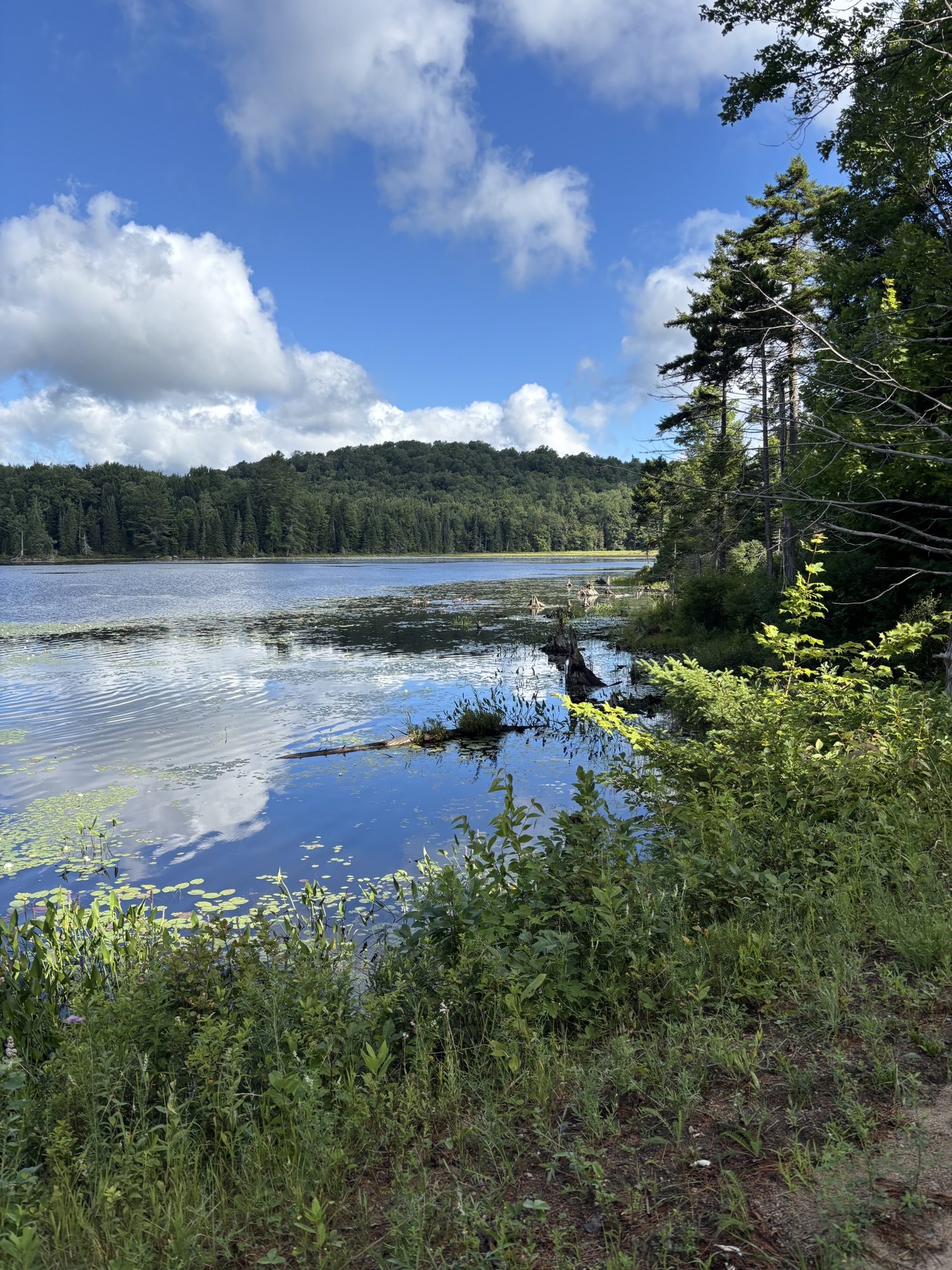
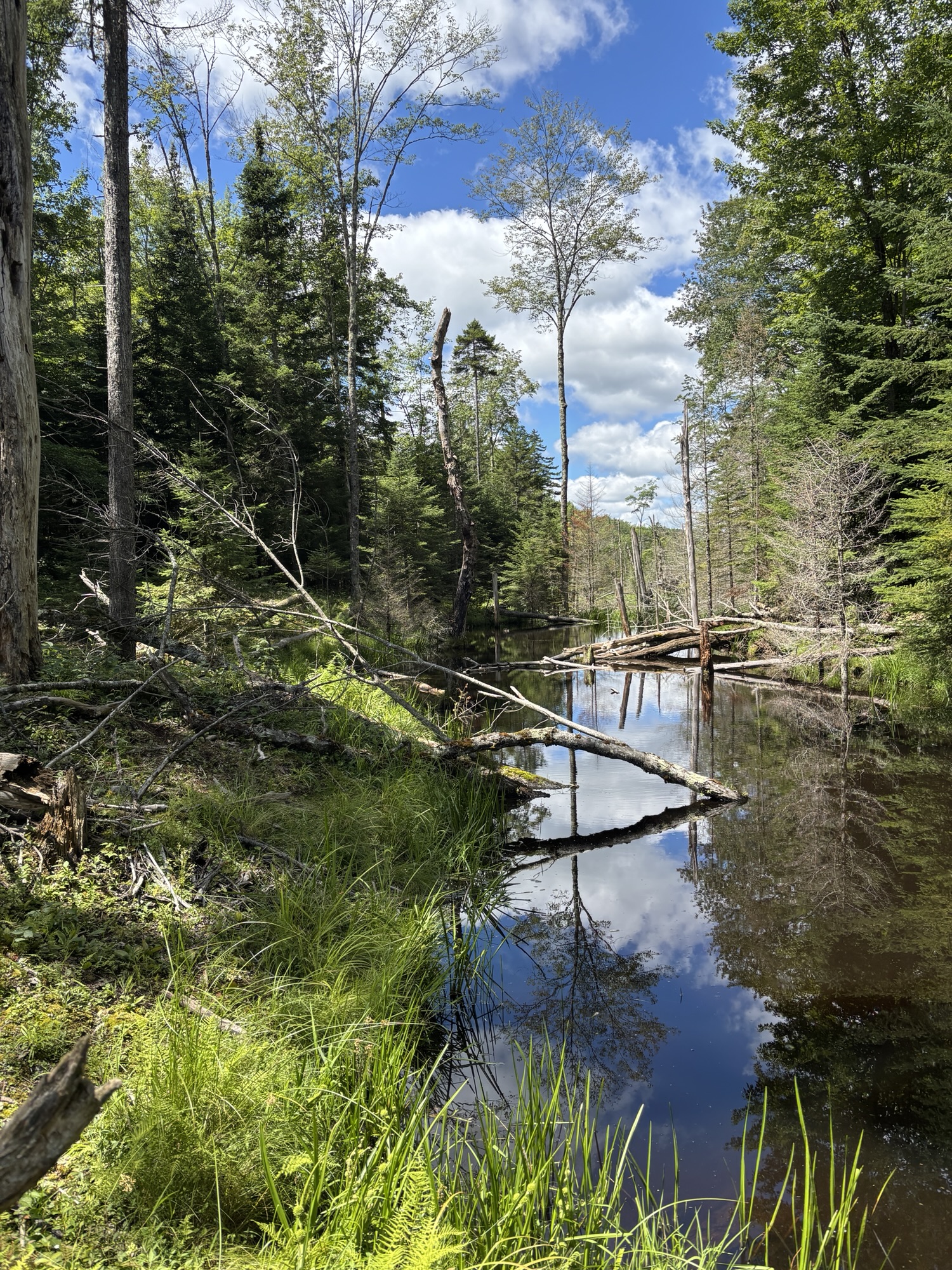
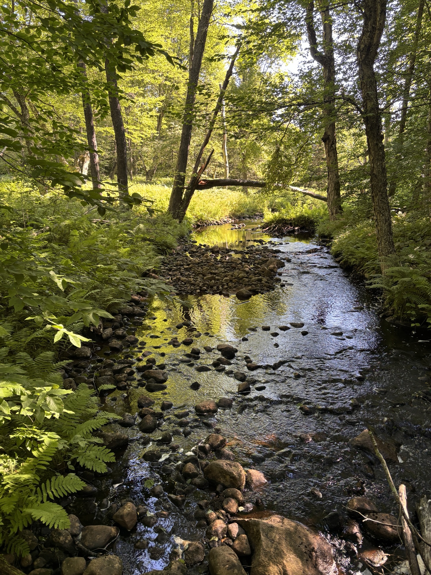
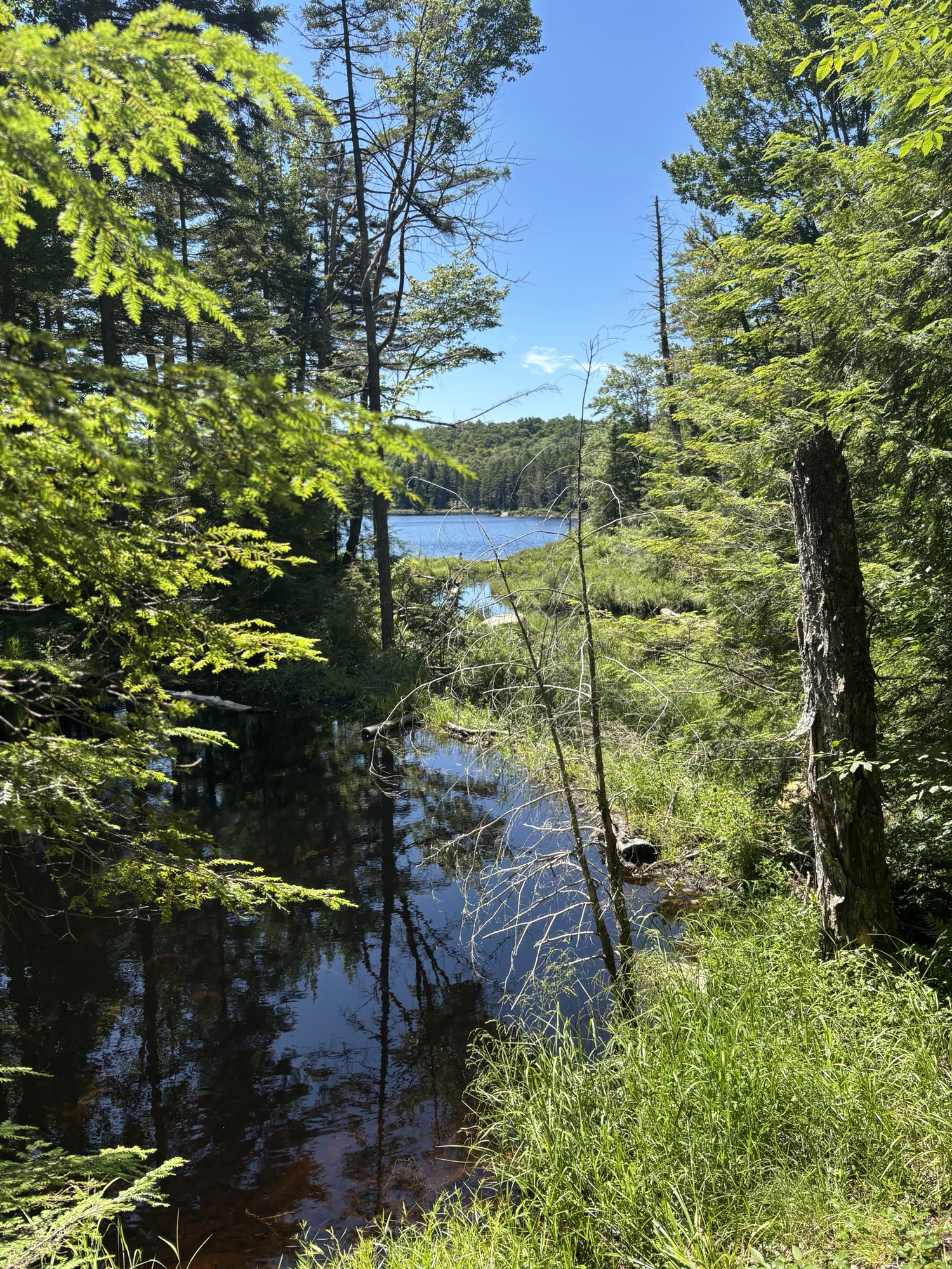
At this point, the trail is nice and even since it’s on a snowmobile trail. But once you leave that, the trail becomes much more Adirondack-y, with rolling ups and downs, rocks, more mud, some beaver flooding and things are a bit more overgrown in places. The views along Brandy Brook Flow were gorgeous.


I was excited to be getting close to Campsite 14 but this is where things got interesting for Shannon and I – not in terms of terrain, but in terms of events.
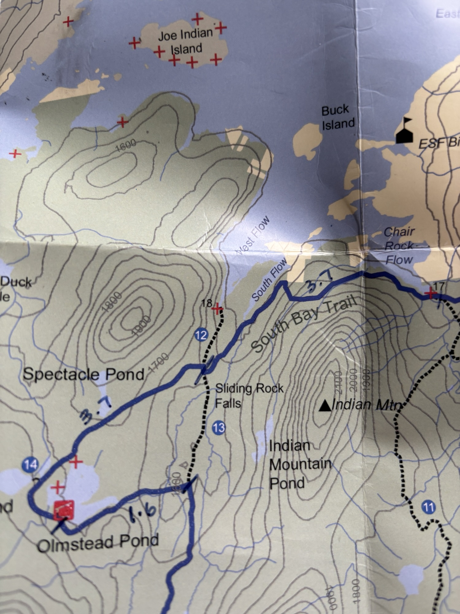
She had a map and spoke with someone about paddling conditions. I had the CL50 map, the guidebook and All Trails. We both expected her to arrive at the campsite first since she was paddling.
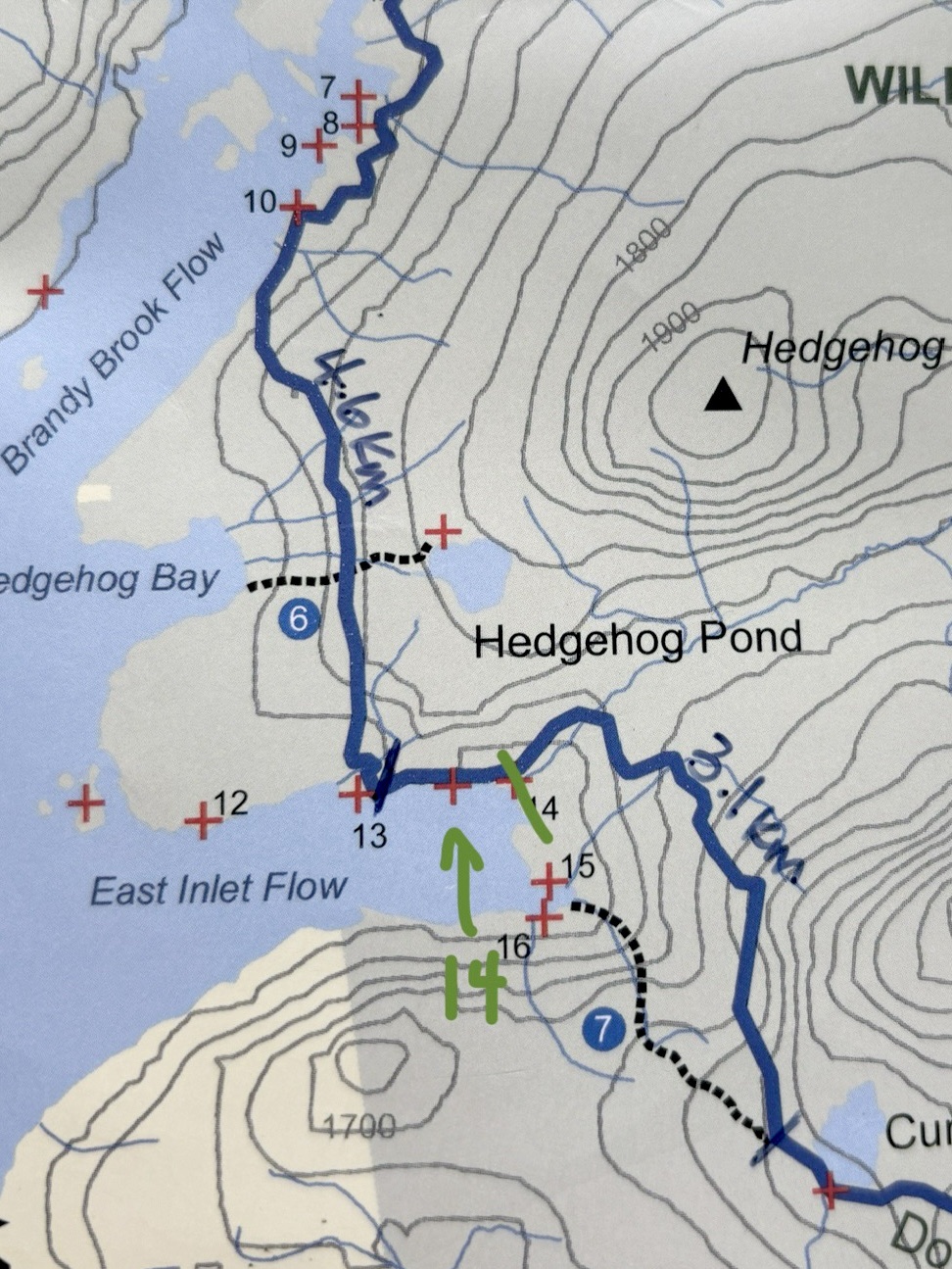
But here’s what I discovered. On the CL50 map, there are three campsites marked. The first is 13, the middle site has no number and the last is 14. The campsites are not numbered from the trail, though I later found out they are numbered from the water. I found the first site, and heard several voices so I assumed (correctly) that it was 13 because it was the first on the map and I wasn’t expecting my friend to be talking to anyone. Then I found the next site, which *was* 14 BUT I thought it was the unmarked one in the middle on the map. Besides, there was nobody there. So I continued on. Until I was no longer near the lake. I looked at All Trails and realized I was past where site 14 should be. So I turned back. Again, I popped into the empty site and nobody was there, and thought, “Maybe she stopped at the first one and that was actually her speaking to someone else.” So I hiked back to 13 and went into it. The two fellows at the campsite confirmed it was 13 and that they saw my friend paddle past to 14. So I hiked back towards 14. Except at this point, I still thought that empty site was the unmarked one on the map, so I kept going. Because she should already be at the site. And of course, AGAIN, I start hiking up East Inlet Flow, away from the lake. I realize that the empty one MUST be 14 and that the unmarked one on my map actually doesn’t exist (maybe it did when the map was printed). I hike back to the empty site. At this point, I’m exhausted and getting a little nervous. I realize we never talked about a backup plan or what to do if we didn’t find each other.
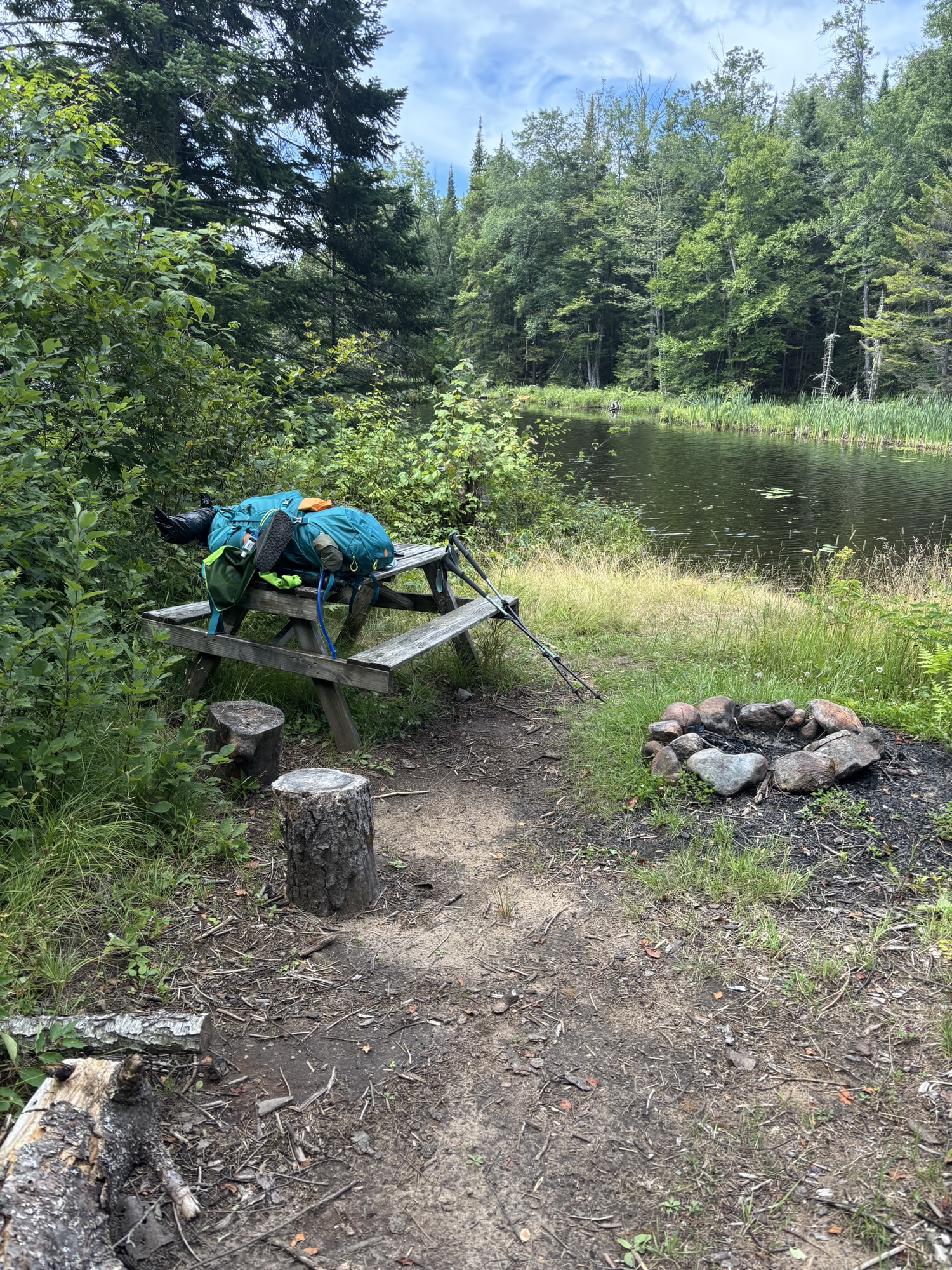
I get back to the empty site (which is actually 14), and there she is! She had literally JUST arrived! She had gotten disoriented when paddling on the lake with all the inlets and islands and ended up taking several hours to find her way! She was exhausted as well but we were both very relieved to have found each other. So… if you have the CL50 map, please note that there are only two campsites off the CL50 trail on East Inlet flow (see photo).
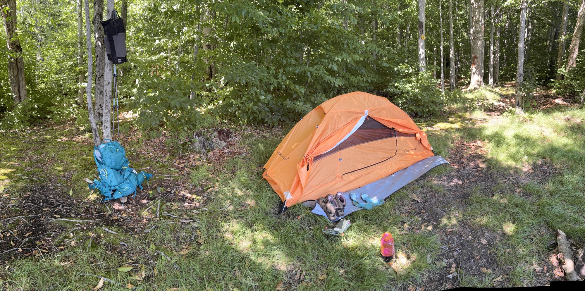

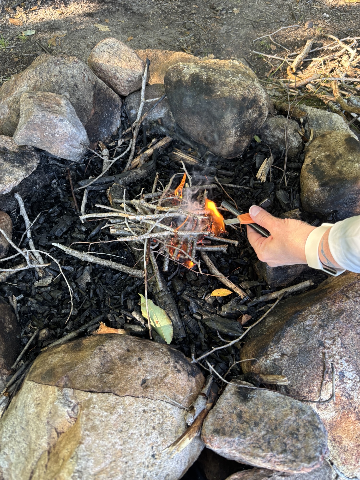
Site 14 is adorable. It’s small, covered in grass, with a fire pit and some stumps to sit on. There is room for a wee tent and a couple of trees that worked well with her hammock. The water was warmer than the air and we soaked in it for a while before setting up camp. The ground was so soft for sleeping and with my sleeping bag, I was warm enough with a couple of layers. Shannon, had a hammock, and another camper, who popped in to check out the site who also slept in a hammock, said they were quite cold, even with all their layers. (I think the temps were down to 8C (46F). ) We hung our food in my bear bag but honestly there were not very many suitable branches, though we didn’t hear any evidence of animals throughout the night. We also had a tiny fire with kindling just to say we did.


Day 2 was in the books and I was loving this trail, even though my bad ankle was definitely taking the brunt of the heavy pack. Day 3 would be my longest day and prove the most challenging.
Day 3, Wednesday, July 23:
My last day of hiking and my first solo overnight. It was going to be a longer distance (21km) and greater elevation this day so I knew I would be taking as many breaks as I needed. The water taxi I had booked wasn’t picking me up until Thursday morning, so I had all day to get to my final destination of campsite 18.

The morning started out beautifully. The mist over the water was gorgeous and the temperature was fresh but not cold. I was packed up and after seeing off my friend for her paddle back to base camp at the campground, I set off back on the trail, to retrace some of my steps from the day before.
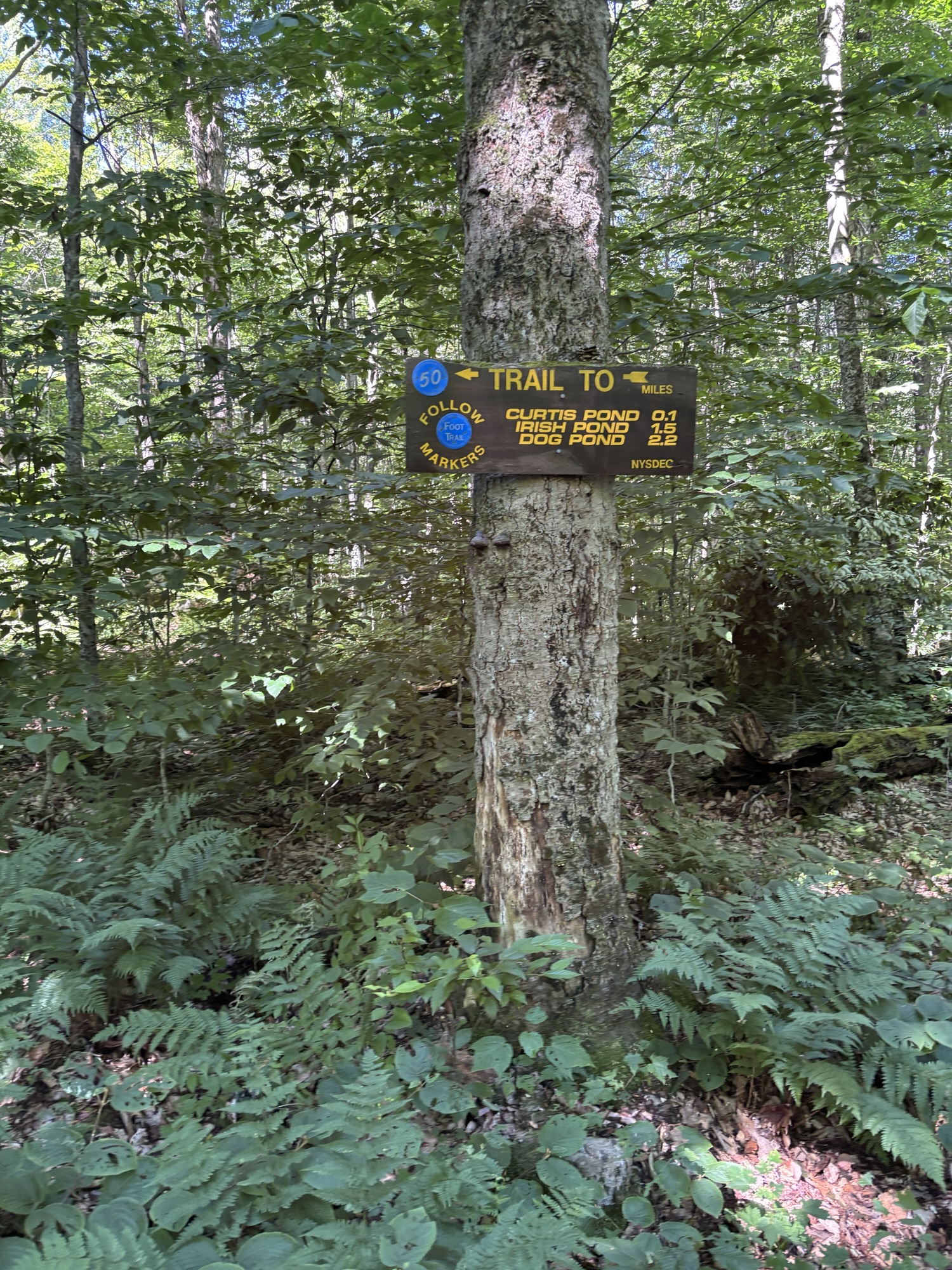
The scenery on the first half of today’s hike was just gorgeous – crossing over East creek on the little wooden bridge, finding Willy’s cave, passing Curtis Pond, Willy’s pond, Irish pond and then Dog Pond offered scenic views and photo breaks. Again, the sky was blue with wispy clouds and the mud and bugs were very manageable. I marveled at my luck having randomly picked these three days to hike back in February and having them turn out so beautifully! The elevation gain in this section was significant. While not difficult, in terms of grade, it felt fairly consistent and I was happy to get to the junction with Otter Brook since it seemed to level off.


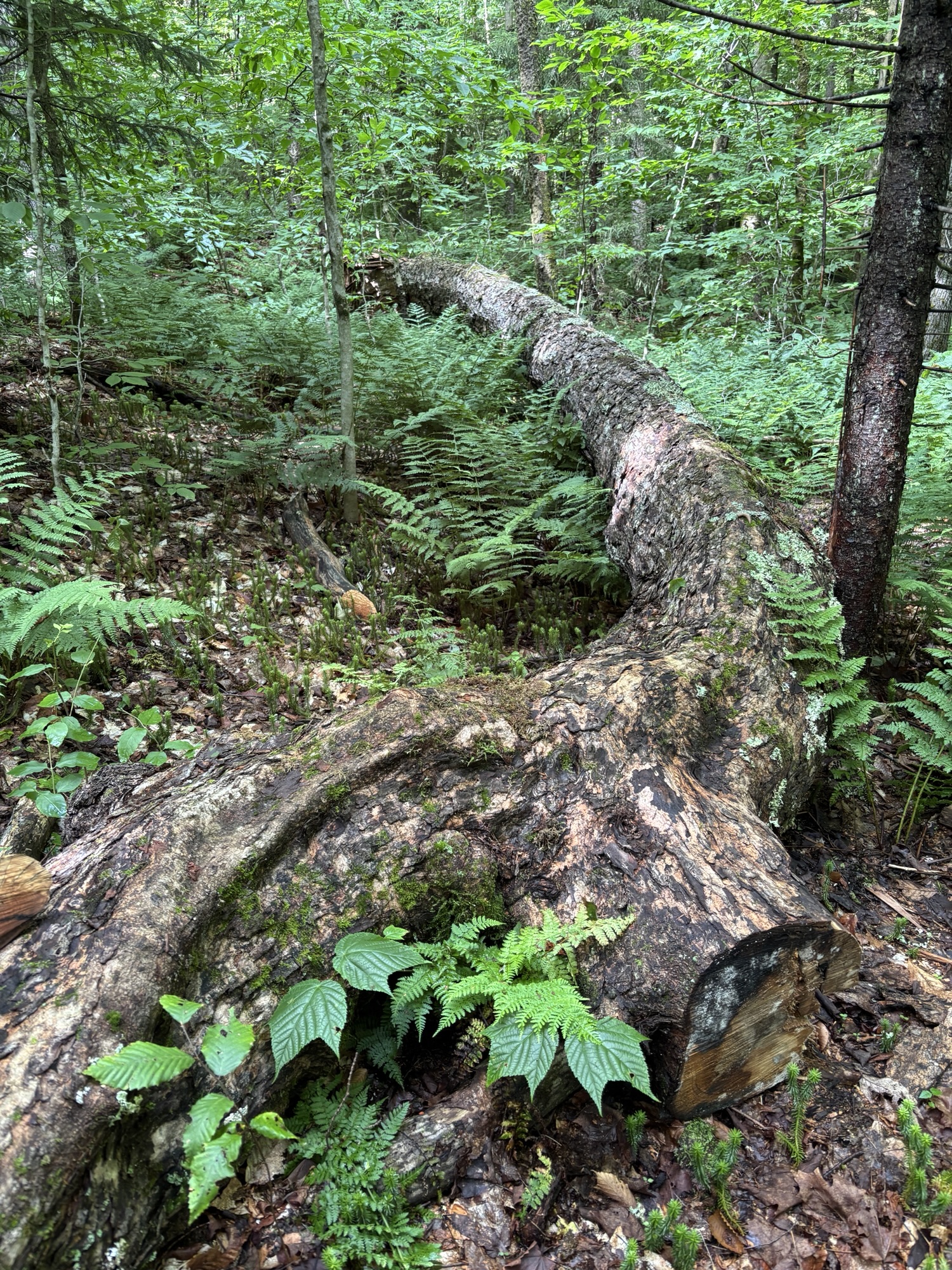
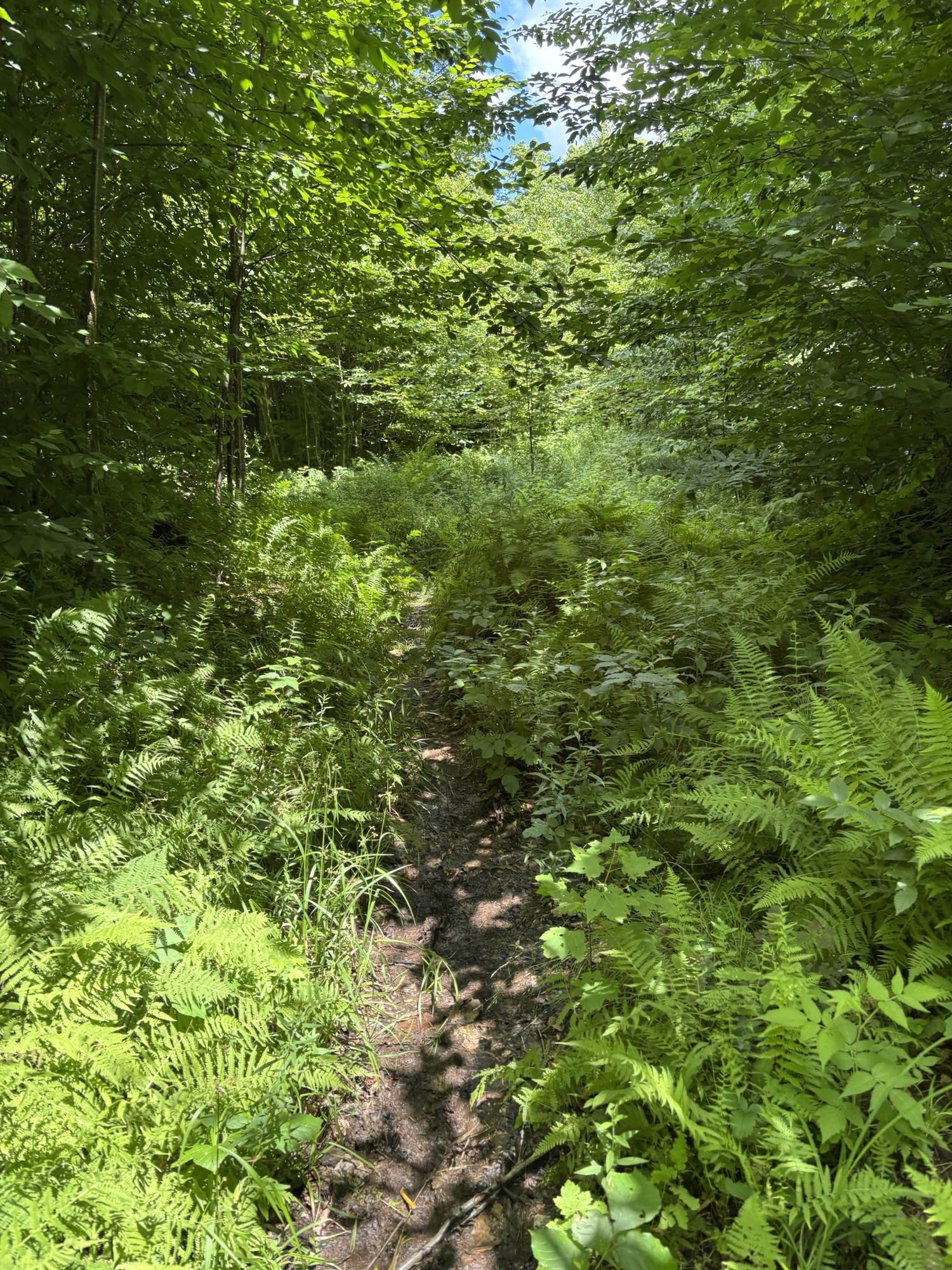
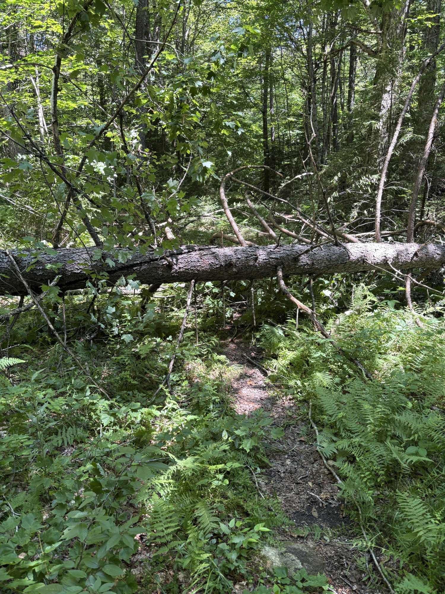
The second half of the hike was less interesting and I found myself listening to music in order to help me pass the 5.2 miles to Chair Rock Flow. I still had almost 3.7km (2.3 miles) plus some to get to campsite 18 after that but in my head, if I got to Chair Rock Flow, I could relax for a bit before hitting those last few miles. The trail was wide at times, fairly even but there was regular deadfall and blowdown to climb over or around. This actually didn’t surprise me; this summer’s rain and storms seems has been hard on the trees. I stopped to rest on several of the tree trunks I had to climb over.


When I made it to Chair Rock Flow, I took a proper break. I took my pack off, sat at the picnic table, ate some snacks, went to the privy, and filtered water. When I felt mentally ready to take on this last section, I hauled my pack back on and started out.
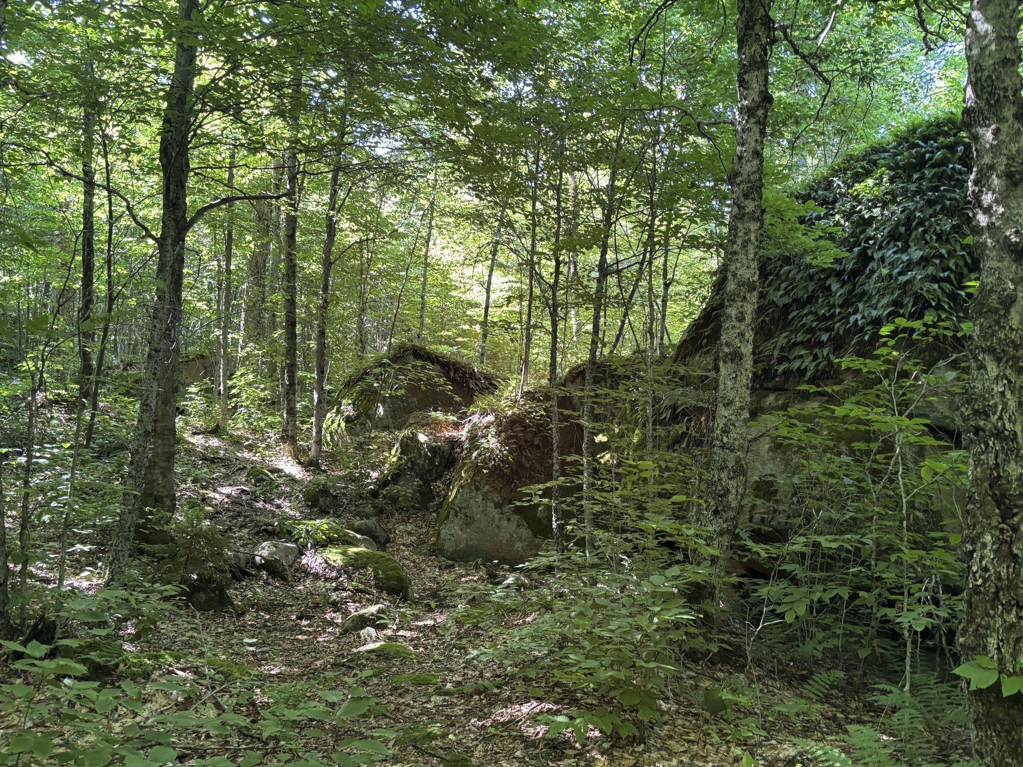
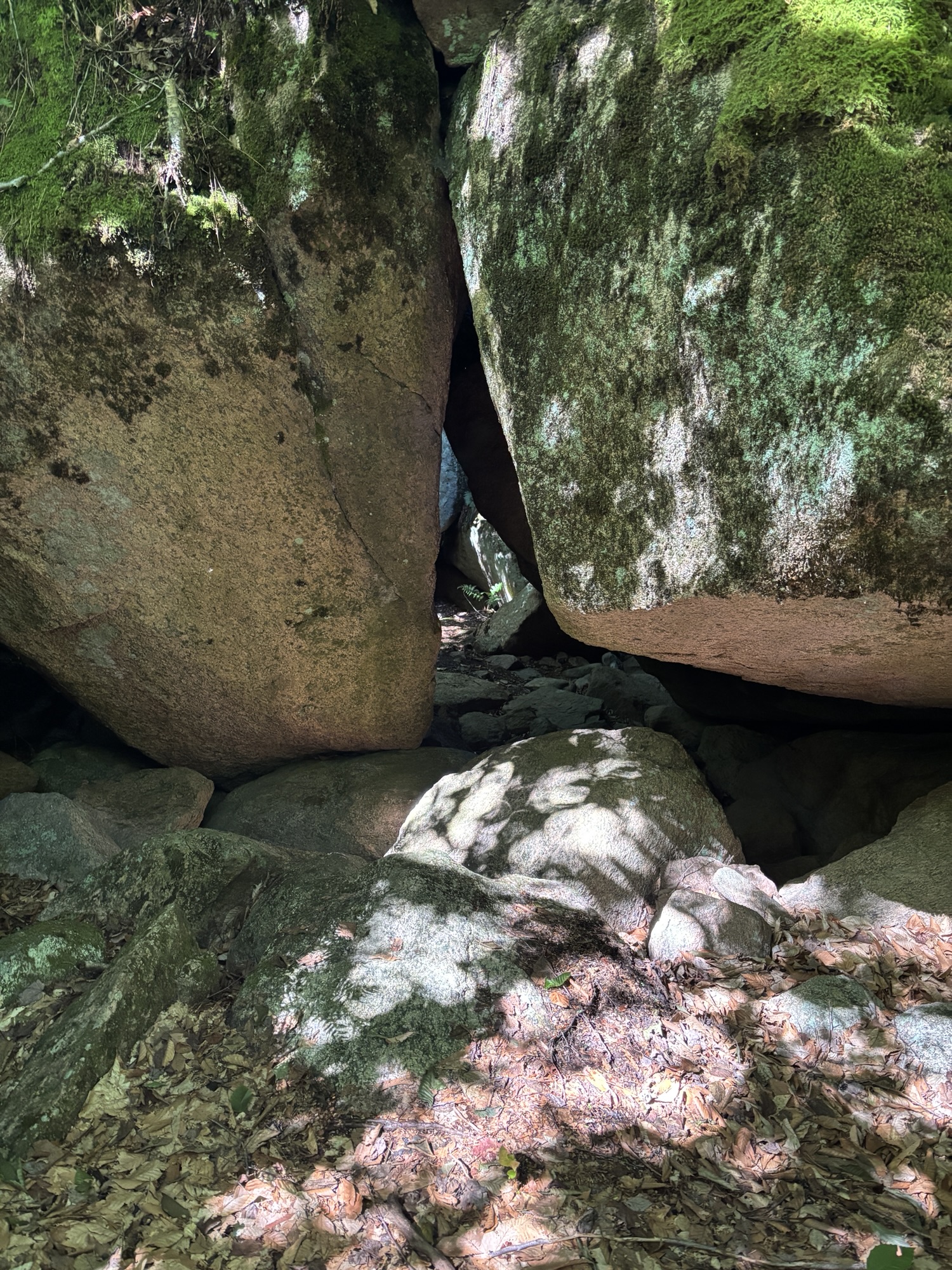
The 2.3 miles from Chair Rock Flow to the junction with Six Mile Creek felt much longer than 2.3 miles should have. There was more uphill that was unexpected and I had to dig deep to muster the energy for it and then a rather steep downhill. Once I was down off the hill, I walked past the stone slab “cliff” faces that I had just descended. It was a pretty cool sight.


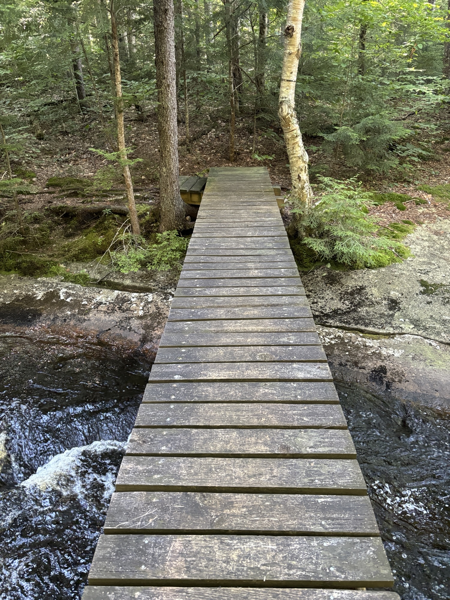

Soon after crossing a wooden bridge, over a delightful running stream called South Flow, I finally hit the junction with Six Mile Creek Trail and headed towards the lake to campsite 18. In hindsight, I really wish I’d had the Cranberry Lake navigation map because I was going by the CL50 map, which was vague in its location of site 18 and All Trails, which was just plain wrong. There was no information about site 18 in the guidebook other than to say that it fit several tents, had a fire pit and you could swim there.
The trail to the lake was easy but things got confusing when I made it to the lake. There was a trail sign but nothing indicated where the campsite was. But it seemed there was a trail to the right. So I rock hopped across a little stream and started hiking along the dotted line that All Trails showed me. I found the spring and continued on my way on the east side of West Flow. I made it to what looked like a campsite – it was an open clearing with a break in the trees that led to the lakeside. But I also noticed the No Camping sign so it seemed like it perhaps had been a campsite but was not regenerating. I was very confused, so I unpacked some food, took my boots and socks off and sat down near the water for a break.


When I looked across the water, I saw the sign nailed to a tree, indicating campsite 18 across the water on the other side of West Flow. So I packed everything up again and headed back past the spring and around to the left side. But there was no definitive trail. I followed what I thought might have been a trail but eventually I found myself bushwhacking through the woods, trying to find campsite 18. After probably only ten minutes but what felt like an hour, I rock hopped over a stream, climbed a hill and came out at a large open campsite. I made it! I was so tired, I didn’t even make dinner. I just ate my trail mix, jerky and dried fruit, set up camp, and lay down.


After I got home and posted my photos and trail report on the Facebook group for this hike, another member told me that the first site I had found used to be site 18 but the Department of Environmental Conservation moved the site due to it being abused by campers.
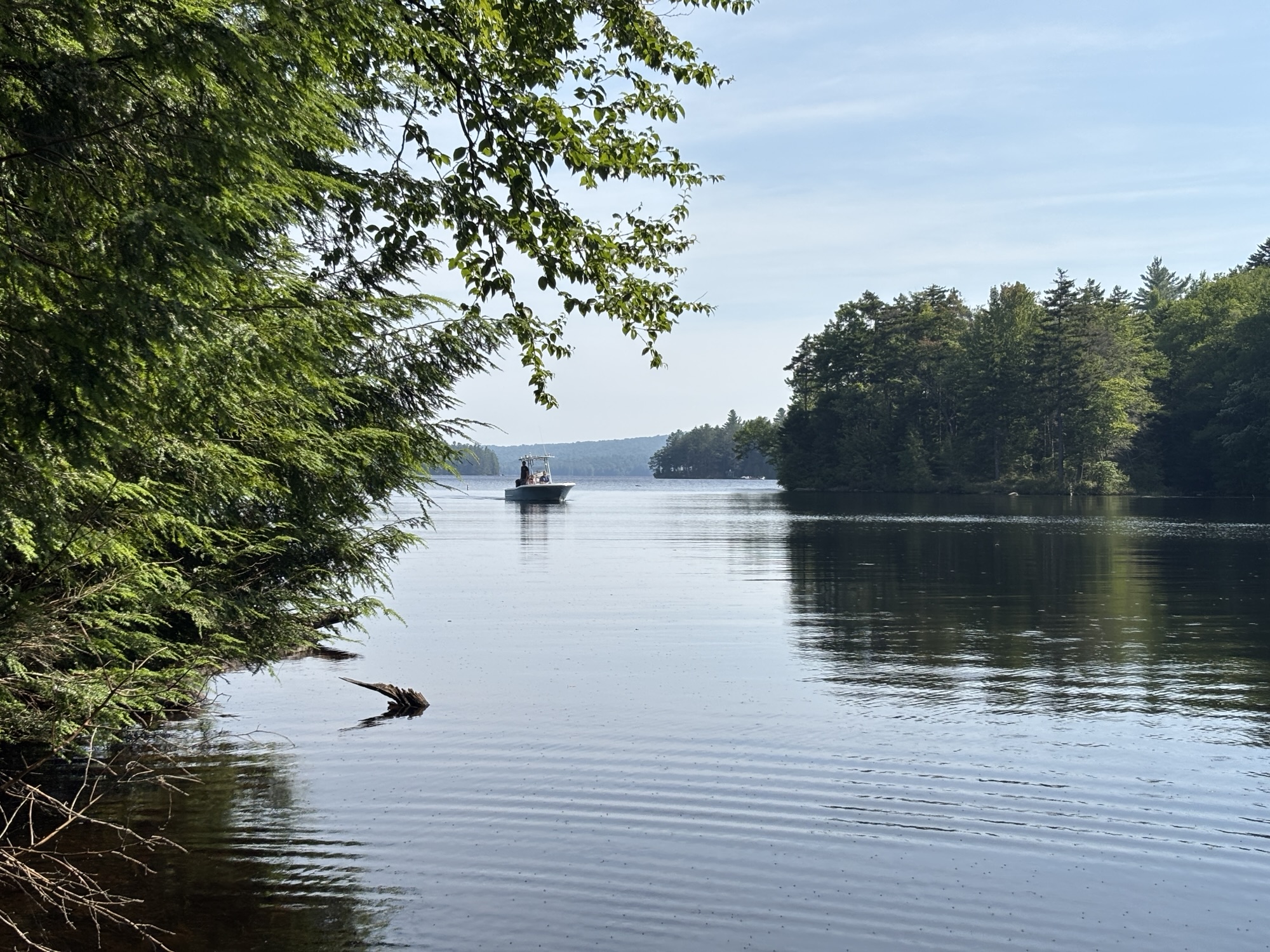
I had been en route for about 9 hours this day. I took my time, took lots of stops. But it was still a long slog at times. Being in such a remote part of the hike was also an anxiety that I had poking around in my head. At one time, just near the end of my hike, when I’m the most tired, I smelled creosote from a dying fire and I started to wonder what would happen if I were caught here in a forest fire. Not that I could imagine anything catching alight in these wet and humid conditions but it was still an unnerving thought. I hadn’t realized the significance of how remote I was. Certainly, the next day, as I was sitting in the front of the water taxi, crossing through the middle of the lake, I saw the vastness of the water and it struck me just how very far away I had been from civilization.
But that night, the pine needle floor and the utter blackness of night made for perfect sleeping conditions. Campsite 14 had been surrounded by deciduous maple and poplar and it let the setting sun in. This campsite is right in the middle of spruce and it is DARK. I know I woke up to get comfortable but immediately fell asleep again and woke up the next morning refreshed and happy I wasn’t going to have to lug that pack another 20 miles.
Day 4, Thursday, July 24th:
The next morning, as the sun rose over the trees, it sparkled off the water and made the campsite glow in a golden light. The three-day reprieve from the heat was over. By 8 am, I had to take the fly off my tent and take off my long-sleeve to stay cool. I was glad I didn’t have to walk in the heat that was coming. Even if I had another two days to hike, overnight on Thursday to Friday had thunderstorms forecast so my timing for pick-up was impeccable.
I stayed in my tent for a few hours in the morning to avoid the bugs. They weren’t awful, just the annoying level they are when one is camping in the deep woods. I knew when I started to pack up, I would need to put long sleeves and pants on in order to get anything done. I wrote in my journal and thought over everything I had learned and experienced.
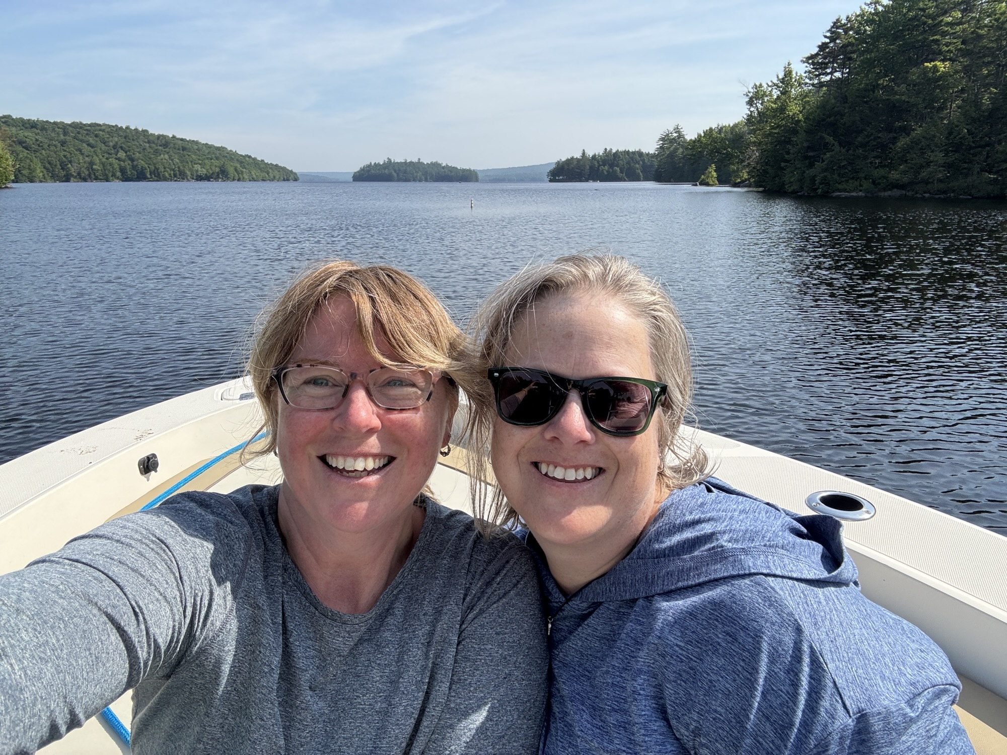
PJ from Birch’s General Store and Shannon were expected to arrive at 10 am for pick up. A few minutes before 10am, I heard the boat approach and then the motor decelerate. I stepped out onto the rock that was just out from the site so that I could see the boat coming in. I heard Shannon call, “Marco!” and it filled my heart. “Polo!” I replied and there they were. My ride home.


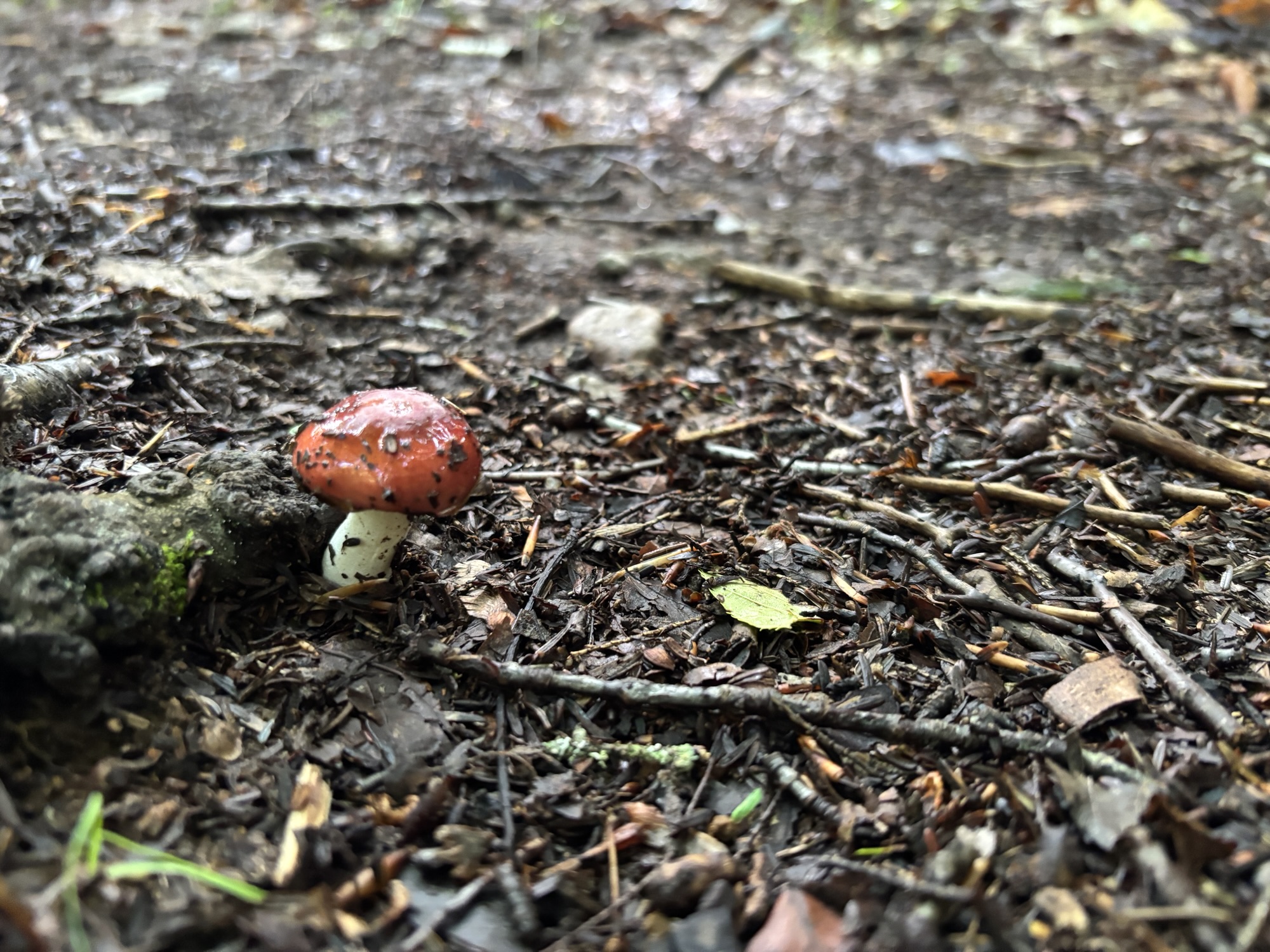
I’m happy that I didn’t try to kill myself by hiking the whole thing in only three days, as was originally planned. I enjoy stopping and enjoying the views. I love taking photos of mushrooms (not as much as Shannon, mind you) and plants and magical scenes. I want to soak my feet (or swim) and have a campfire, watch the sun set and just relax into the whole experience. And you can’t do that if you are only concerned with eating up the miles.
I also think three days was the maximum for my ankle. The pack was getting incrementally lighter and I was getting used to the weight over the days but ultimately, the load was a lot for my bad ankle to manage day after day. Surprisingly, my shoulders, knees and back seemed to take it all in stride. All the lat pulldowns, planks and shoulder presses at the gym really paid off!
What an incredible experience. I was not expecting this trail to be as beautiful or as challenging as it was. This was a challenge I had set for myself and I worked hard toward achieving it for several months before. I was met with some unexpected challenges but I handled everything that came my way and succeeded. This was no easy task. No matter what the young ‘uns or the athlete’s say, this is not a challenge to be taken lightly. I learned so much and I’m really proud of myself for what I accomplished. I feel like I will be even more prepared for when I come back to finish the last 20 miles, whenever that may be. And I think I might invest in some lighter gear.
Packing list (2 days and 2 nights):
- Mountain Warehouse 65L Inca Extreme backpack
- Sleeping:
- MEC Aqualina 0C sleeping bag
- Clostnature Crux Lightweight 1-person tent
- MEC Camper 2 footprint
- Sleeping pad
- Clothing:
- 1 long sleeve sleep shirt
- 1 pair of leggings
- 1 extra bra and underwear
- 2 extra pair of socks
- quilted insulating layer
- Eddie Bauer rain pants
- Mountain Warehouse Pakka Jacket rain jacket
- Cooking:
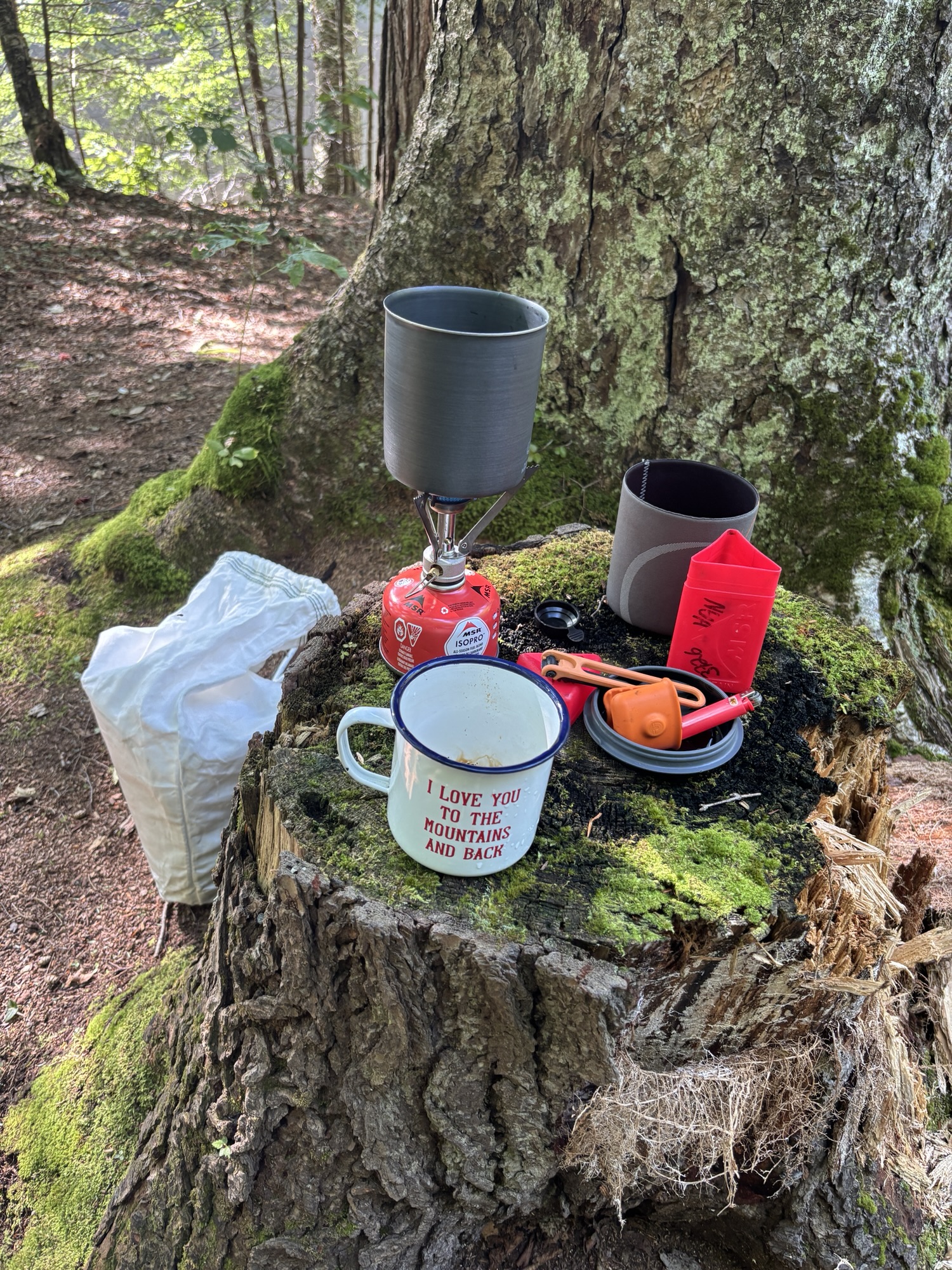
- MSR pocket rocket stove
- small canister of MSR IsoPro camp fuel
- single small pot and pot holder
- spork
- lighter
- collapsible bowl
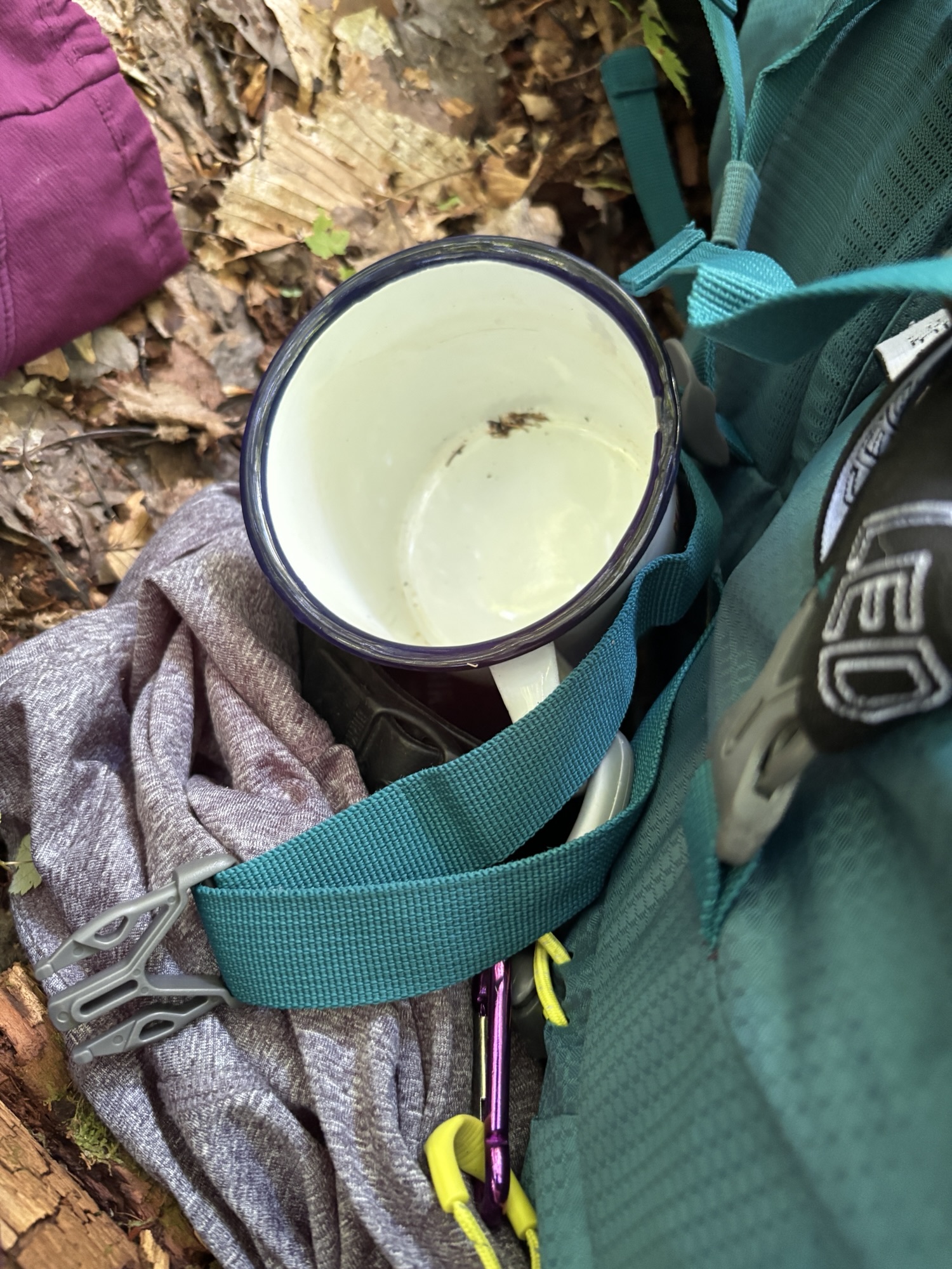
- tin mug
- Water:
- Lifestraw personal straw
- Lifestraw collapsible water bottle
- 3L Camelbak
- aquatabs
- empty water bottle to hold filtered water at camp
- Food:
- Ursack bear bag
- two boil-in-the-bag meals
- trail mix
- jerky
- corn chips (for salt)
- sandwich for Day 2
- Snickers
- protein bars
- dehydrated mango
- map
- guidebook
- compass
- first aid kit
- fire starter
- ferro rod
- journal and pen
- Benadryl
- emergency blanket and handwarmers
- phone battery and charger
- headphones
- toilet paper
- Kleenex
- insect repellant (full of DEET)
- toothbrush and toothpaste
- two headlamps and batteries
- knife
- Ziploc bags

So proud of you. What an incredible journey filled with beautiful sights.
LikeLiked by 1 person
I really enjoyed your telling of the tale of this hike, and your beautiful photos made me feel like I was right there with you.
LikeLiked by 1 person