Back in July when I asked the water taxi how late he had a boat in the water, as I was hoping to come back and finish the final 30km (20 miles) of my Cranberry Lake 50 hiking challenge, he said, “Come back around October 2nd. That’s usually peak fall colours and it’s beautiful.”
So that was the plan. At the end of August, Shannon and I started making plans to head back to Cranberry Lake so I could finish all 50 miles and earn my patch. Don’t forget that this challenge was one I wanted to complete this year because I celebrated my 50th birthday in June and I thought it fitting.
After I got back in July from the first round of hiking, I honestly didn’t know if I would return to finish it. It was harder than I expected and I decided that hiking solo in so remote an area, in which I saw very few humans along the route, was not something I enjoyed as much as I thought I would. It created a level of anxiety in me that had an impact on how much I enjoyed the experience. And Day 2 and 3 were hard with a full 33lb pack. Day 2 had some more typical Adirondack terrain with lots of rocks, roots and mud and Day 3 had a lot of elevation and blowdown. I just didn’t know if I wanted to tackle two more days of similar terrain. My ankle took about a week to recover from those three days of hiking the trail in July and throughout August and September, I had been actively working on strengthening a minor back injury so I didn’t know if I really wanted to carry the big pack again. I was back to work too so aggravating my ankle or back did not sound like a good idea. Not to mention a fall backpacking trip would mean packing more gear for warmth. To be honest, a few weeks after, my memory kept focusing on all of the challenges instead of my successes. Part of me wanted to let go of this challenge and part of me wanted to do it just to get it over with.
Little did I know that the last 20 miles of the hike were almost road-like conditions compared to the first 30 miles and I would be once again blessed with spectacular hiking weather.
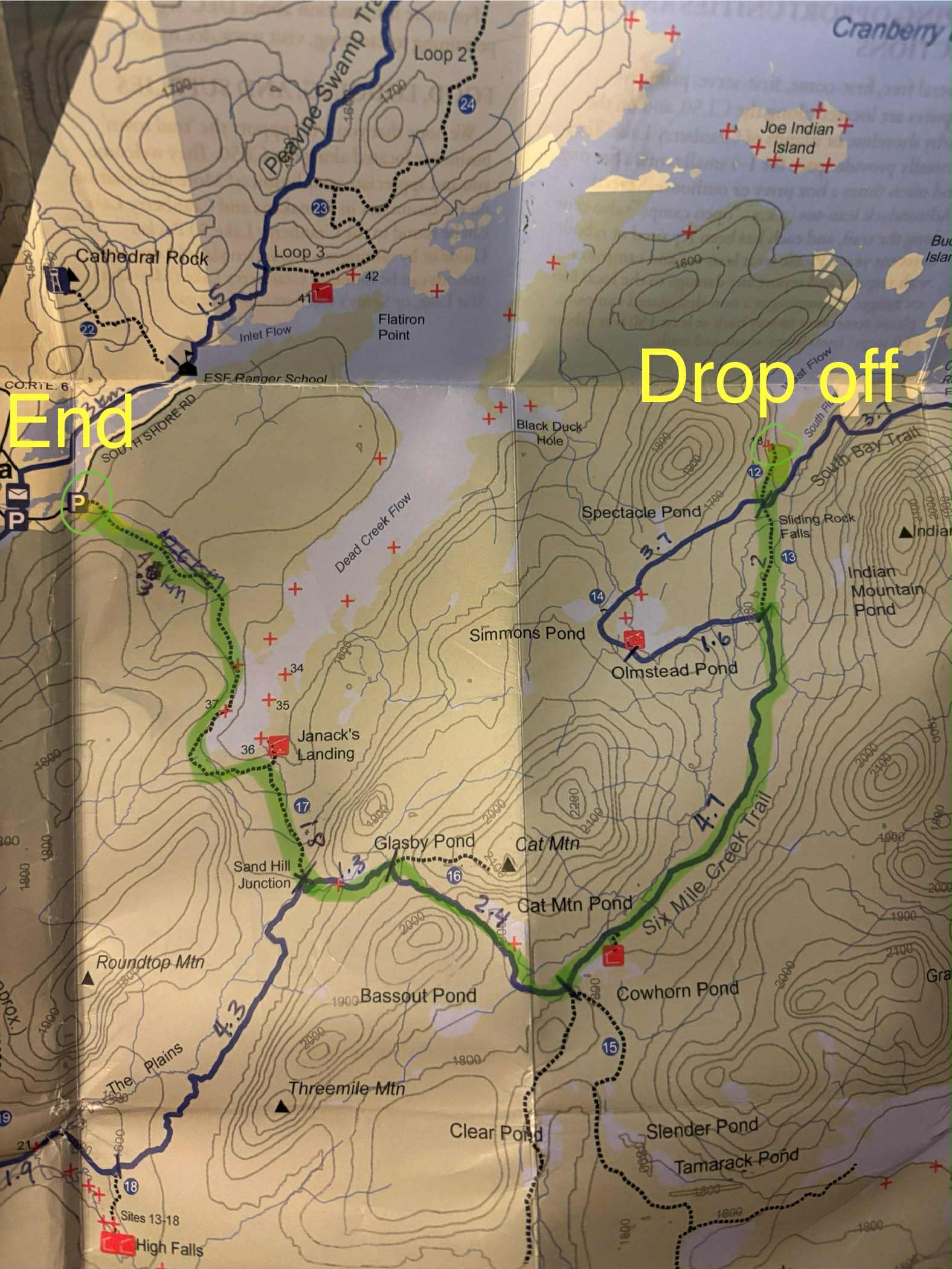
We booked a campsite at the Cranberry Lake campground again for three nights – October 3rd – 5th. This was our base camp once again. My plan was to get dropped off at West Flow, where I had been picked up back in July. Carrying just a day pack, I would head south past Sliding Rock Falls, all the way around to Cowhorn Pond and then turn north to Janack’s Landing just past Glasby Pond, and then head north past Dead Creek Flow, completing the first day’s hike. The second day I would return to that trailhead, hike south again past Janack’s Landing, back to the 50 trail, hike the High Falls loop, completing the 50 mile loop at the big 50 sign starting point in Wanakena.
We left camp around 8:30 on Saturday morning. Shannon and I drove in tandem to the Dead Creek Flow trailhead in Wanakena, where I dropped off the Jeep, which I would eventually hike back to. Then we drove back to Cranberry Lake together to meet PJ, from Birch’s Lakeside General Store at 9 am for my water taxi drop off at West Flow, almost directly on the far side of this massive lake from the general store. He had just completed part of his first Cranberry Lake 50 and we shared stories.
Day 4: West Flow to Wanakena (via Dead Creek Flow)
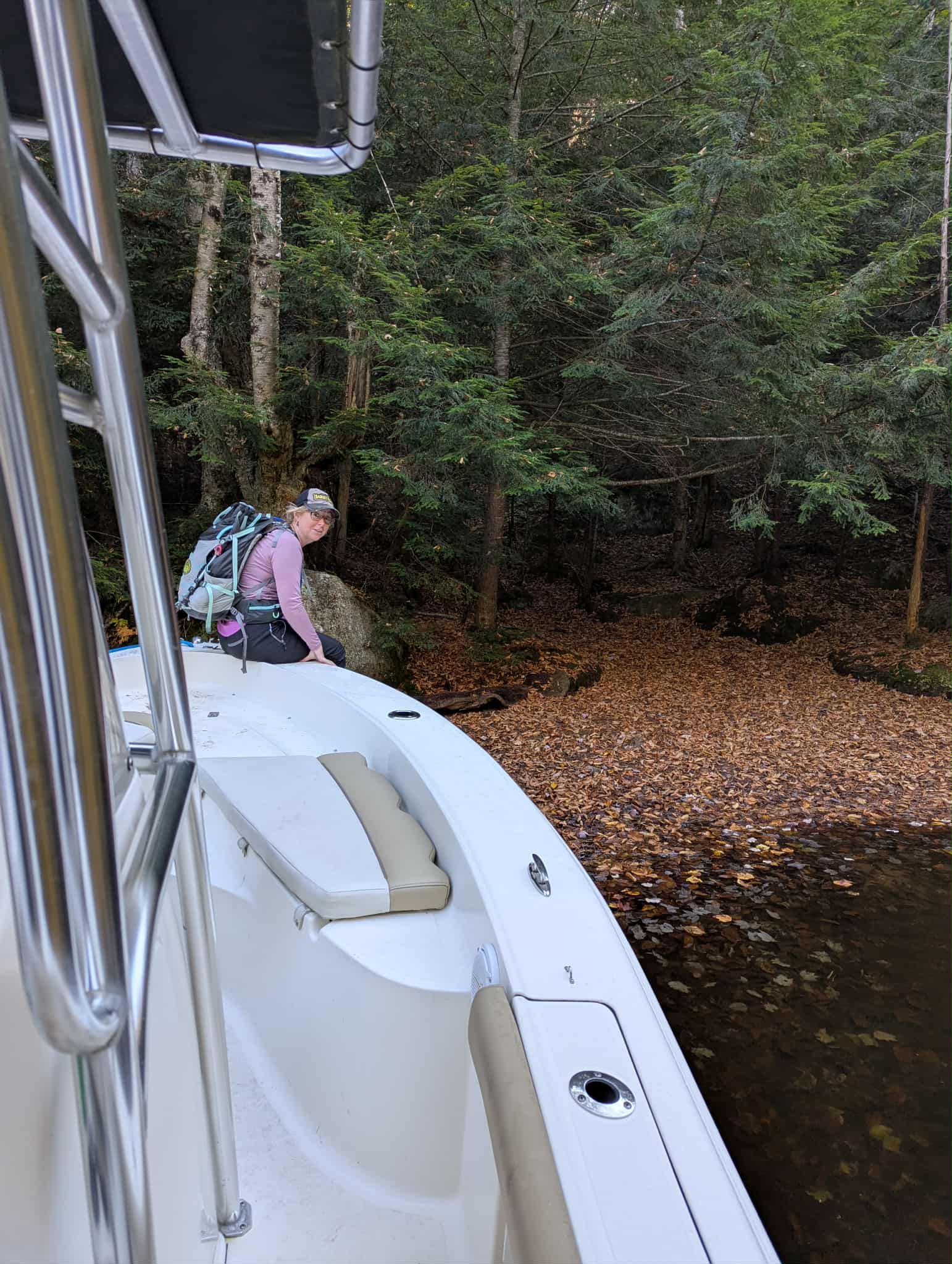
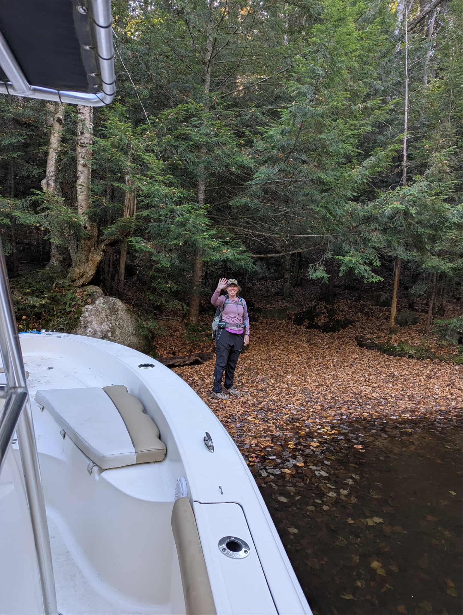
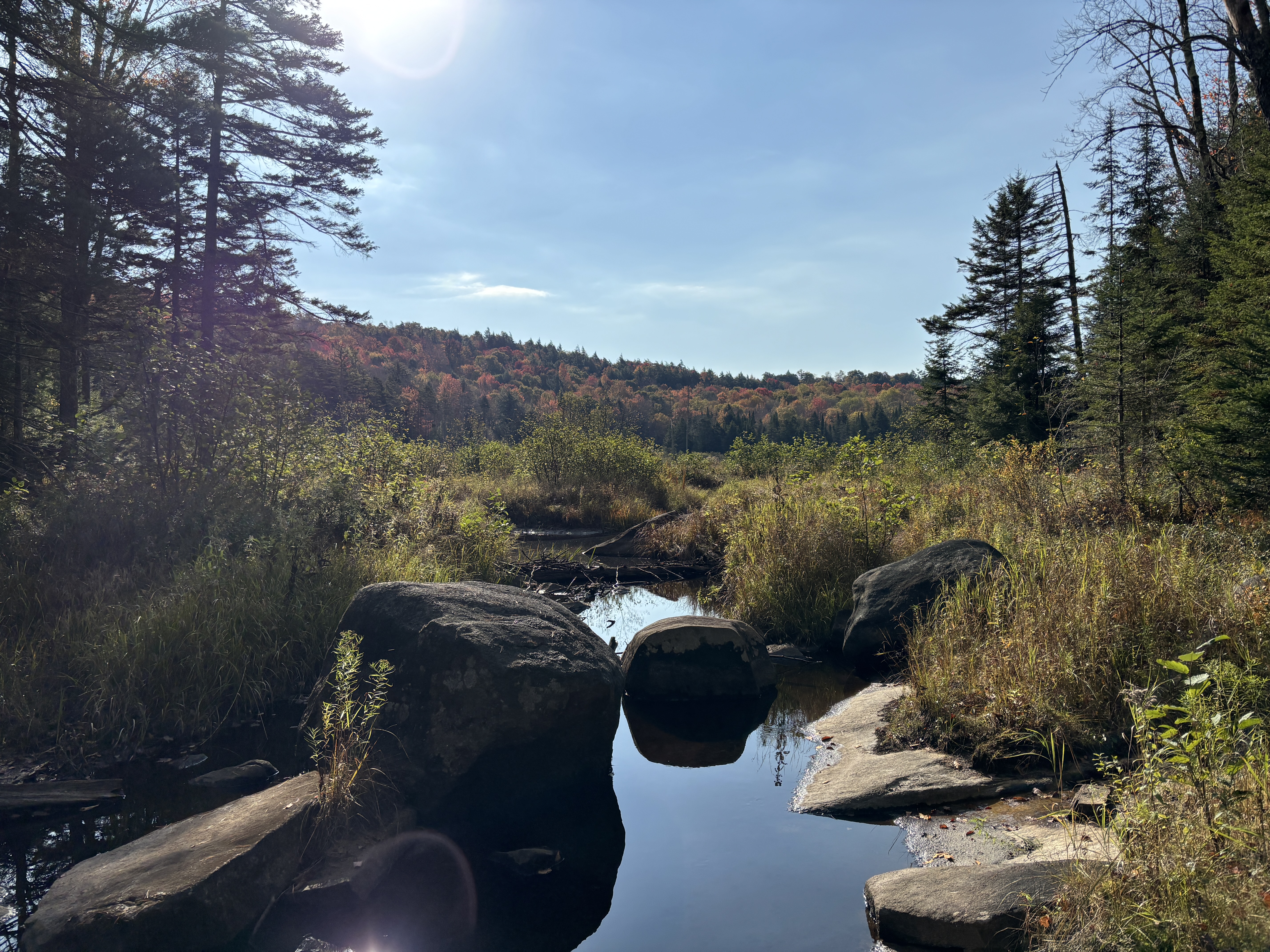
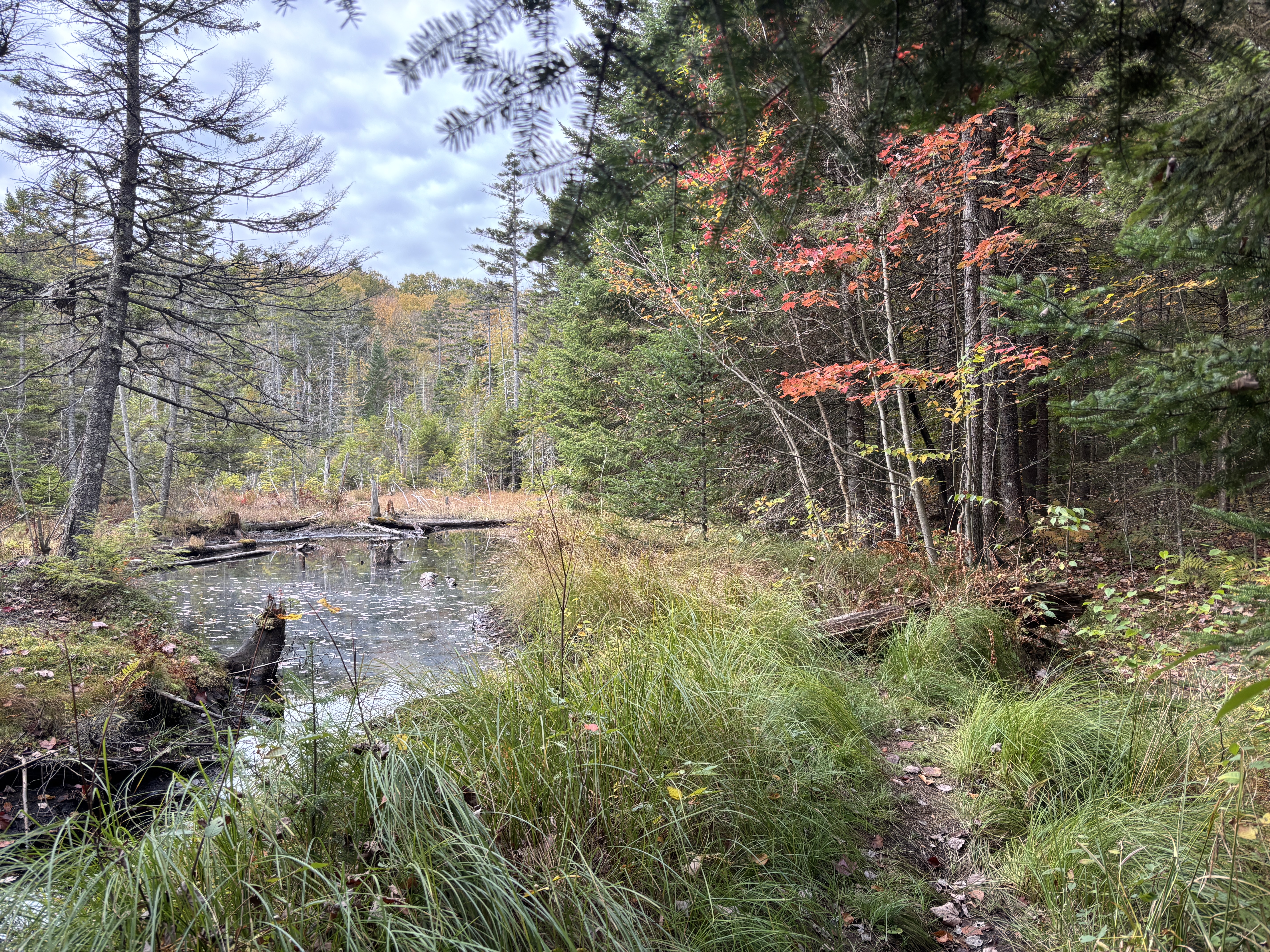
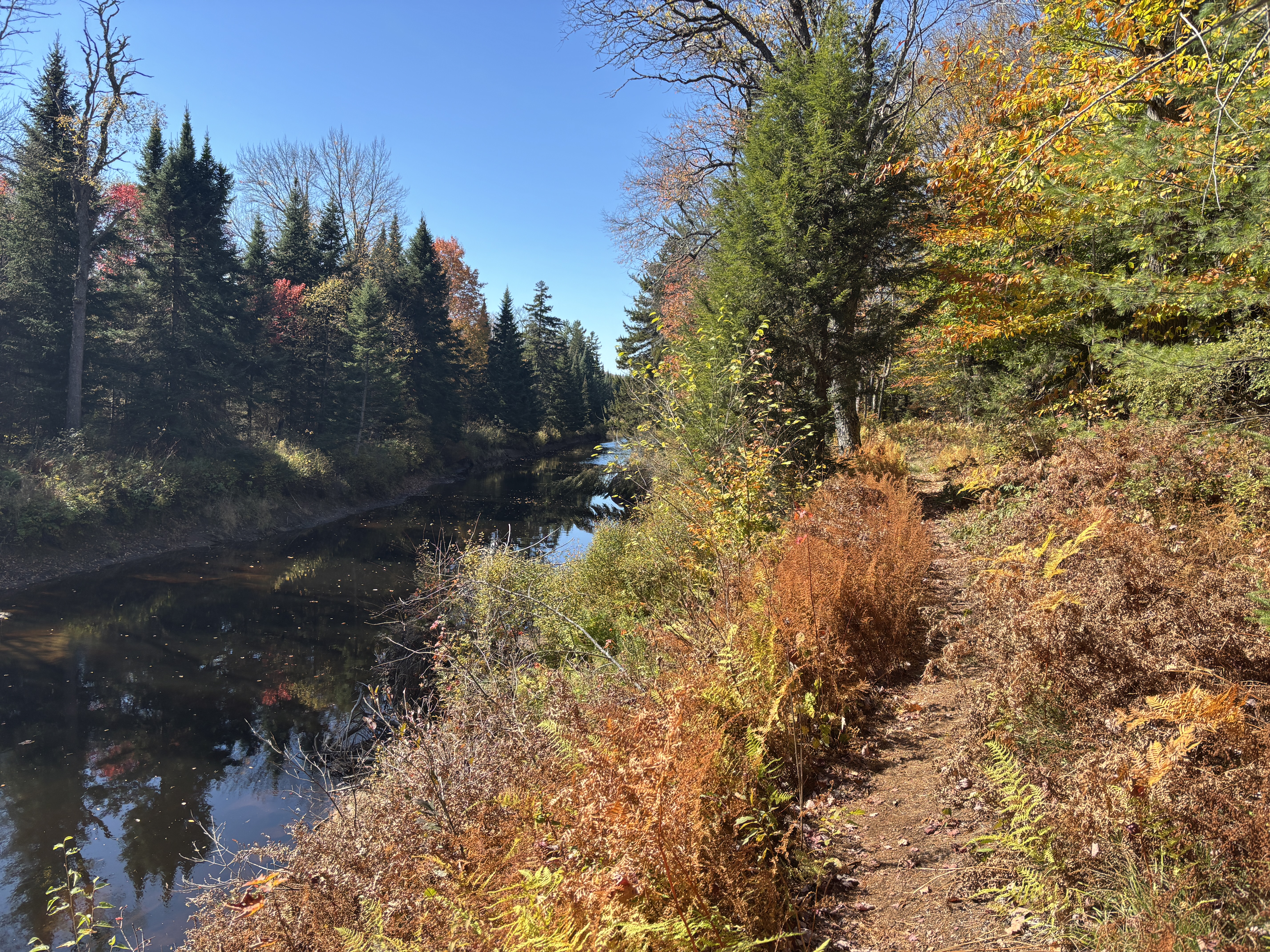
There’s nothing like starting an adventure with a boat ride across a massive lake surrounded by fall colours and blue sky. My excitement was growing. We arrived ten minutes later at West Flow, where I was going to hop off and begin my hike. As we made our approach, my memories of my hike in July were trying to fit with the scene in front of me.


Back in July, I had a really hard time finding Campsite 18, my pick up point. There had been a lot of uphill that day, I was exhausted and the final 5K felt like it was more like 20. When I was making my way to campsite 18, I was so tired that I felt like it had taken me half an hour to get from the main 50 trail to the water, which was only .3 km. Then I had gone to the wrong side of the flow, and I retraced my steps for ages before I saw the sign for 18 across the flow. Then, as I made my way back and along the other side of the flow, I realized there was no trail and I actually had to bushwhack to campsite 18. It was probably only a few minutes but it felt like an hour and by the time I reached the campsite – my final destination! – I was DONE. My anxiety was through the roof. I was exhausted. I had these irrational disaster thoughts that the water taxi would not be able to get in and pick me up and I’d have to keep hiking. I was starving but too tired to cook anything so I just ate jerky, corn chips and Gatorade. The site was dark and getting darker as the sun went behind the trees, and the water was wild and gritty, filled with roots and leaves. In truth, I was very close to panic-mode. I actually took some Benadryl (I’m allergic to some bug bites so I always hike with it) to help calm my nervous system.
I didn’t tell anyone except Shannon what my mental state had been that evening because the next morning, after a long and deep night’s sleep, I awoke refreshed and optimistic, with golden morning light peeking through the needles and leaves, dappling the ground and sparkling off the calm water.
In the days after I got home, when I thought back to that final hiking day, and then returning to finish, I was filled with feelings of foreboding and malevolence when I thought of getting back on the trail at that spot. I would not get dropped off at Campsite 18 but at the tip of the inlet, where the actual DEC trail ends, so there was no bushwhacking this time but the memory of my anxiety, hunger and uncertainty of that evening remained etched in my mind.
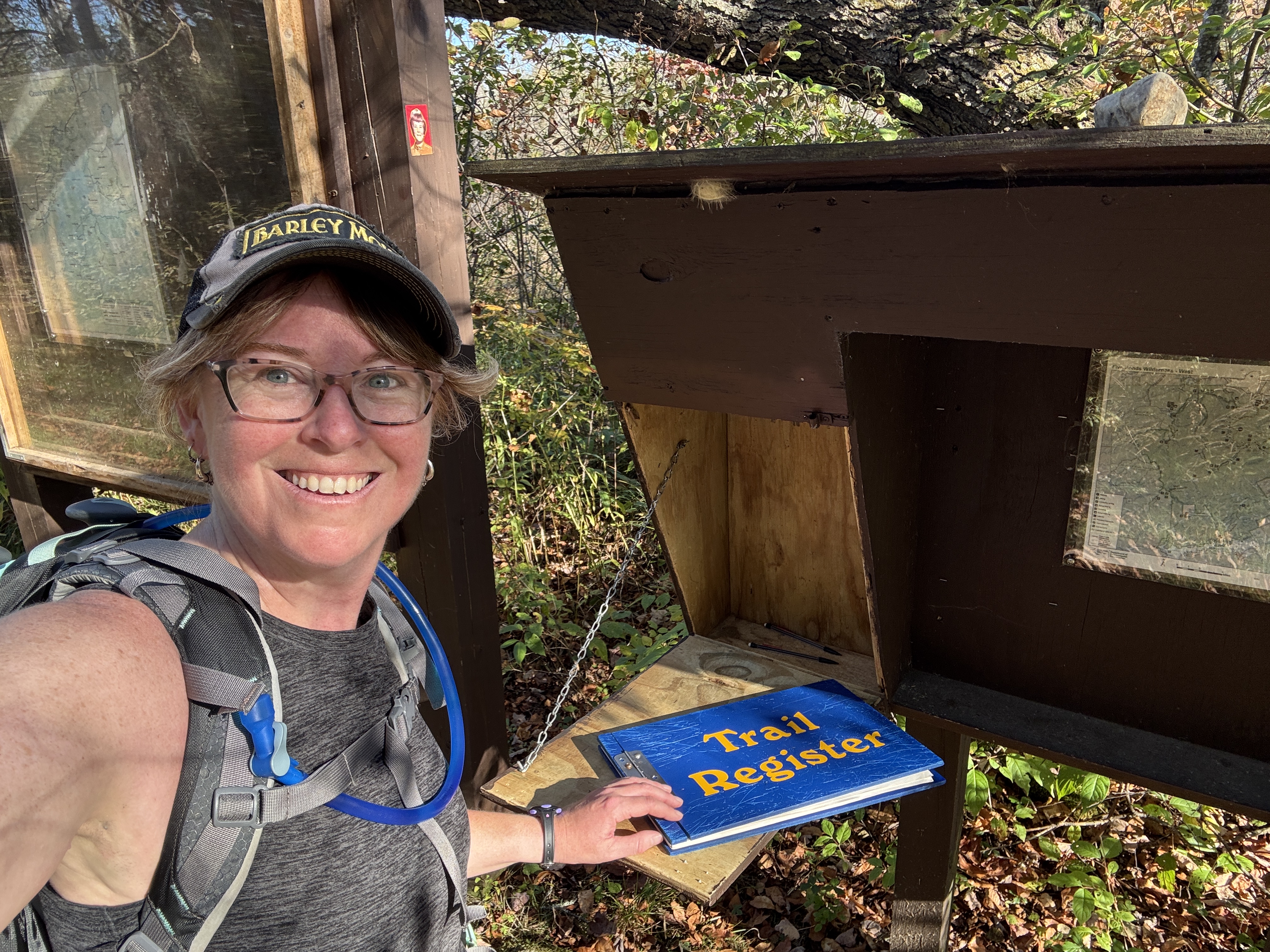
But the boat ride across the lake pushed away any lingering fears I had. As soon as I jumped off the boat, and my boots hit the trail, I felt like I could tackle any challenge that came my way. I was wearing my usual 40L pack, which felt so much lighter than my memory of lugging that monster of a pack around. The morning light was peeking through the trees, the leaves were gently falling around me and the temperature was an absolutely perfect 15C. The trail didn’t look at all dark and gloomy as I remembered and I found myself back at the trail register on the CL50 after only about 5 minutes. How tired must I have been to have it ingrained in my memory as half an hour?
It is at this trail register, at the junction of Six Mile Creek and the Olmstead Pond trail, that I had two route options. Many people do a the loop and go past Olmstead Pond. But you can go straight south past Sliding Rock Falls instead. The straight path is not marked on the CL50 map as the “official” route but the guidebook clearly states that due to beaver flooding, the route past Sliding Rock Falls is also considered an official route. Because I had a big day ahead of me and I wanted to hike Cat Mountain as well, I opted to go straight south past Sliding Rock Falls.


Within only a few minutes of hiking back on the CL50 trail, I crossed paths with a group of about 8 hikers (I didn’t actually count) all with glitter on their cheeks. We exchanged cheery hellos and one told me they were The Glitter Gang. Already, in the first 15 minutes of my hike I had seen more people than I saw in my entire three days hiking in July. It was going to be a good day.
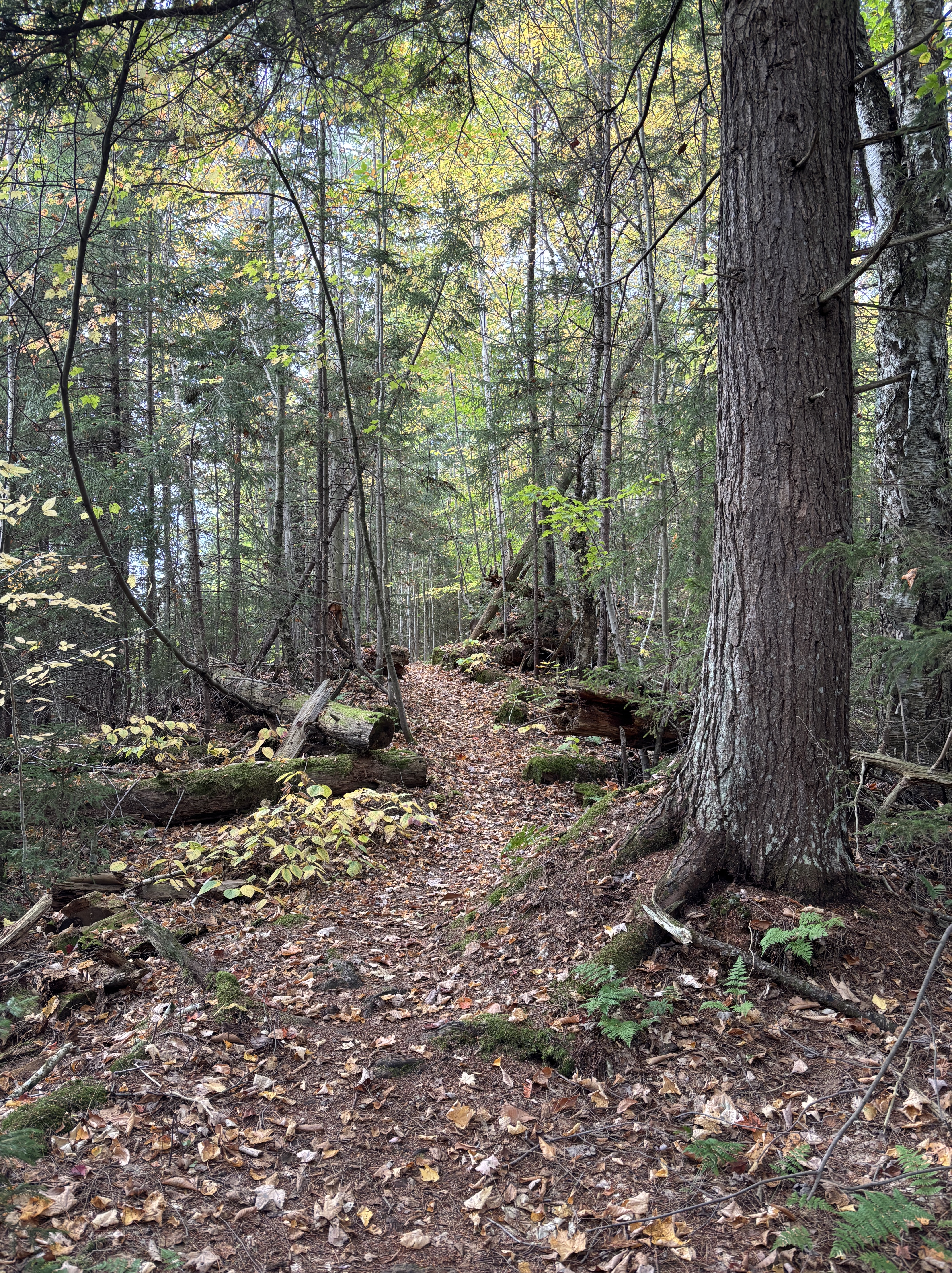
The trail was mostly even and easy to walk, which was helpful since it was covered in leaves. I quickly warmed up and took off my long sleeve shirt. The breeze would gently blow leaves off the branches which created a magical feel to the morning. Is there any better place to spend a weekend than in the woods??


I was eating up the miles. I felt like I could hike forever. There were a few spots of some easy uphill but overall, I was shocked at how much easier this day had started out to be compared to Day 2 and Day 3 in July. I started to wonder if I should have backpacked these final 20 miles, considering how even the terrain was. I made it to Cowhorn Pond in an hour and a half. I was almost halfway!
The trail in this section is along the top of an esker so it’s basically a ridge walk, which is a unique and interesting part of the trail. Another 15 minutes and I was at Cowhorn Pond Junction, where I followed the trail down off the esker and towards Cat Mountain, past Cat Mountain pond.
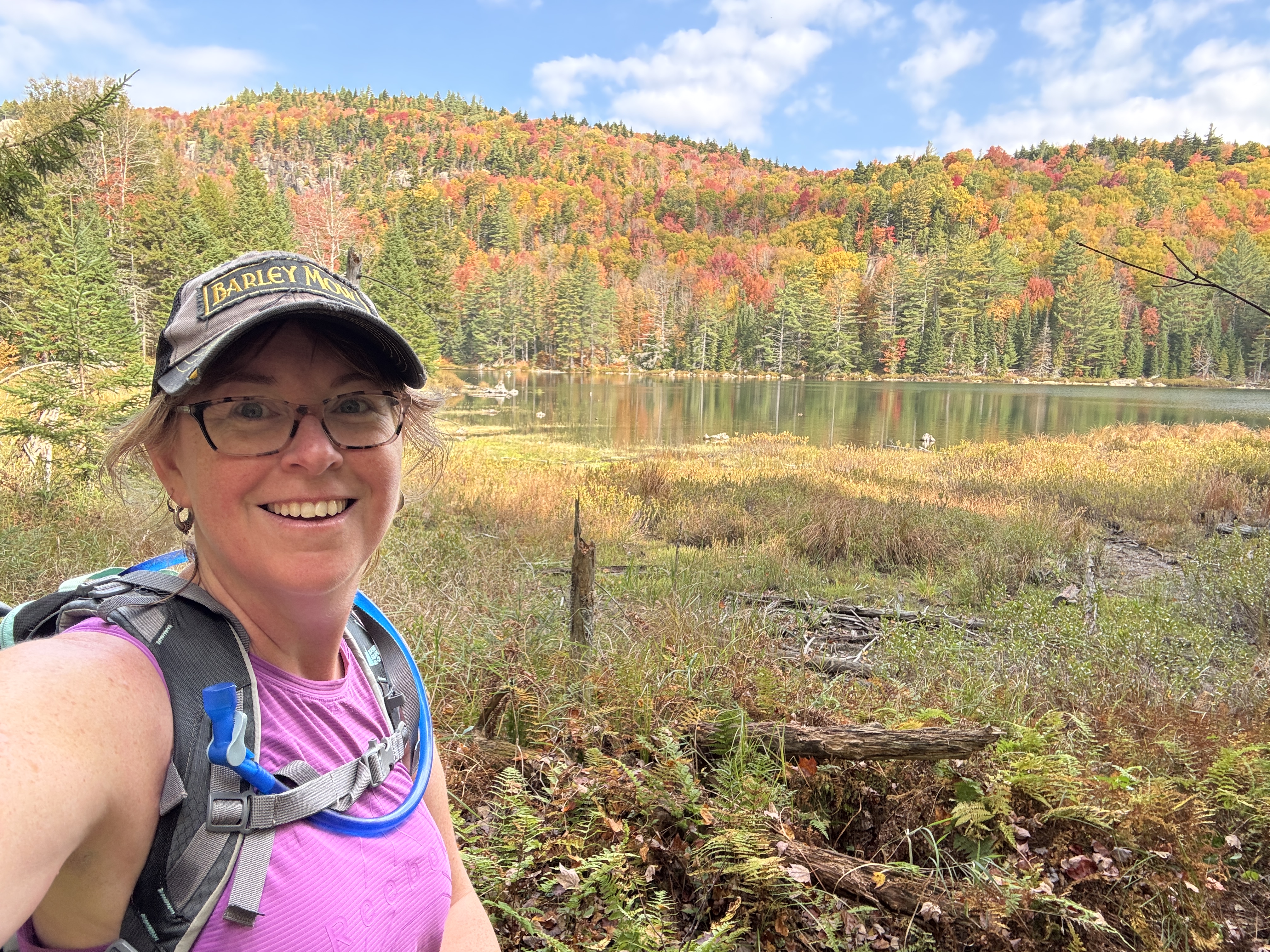
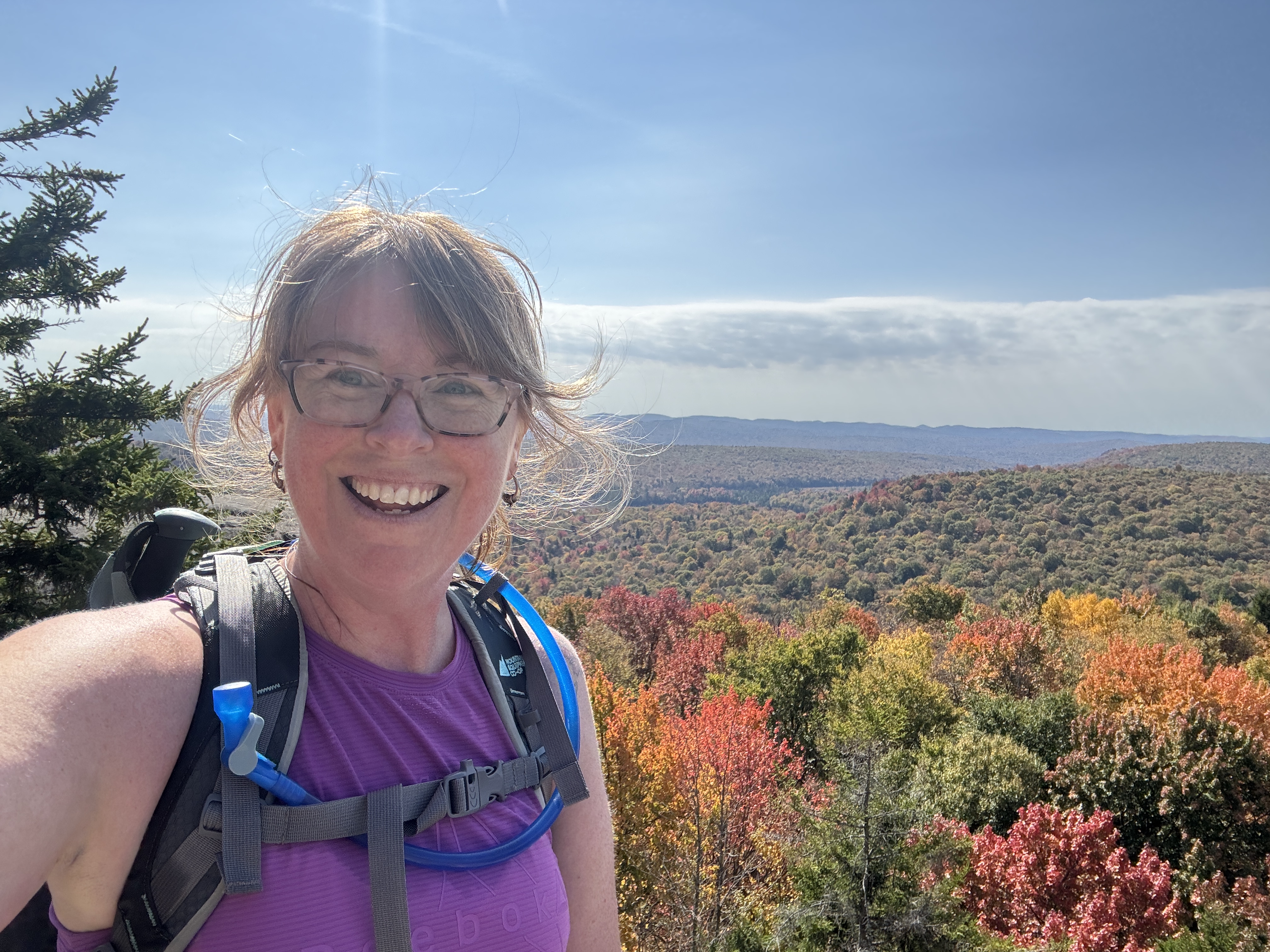
Another 45 minutes over a well-worn, clearly visible trail and I was at the foot of Cat Mountain. I do love a summit scene. The trail up to the summit is only 1.1 km so I anticipated a half an hour up and half-hour down. It was a mix of short bouts of steep and lovely easy uphill and flat. The colours are a bit muted this year due to the drought but the view was still gorgeous.


I relaxed at the summit, had a proper lunch of my turkey sandwich, dried mangoes and trail mix and chatted with some other hikers who were not hiking the 50 but just hiked in (on the same trail I would hike out) to see this view from the summit of Cat Mountain.
When I reached the foot of the Cat Mountain trail, back at the CL50 trail, I saw a couple of glittery faces I recognized. Two members of The Glitter Gang! We chatted about our day and they told me they had started hiking at 2am and they were pushing through the entire 50 miles in a day! These two gentlemen were waiting for the rest of their gang, then most would continue on to High Falls and the rest would head up Cat Mountain to see the view. I wished them good luck and figured they would catch up to me eventually.
And they did. One kilometer later, I found myself at the Glasby Pond campsite. I was so happy to have found a sign pointing the way to a privy too! As I mentioned in my previous post, most of the privies on this route are in fact thunderboxes (outhouses without walls). And this one honestly didn’t feel that far away from the trail. As I took my pack off and started searching for my toilet paper, sure enough, I heard voices. I stood up and saw the first two (fastest) hikers from the Glitter Gang march through the campsite and past the privy turnoff. As the orange shirt faded into the woods, I took my chance and did my business. As I was getting my pack back on and making my way back to the trail, I came across another four from the Gang. I’m sure they did not see the sign pointing the way to the privy because they were surprised to see me, emerging from what looked like the thick woods.
“Oh my God, I know you!” said one of the ladies. I laughed and said, “Yes! You’re the Glitter Gang!” Smiling, she said, “How is this possible? Where did you come from? Are you real?” We all chuckled and I explained that I had originally passed them while they were on their way around the Olmstead Pond loop and I had headed straight past Sliding Rock Falls, that I had met their two other friends at the foot of Cat Mountain and now, well, I was just returning from the privy. “I’m calling you The Fairy of the Woods!” We all laughed and exchanged names and they invited me along to hike with them. I politely declined, explaining my turtle pace would not be able to keep up with them and their epic adventure of all 50 miles in a day. We wished each other luck and they headed off ahead of me. Sure enough, they were out of my sight in a matter of minutes.
It was only another half a kilometre or so until my final turn off the CL50 and heading back to Wanakena past Janack’s Landing and Dead Creek Flow. About half way there, I came across the four Glitter Gang that I had met at the campsite. They had stopped to fill up their water bottles (with filters) at a running stream. I said, “We meet again!” as I approached them and the same woman came back onto the trail and welcomed me with “It’s the Fairy of the Woods again!” I laughed and as I continued on, I said over my shoulder, “I’m sure I’ll see you again in a few minutes!” knowing that they would easily overtake me again.
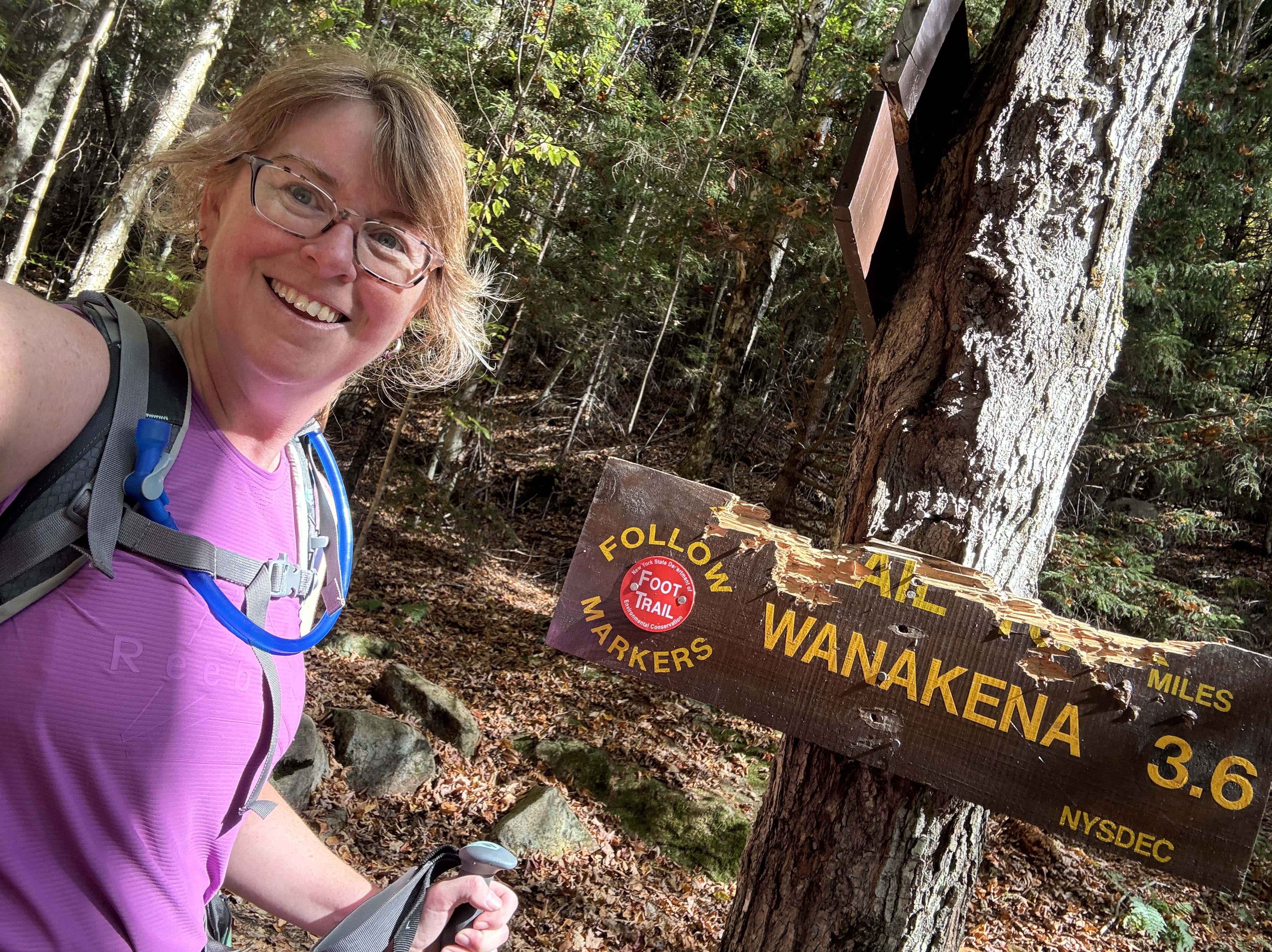
But before they could, I came to my junction to Janack’s Landing, turned north on it and started my 6 km hike back to the Jeep. I was finished today’s section of the Cranberry Lake 50. I chuckled thinking that for the rest of their hike, The Glitter Gang would be expecting to meet me again but wouldn’t find me, adding to my aura of being a truly magical fairy, disappearing into the woods.


The 1.8 km to the junction to Janack’s Landing lean-to only took me 20 minutes and then I just had a flat and fairly straight 4km left to go. I had now hiked 16km and I was getting tired. But 4km would only take me an hour.
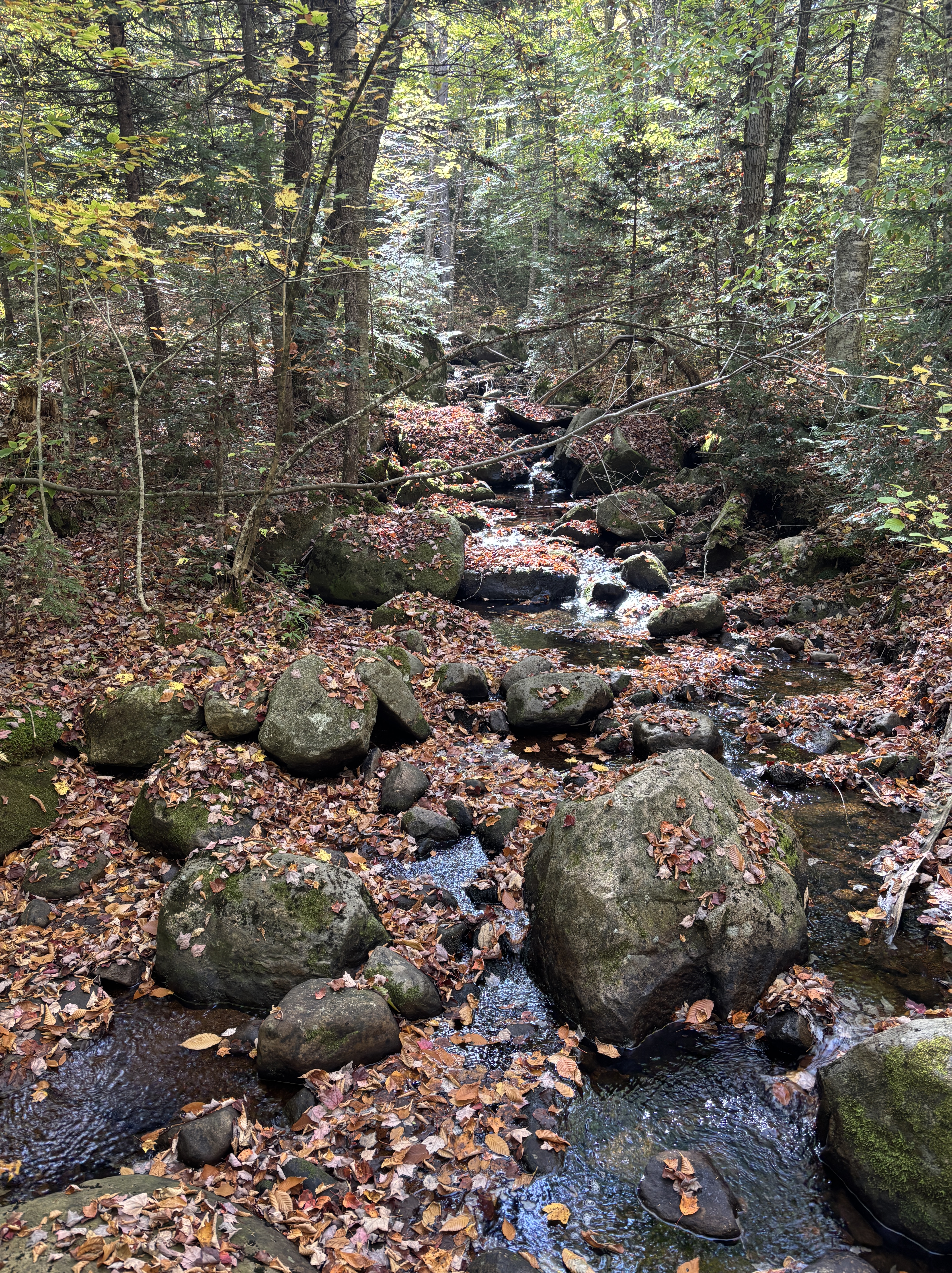
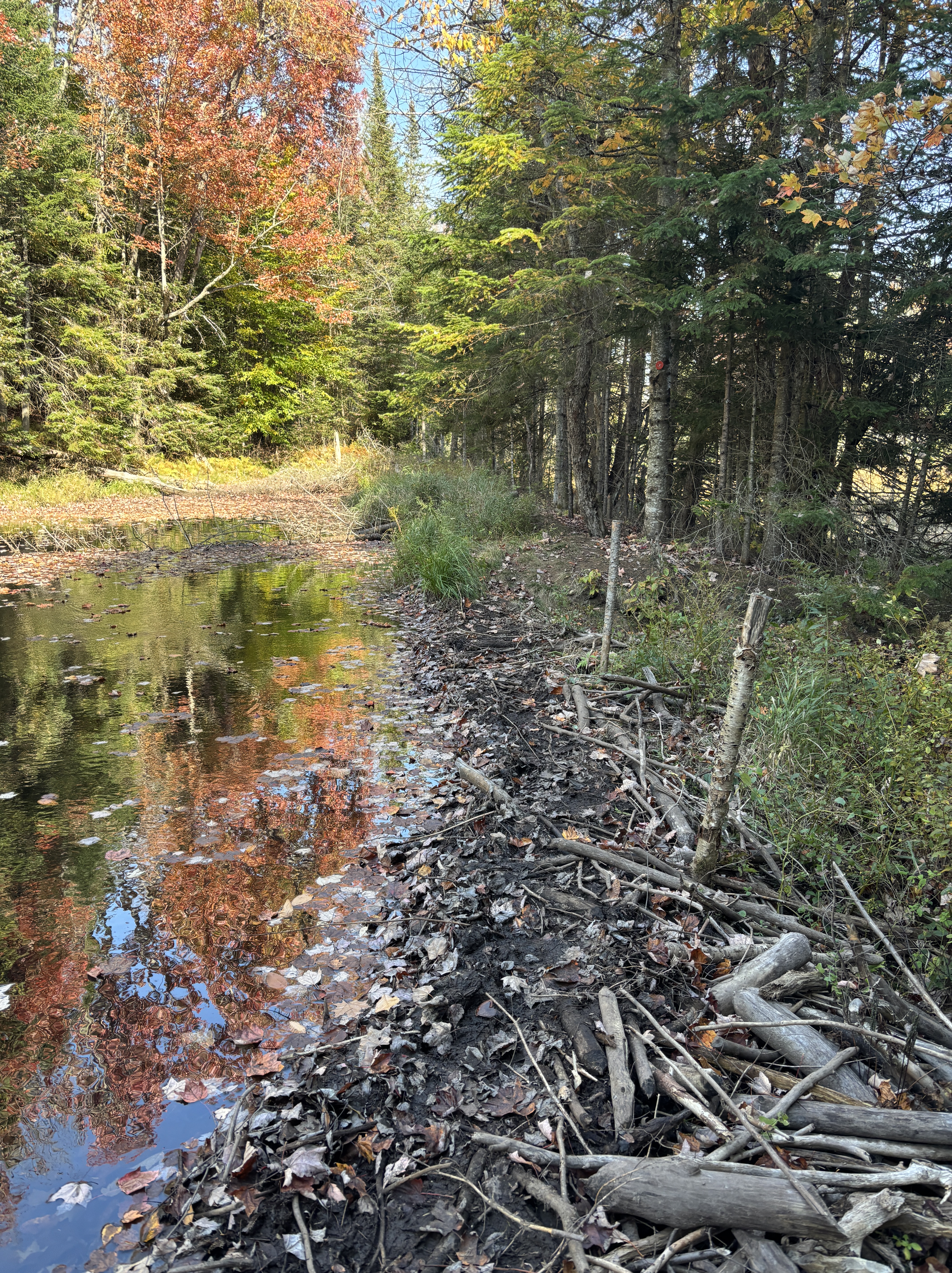
It was a beautiful walk, past several campsites that looked inviting for another hiking adventure. I saw several people out paddling on the lake and I crossed paths with some more hikers. Fortunately for me, it happened to be at the high water reroute, to get past a flooded part of the trail, and the gentleman directed me to the flagged path, which I almost walked right past. (I would have turned around after coming to the lake that the beavers had created.) Just after that, I crossed a fairly well-established beaver dam and was soon on what seemed to be an access road of sorts – wide and even for the last 2 km.
There were six of us that converged on the trailhead at pretty much the same time, making my 20 km, 5.5 hour hike much more social than the previous three CL50 days combined. My body felt tired but not sore and I felt excited that I was only one more day away from finishing the challenge.

Day 5: High Falls Loop (Dead Creek Flow trail to High Falls to Wanakena)
Today’s challenge was going to be the beaver dams. I didn’t know how many there were but this is the part that everyone talks about: how wet or flooded they are, that you should bring water shoes, that they are long and challenging, etc. I was nervous because I didn’t know what to expect. But also not nervous because even if I did get wet feet, I would only have a few km left to hike before coming to the finish. I’ve hiked longer in wet boots. Given the drought of the past few months, I was also hopeful that the beaver dams wouldn’t be as wet or squishy as they are known for being. Finally, even though it was a longer day (an estimated 25km), I was optimistic, since when I looked at AllTrails, it seemed like the trail was overall a gentle downhill grade. And we were in for another gorgeous day, with a high of 27C!
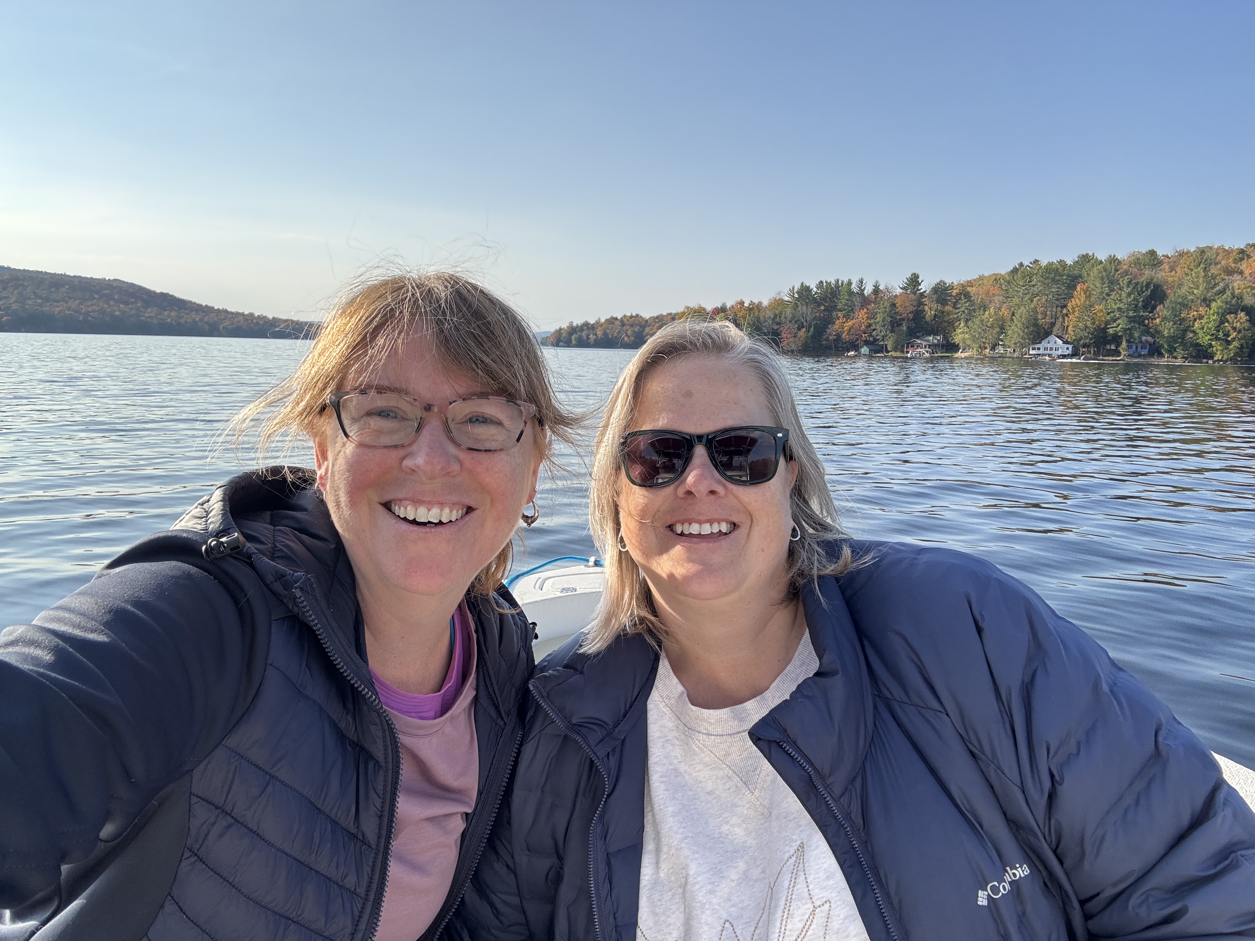
Shannon woke and we shared our morning beverage together (coffee for me, hot chocolate for her) and talked over the day. She was hiking Bear Mountain (from the campground) and I was heading back to Wanakena.
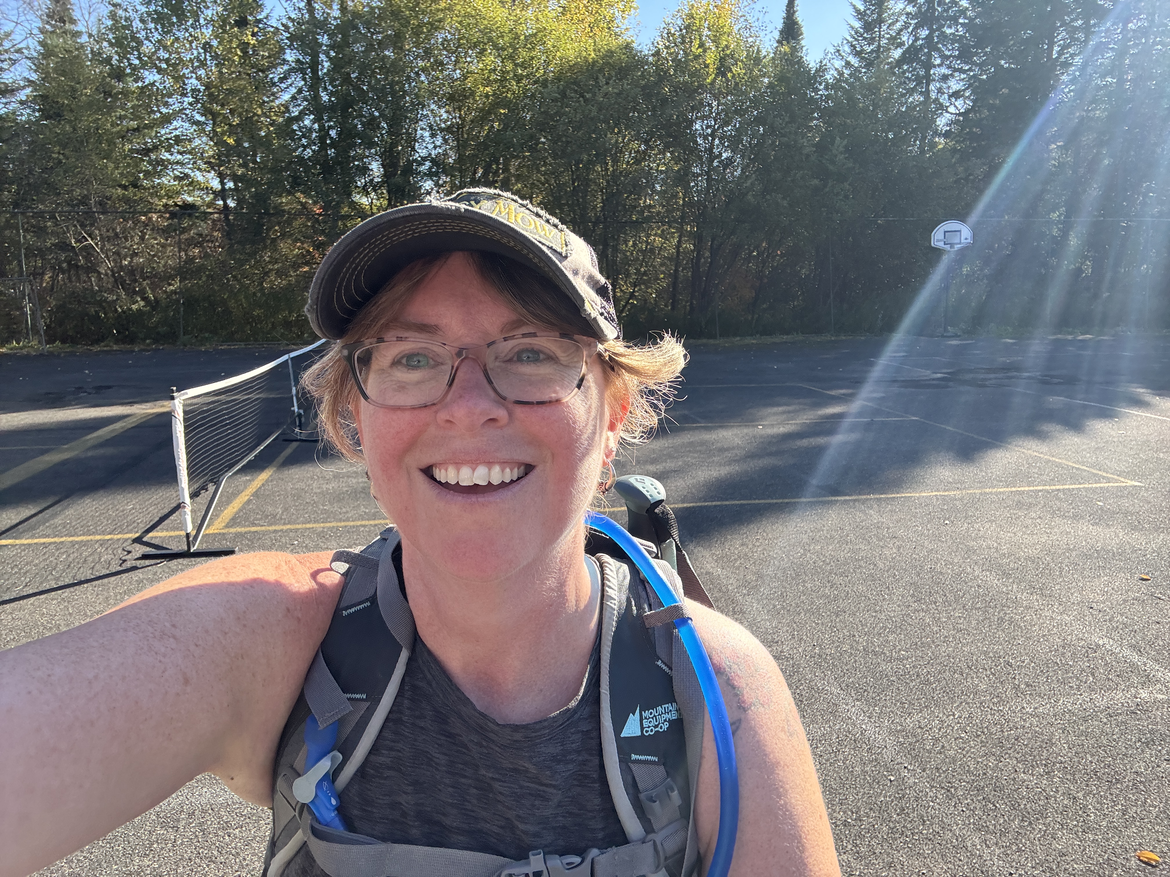
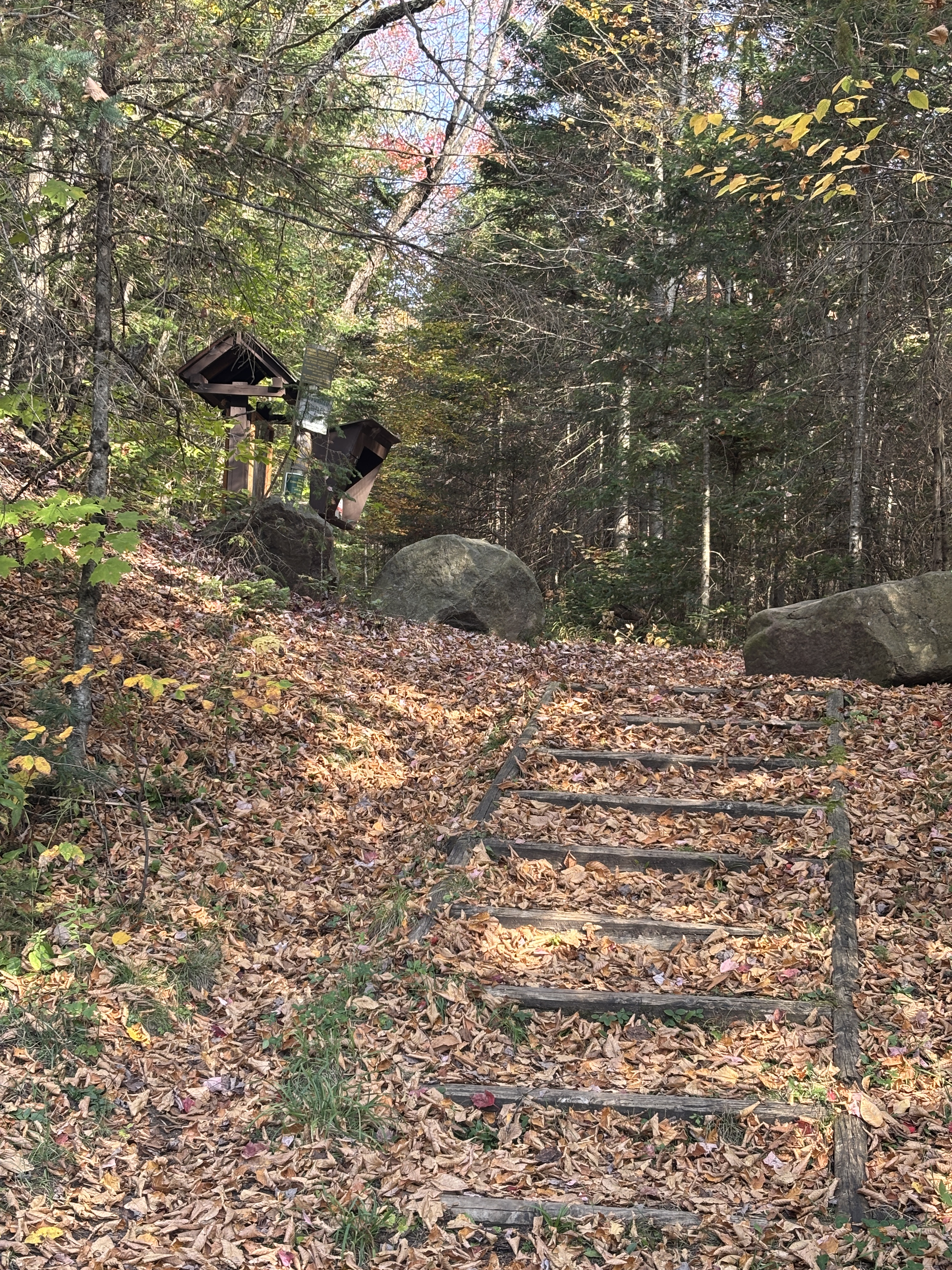
I parked the Jeep at the tennis courts at around 9 am and walked the half a km to where I had ended my hike the day before. I was signed in and back on the Dead Creek Flow Trail at 9:08. Today’s plan was to retrace my steps 6km back to the official CL50 trail, hike around to High Falls, continue around toward High Rock and finally end up at the starting point of the big Cranberry Lake 50 sign.

At first I was not looking forward to retracing 6 km, seeing as it dragged a bit the day before. But as always, the beginning of a hike always goes by faster. It was a flat, easy trail and just like the day before, I clocked the klicks fairly easily. I was back on the Cranberry Lake 50 by 10:30am ready to take on the final leg of this challenge.


It only took an hour to get to High Falls. Again, the day was gorgeous and the trail was so much easier than my Day 2 and 3. I really wish I had known because it might have changed my mind about backpacking for the two days.


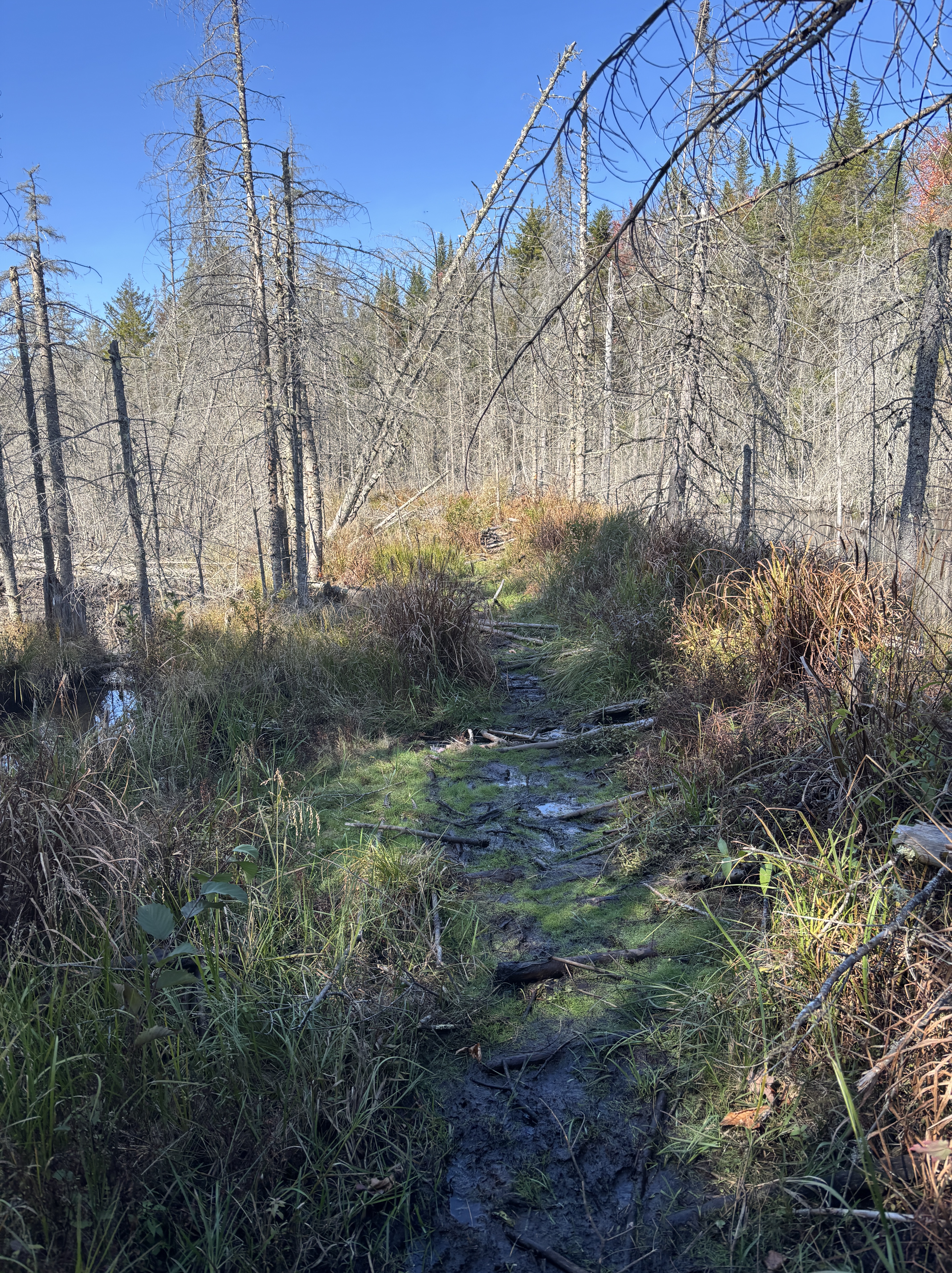
I had made a decision today as well to keep fueled up and hydrated. I am terrible at eating and drinking enough on the trail so I made sure to stop every 90 min to have a real bite to eat. I decided to sit down for lunch at the next junction. Before I got there, I hit my first beaver dam. It was not as scary or wet as I was expecting. It was definitely squishy but the water was low enough that I could step on the grassy areas and not sink. It also wasn’t too wide which meant I could fairly easily step from one side to the other if a sturdier path presented itself on the other side. I easily managed to get through it with minimal mud on my boots. I was happy to have my first beaver dam under my belt!

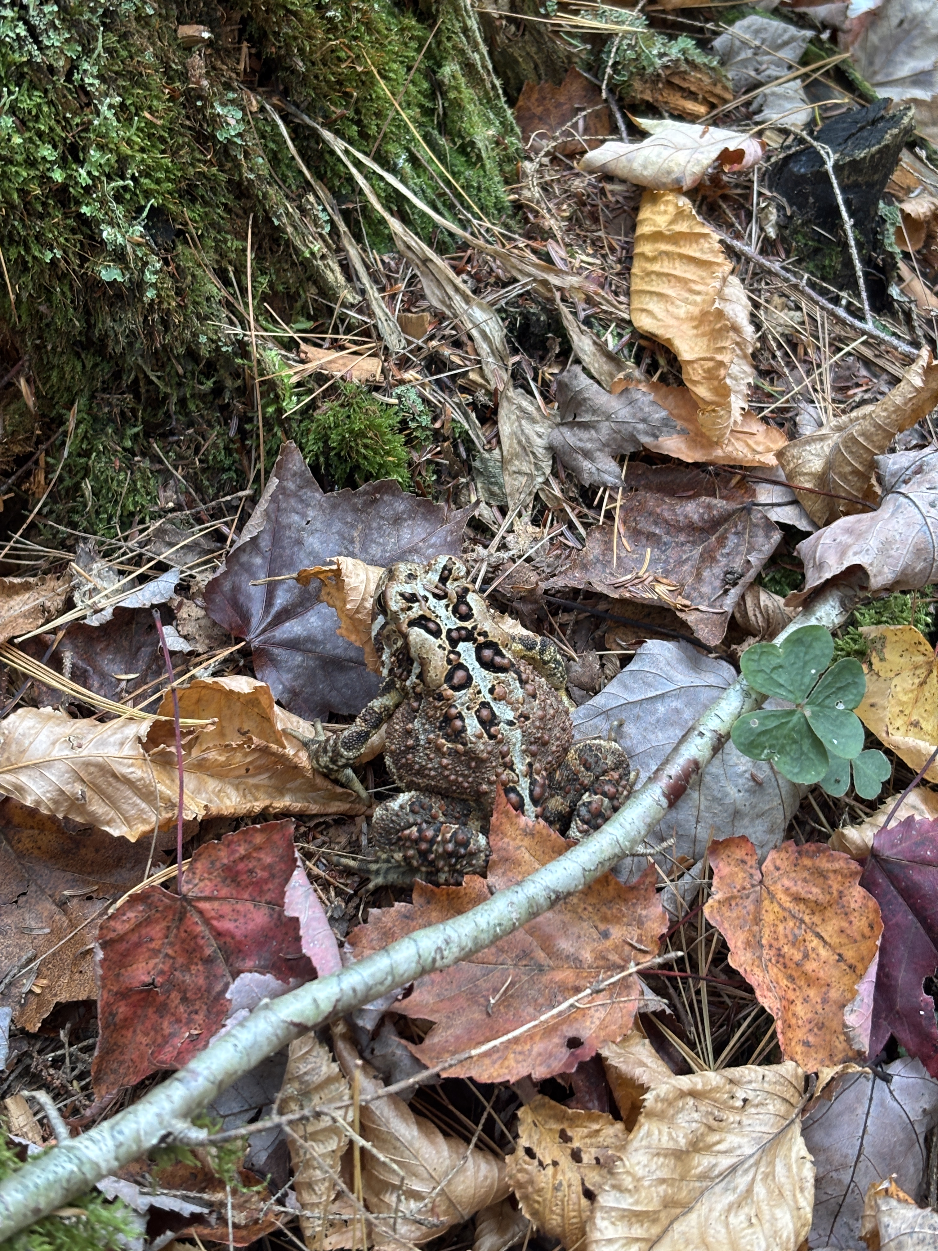
Beavers are fascinating. Yes, I know, they can be extremely destructive if they decide to work their mojo in an unwanted area but for such a small animal, they have an incredible power to change landscapes and ecosystems. At one point on the trail, I was actually lower than the lake. On my right, the lake that had formed due to beaver activity was being held back by long grass and a barricade of sticks and mud, then the trail over the old, very well-established dam and on my left, a much lower level of water. I took lots of photos to show my class as we study habitats in Science.
Shortly after that I found myself at the junction to Five Ponds. I met an ADK member who had hiked from that trail and was documenting trail conditions for the trail crew, including the massive tree across the trail. As we were chatting, he told me that there were four other beaver dams ahead of me and a nice flat trail. He mentioned that there were two that were well-established, one that was newer and a bit muddier and one that was very long and very wet. He told me not to stray too far off the trail in search of drier ground since the beaver channels could get very confusing.
He went on his way, the same way I had just come from, and I sat down on a log to enjoy my turkey sandwich, some veggies, a peanut butter bar and lots of water. I was about halfway and starting to get really excited. The end was in sight! Only 12 more km! Now I had a good idea of how many beaver dams to expect and I could use those as benchmarks, checking off the kilometers.

I didn’t bring water shoes with me for the beaver dams, but I did bring plastic bags and gaiters in the hope of minimizing the wet feet. In the end, I didn’t need either. I was expecting four beaver dams but the two older ones must have been so established that everything had started regenerating over them so they just looked like part of the trail. I remember noticing the trail must have been a beaver dam at some point but it was so solid and overgrown with long grass that I figured it couldn’t have been one that people would be worried about crossing. Maybe in higher water levels, it is a bit more daunting.
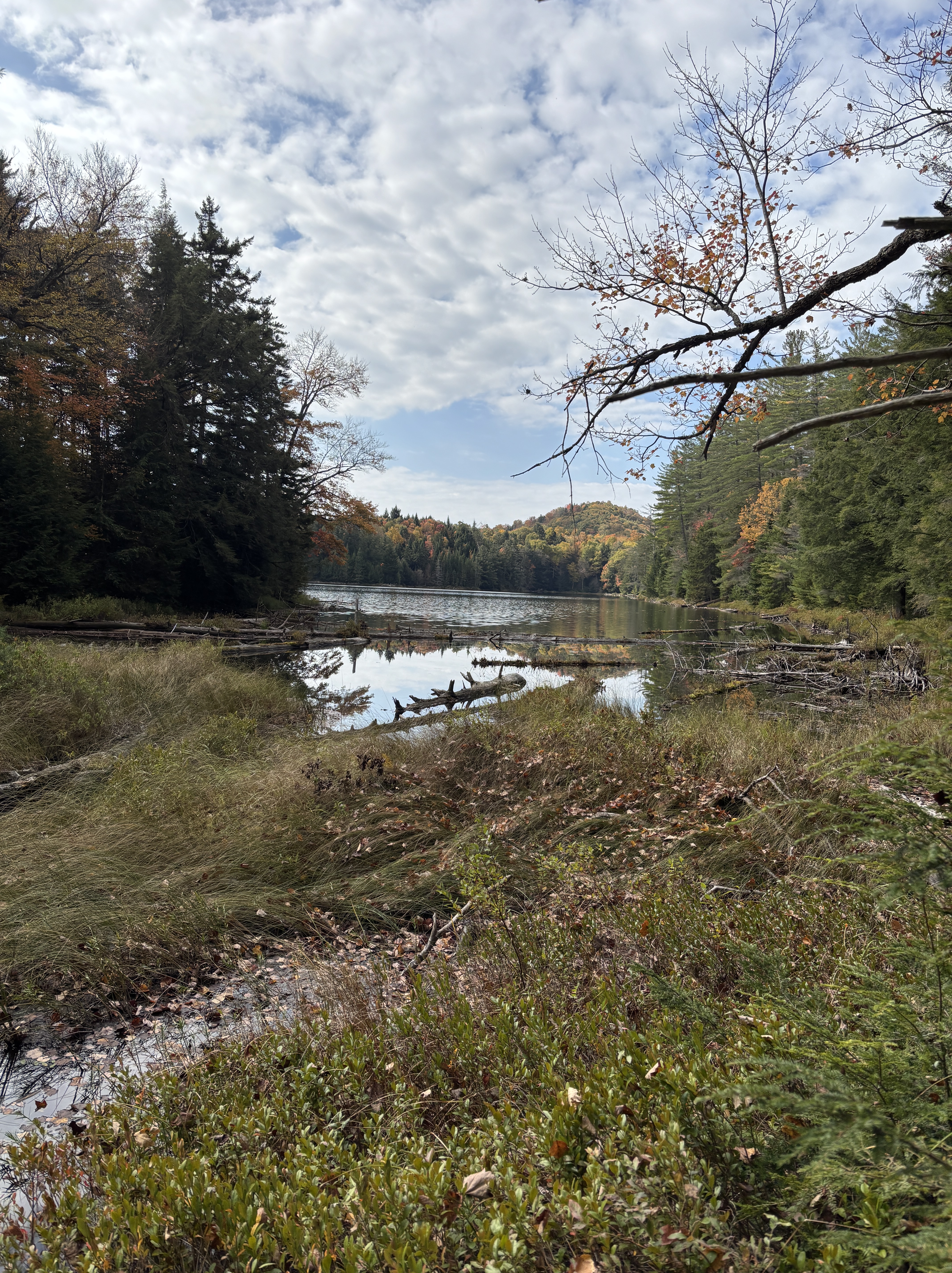
As I walked, I also took the opportunity to check out some campsites that were possible sites for kayak camping. Shannon had done some asking around the day before about great places to paddle and was told the Oswegatchie river, which flows along the west of the Cranberry Lake 50 for the last 12km or so, was a gorgeous paddle route. Specifically, campsite 28 and High Rock were two that were just off the trail and accessible by water. I passed campsite 28 on the way and scoped it out.
Then came the beaver dam that was a bit wet and squishy. This one was an obvious beaver dam. The bare branches were still visible, the mud and water seeped between the sticks and I needed to step mindfully to avoid sinking. I had my two hiking poles as well which helped me find buried sticks and solid sections to safely step on.

This was the second one and from what I had been told, I still had three left. So far so good! I still had dry feet! But 20 minutes later, I hit the big one.
This one definitely would have been difficult to traverse with a big backpack on. It was slow going trying to find some solid-ish spots to step. The hiking poles were essential in not only finding acceptable places to step but also holding my balance while tip-toeing on tiny branches, trying not to sink. It was also quite long. Of course, I’m going from memory at this point but I’d say about 25 m. Those of you with more recent memories can freely tell me I’m way off base. I am fully aware that memories can be deceiving. But it felt really long. It started out relatively branch-y and again, I thought, “This isn’t too difficult.” But then it got really wet. I went into the woods on the side to go around what I thought was a small section but no, this flooded section was about half of the length. Remembering what I had been told about veering off into the woods, I stayed close to the trail and tried to use the tree roots to stay out of the worst of it. And when I could see solid ground again, I did a quick dance over some grassy bits and branches until I was past it. I had made it through with completely dry feet!


I was feeling pretty stoked after this, so I sat and had a snack and some Gatorade. After a few minutes, I continued on my way. I had about 9 km left and according to my intel, two beaver dams left. After about 40 min I had not come to any more beaver dams and was optimistic that perhaps my intel was mistaken and I was past them all. I was told that the biggest and wettest one was the last I would encounter. Maybe the one I had just traversed was it?
I had reached the High Rock campsite, another campsite that was right on the Oswegatchie River that Shannon had wanted me to check out for possible camping next summer. It was much bigger than 28 and was quite a bit higher than the river. So I followed a path down to check out where we could moor our kayaks. I heard voices as I walked towards the water and discovered two young men with canoes and gear, plotting their route.
“Mind if I crash your party?” I asked.
“Where did you come from?” one asked. And I was reminded of my role as Fairy of the Woods from the day before. Just me, a magical being, emerging from the forest. Ha! I told them I was hiking the 50 and just wanted to check out this campsite. As I was chatting with them, I was also being swarmed by bugs. After a minute or so of swatting them away from me, one of the guys said, “They’re ladybugs. Look at your pants.” And sure enough, I had about 10 ladybugs all over my pants. I have never in my life seen so many ladybugs flying around! It was a little surreal to be honest.
I picked their brains for a bit longer, one even showed me photos of High Falls, which I did not hike to, but if I had been backpacking, that’s where I would have stopped for the night. The photos were gorgeous – the falls, both in daytime and nighttime, and the almost full moon (since they had slept at one of the lean-to’s there). But I did not regret my decision to bypass High Falls this time. It would have added several kilometres onto an already long day. I went back up to the campsite and had an apple to recharge for the last 6 km.


The trail after this point was flat and even, which sounds amazing. My legs definitely appreciated it. But it makes hiking a bit more mentally challenging. The scenery was still spectacular. The sky was blue and the sun shining just made for an incredible day for a hike. But because I was so close to the finish, the kilometres felt long and my hips were really starting to feel the mileage. But I hadn’t hit anymore beaver dams and I was starting to feel more confident that I had actually passed them all. Maybe some of the overgrown ones were usually flooded but I didn’t notice them because everything has been so dry for the past two months.


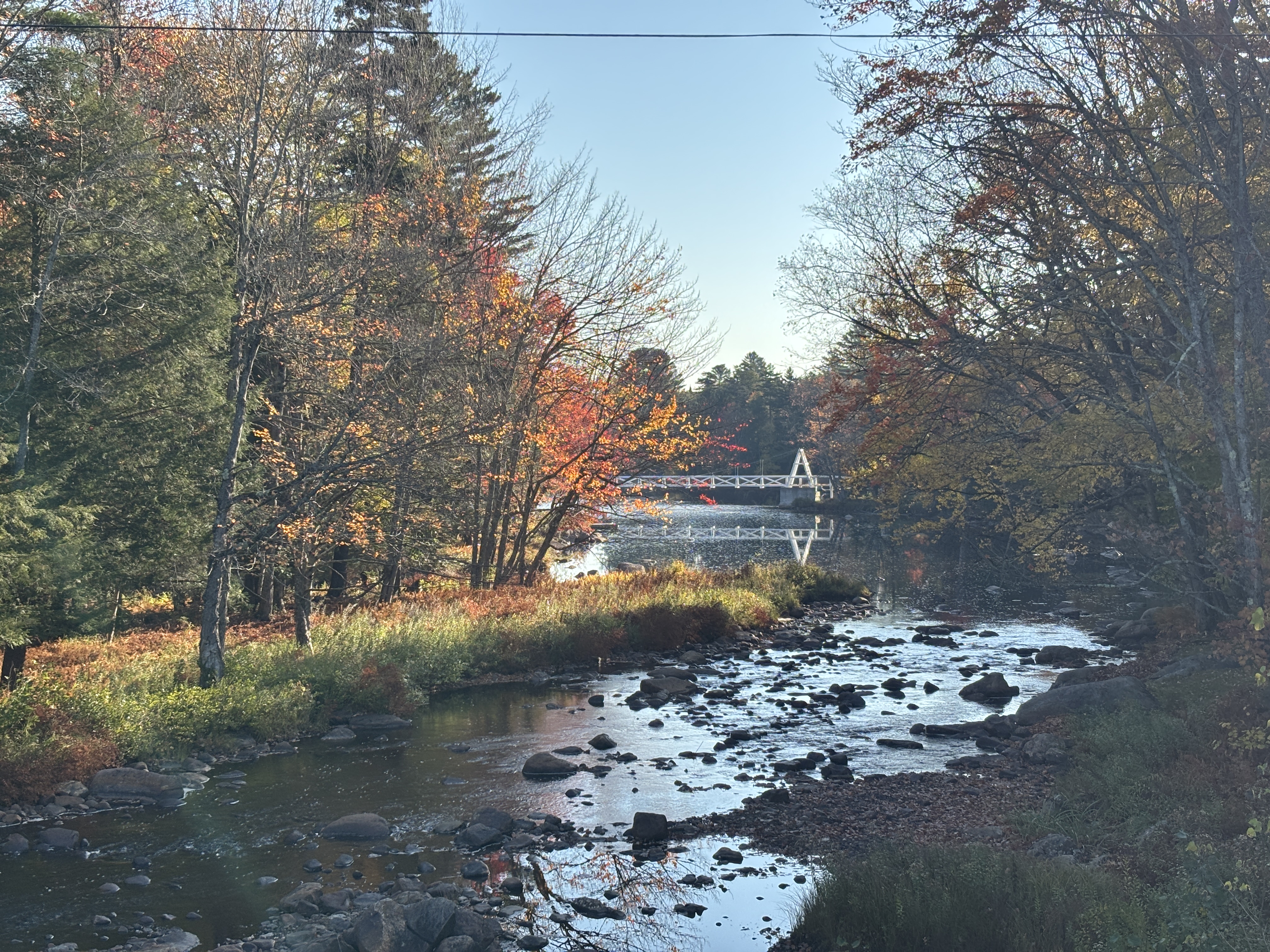
It was a lovely surprise when I paused for a short break and I checked AllTrails and I had only 3 km left! That’s a dog walk! That’s a walk across town! That’s nothing! Holy cow! I’m almost done! And the trail continued nice and flat the whole way to the final trail register, across the tennis courts and over the footbridge for the last time. I had made it. I had officially finished the Cranberry Lake 50!!
Sunday’s stats: 26.1 km in 6:49.